Brian Peters: Showers sticking with Alabama
Brian Peters: Alabama stays in the soup this week from Alabama NewsCenter on Vimeo.
TODAY: Temperatures remain mild across Central Alabama with lows in the lower 70s. Unfortunately, the humidity also remains high, with dew points in the lower 70s. Some fog was reported in northeast Alabama, where a dense fog advisory was posted until 9 a.m. Fog was also occurring in west central Alabama, with visibilities between a quarter and a half a mile. We should see a mixture of sun and clouds today with highs climbing to around 90 degrees. The high humidity and afternoon heating, together with boundaries left over from convection yesterday, will result in showers once again.
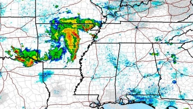
It was interesting to note another large double cluster of thunderstorms in Arkansas this morning. The Global Forecast System was even picking up on the occurrence, which is forecast to stay north of central Alabama.

TROPICS: Looking toward the tropics, the broad area of disturbed weather southwest of Cabo Verde was nearly stationary, but conditions west of that area appear conducive for gradual development over the next several days. In the eastern North Pacific, two areas of disturbed weather were being watched. Both areas may develop slowly as they move away from land and remain over open water.

THE WEEK AHEAD: We start off with an upper air pattern that features weak troughiness over the eastern half of the country with an upper ridge over the western third of the country. A weak short-wave trough will dig into the Middle Mississippi River Valley on Wednesday and into the Ohio Valley on Thursday. This will help to keep the troughiness in place across the eastern half of the country and thus keep us out of any excessive heat. Much of the week ahead will see highs in the range of 89 to 92, with morning lows around the 70-degree mark. The continuation of the rather humid air mass as represented by the precipitable water values will assure us of seeing some showers or thunderstorms just about each day this week, with rain chances for a given area in the 20 to 40 percent range each day.
Friday the digging short wave moves eastward to the Mid-Atlantic states. A surface low moves into the same area with a front that should trail into the Southeast. Climatologically, we don’t usually see a lot of fronts reach the Southeast this time of year. It appears this one could. While the cold front won’t do much for temperatures, the GFS is projecting some lower humidity levels, enough for us to potentially see some drier air reach us by Sunday. The GFS MOS guidance table drops dew points from around 70 on Saturday to the lower 60s on Sunday, so even though temperatures don’t change that much, the lower humidity will feel good, even if it only sticks around for a couple of days.
The lowered humidity may also allow us to take those daily rain chances out of the forecast for a couple of days into the first portion of next week before moisture levels come back up for us.
BEACH FORECAST: The weather at the beach will feature the possibility of a passing shower just about every day for the next week, with highs in the upper 80s. There is no indication of any all-day rain situation, so you should be able to enjoy the beach with only short interruptions for a passing shower. Please heed those showers and don’t become a lightning statistic. Click here to see the AlabamaWx Beach Forecast Center page.
THE LONG VIEW: Looking out into voodoo country, we’ve seen the GFS with a huge ridge followed by a trough big enough to keep us out of the excessive heat. The run today is sort of a blend. The ridge is forecast to extend its reach eastward around July 12, with the eastern edge reaching the Mississippi River Valley. But a strong trough moving across southern Canada will beat back the ridge around July 15. This puts us back into a trough over the eastern half of the country by July 18. Well, at least we can say it has not flipped completely.
Have a great day and Godspeed.
For more weather news and information, visit AlabamaWx.


