Brian Peters: Alabama stays dry through Wednesday
TODAY: The satellite view of the Southeast showed clear skies this morning, though some passing cirrus clouds may dim the sunshine a little during the day. It’s starting out fairly cool for late July, with the morning lows in the 60s. We’ll see lots of sunshine, but with a northeasterly wind, highs should be around 90 degrees.

THE WEEK AHEAD: The upper trough that pushed last week’s front well into the Gulf of Mexico will weaken over the next several days. While we do maintain a northwesterly flow aloft, the surface flow will gradually come around to the South late Wednesday and Thursday, bringing the moisture levels back up. This means we will need to forecast a chance of showers for Thursday, while high temperatures will remain close to the 90-degree mark.
A front that will drag down into the Southeast on Friday and Saturday does not appear to have the necessary momentum to travel all the way to the Gulf of Mexico as the latest front did, so it will wash out across central Alabama on Sunday and Monday. With the surface front in the area and without significant drying, we’ll have to maintain low chances for showers. Temperatures will remain slightly below seasonal averages with highs in the middle and upper 80s for the latter part of the week and into the weekend, thanks to the presence of additional clouds and showers.
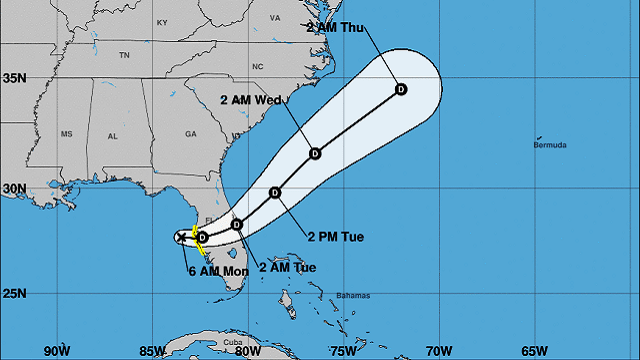
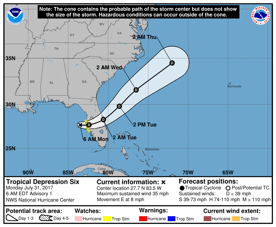
TROPICS: The tropical Atlantic has become a tad more active with the development of Tropical Depression Six just west of Tampa. Shear in the vicinity of the depression is fairly strong, so there is little likelihood for development before it moves ashore on the Florida West Coast. The National Hurricane Center projects it moving into the Southwest Atlantic as a depression, but due to the presence of the Gulf Stream, we’ll need to watch for additional development. Farther east in the South Atlantic, an area of disturbed weather was chugging along to the west with little additional development expected over the next couple of days.
BEACH FORECAST: The beaches of Alabama and northwest Florida will have great weather. It will be dry through Tuesday, with chances of showers returning by Wednesday and into the latter half of the week ahead. You can expect to see highs in the middle and upper 80s. Click here to see the AlabamaWx Beach Forecast Center page.
A LOOK AHEAD: Looking out into voodoo country, the Global Forecast System maintains the pattern of a trough over the eastern half of the country. The latest run breaks down this pattern by Aug. 15 as the upper ridge to the west migrates into the Central Plains states. This would signal an increase in the heat for the Middle Mississippi River Valley and possibly for Alabama.
WEATHER BRAINS: You can listen to our weekly 90-minute netcast anytime on the web, or on iTunes. This is the show all about weather featuring many familiar voices, including meteorologists at ABC 33/40.
James Spann is on vacation this week, so we will be on a one-a-day schedule until Aug. 6. Enjoy the drier weather for the next couple of days. Godspeed.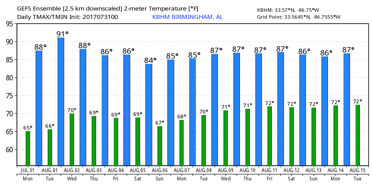
For more weather news and information, visit AlabamaWx.


