Brian Peters: Warm, dry conditions for Alabama in week ahead
Brian Peters: Drier, cooler air moving into Alabama from Alabama NewsCenter on Vimeo.
TODAY: Alabama is sandwiched between clouds over the Florida Peninsula and clouds over Arkansas, but the Alabama sky remained clear this morning. The cold front that was moving through central Alabama will be washing out, and while we’ll see some clouds late this morning and during the afternoon, we should remain dry with highs in the lower and middle 80s. Great day and evening for football.
FOOTBALL WEATHER: Auburn will host Mississippi State today at Jordan-Hare Stadium with a 5 p.m. kickoff. There will be some clouds in the sky at the start of the game, but the sky will clear, with temperatures falling from 78 degrees at the start of the game to near 73 by the final whistle. Alabama will host the Ole Miss Rebels tonight in Tuscaloosa with an 8 p.m. kickoff. The sky will be partly cloudy, with temperatures falling from near 78 at kickoff to near 70 by the end of the fourth quarter.
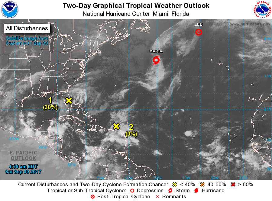
TROPICS: The tropics remain somewhat active with Lee and Maria heading into the sunset over the North Atlantic. Two areas of disturbed weather, one over Florida and one near Puerto Rico, are not expected to develop for the next several days because of upper-level shear as well as proximity to land.
THE WEEK AHEAD: The latest 06Z run of the Global Forecast System depicts a dry week ahead for Alabama, thanks primarily to upper-level ridging together with surface high pressure. The surface high over the Great Lakes this morning will slide to the east Sunday, setting up a wedge pattern, especially for Georgia. I usually like to see a strong high to create a wedge strong enough to affect eastern Alabama, but with the front washing out, we will see at least marginal impacts, so look for highs to be mainly in the upper 70s on Sunday.
The upper ridge builds stronger through Wednesday while we maintain a surface high nosing into the Southeast from the New England states and the North Atlantic. This should keep the weather dry with warm afternoons as highs climb each day into the lower 80s.
A strong upper trough moving from Idaho on Wednesday to the Central Great Lakes by Saturday will help to dampen the upper ridge over the Southeast. This will bring a cold front into the central United States next Saturday with the potential for some chance of rain by Sunday. There are model differences between the Euro and the GFS.
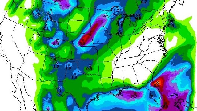
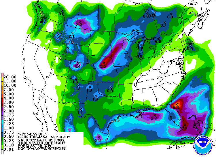
Rainfall through early next Thursday is projected to be zero across a sizable chunk of the Southeast as fairly typical dry fall weather holds sway for us.
BEACH FORECAST: Click here to see the AlabamaWx Beach Forecast Center page.
WEATHER BRAINS: You can listen to our weekly 90-minute netcast anytime on the web, or on iTunes. This is the show all about weather featuring many familiar voices, including meteorologists at ABC 33/40.
BEYOND NEXT WEEK: Looking out into voodoo country, there is a shot at some showers and storms in the Oct 8-9 time frame, with a strong trough moving across the eastern United States. But by Oct 11 we’re back under an upper ridge, which generally holds through Oct. 18 as the main storm track remains well north of Alabama.
Have a great day and Godspeed.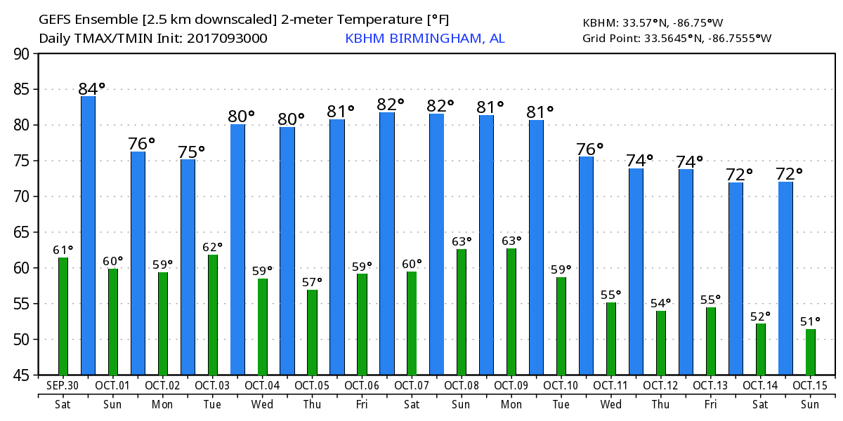
For more weather news and information from Brian Peters and other members of the James Spann team, visit Alabama Wx.


