James Spann: Big weather changes ahead for Alabama
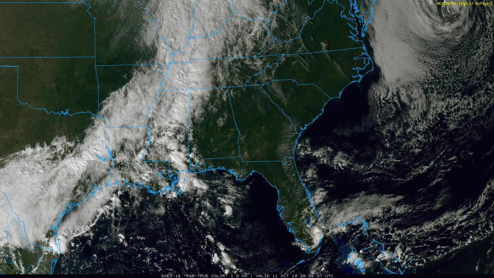
COLD FRONT NEARING NORTHWEST ALABAMA: A strong cold front, which represents the leading edge of the coolest air so far this season, is near the northwest corner of Alabama this afternoon. A band of showers and thunderstorms will move into west Alabama over the next few hours ahead of the front. No severe storms are expected, and rain amounts overnight should be generally less than one-half inch.
THE ALABAMA WEEKEND: Much cooler air invades the northern half of Alabama on Saturday. Temperatures won’t get past the mid 60s, and some places north and west of Birmingham could hold in the 50s much of the day. Clouds linger during the morning with just the risk of a few isolated showers; then the sky becomes partly sunny by afternoon.
Clouds increase again Sunday morning, and rain should become widespread across much of north and central Alabama by Sunday afternoon as an overrunning pattern begins — moist air going up and over a stalled front over the southern part of the state. Rain will continue Sunday night. Sunday’s high will be in the low to mid 60s.
NEXT WEEK: The best chance of rain Monday shifts down into south Alabama, but rain will increase again statewide Tuesday and Tuesday night as the next wave approaches. Rain will end Wednesday morning, and for now the rest of the week looks cool and dry.
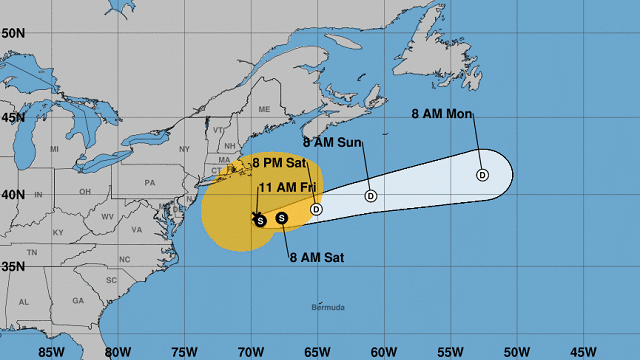
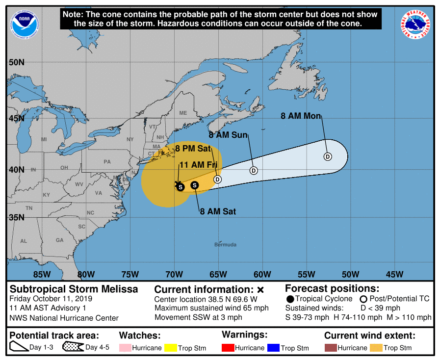
TROPICS: Subtropical Storm Melissa has formed in the Atlantic, off the east coast of the U.S. It will slowly move eastward in coming days.
RACE WEEKEND AT TALLADEGA: A few isolated showers are likely around the Superspeedway late tonight or early Saturday, but the bulk of the day Saturday will be dry with a high in the mid 60s. For Sunday, the sky will be mostly cloudy; unfortunately, it looks like rain is likely by afternoon. There’s still a chance the rain holds off until after the big race, but just a chance. The high Sunday will stay in the 67- to 70-degree range. Monday looks rain-free for now.
FOOTBALL WEATHER: For the high school games tonight, the sky will be mostly cloudy and showers are possible, mainly over the western half of the state. Temperatures will be in the 70s at kickoff, falling into the upper 60s by the fourth quarter. Some 50s are possible over northwest Alabama behind the cold front.
Alabama travels to College Station Saturday to take on the Texas A&M Aggies (kickoff at 2:30 p.m. Central Time). The sky will be partly sunny with a kickoff temperature near 68 degrees.
UAB will also be in Texas Saturday, playing at UTSA (kickoff at 5 p.m. Central Time). Temperatures will fall from near 70 at kickoff through the 60s during the game with a brisk northwest breeze (although the game will be played in a dome). The sky will be mostly fair with no risk of rain.
Jacksonville State will take on Eastern Illinois Saturday (kickoff at noon Central Time) in Charleston, Illinois. The day will be cool and dry, with mid 50s at kickoff; sunshine will be in full supply during the game.
ON THIS DATE IN 1780: The Great Hurricane of 1780 made landfall on the island of Barbados with estimated wind gusts of 200 mph. This hurricane went on to affect the islands of St. Vincent, where only 14 of 600 homes stood at Kings Town. St. Lucia, Martinique, Dominica and Puerto Rico were all affected by this hurricane. This storm is the deadliest Atlantic hurricane on record, with between 20,000 and 22,000 deaths.
BEACH FORECAST: Click here to see the AlabamaWx Beach Forecast Center page.
WEATHER BRAINS: You can listen to our weekly 90-minute show any time on your favorite podcast app. This is the show all about weather featuring many familiar voices, including the meteorologists at ABC 33/40.
CONNECT: You can find me on the major social networks:
Facebook
Twitter
Instagram
Pinterest
Snapchat: spannwx
For more weather news and information from James Spann and his team, visit AlabamaWx.


