James Spann: Occasional showers, a few storms for Alabama through Wednesday
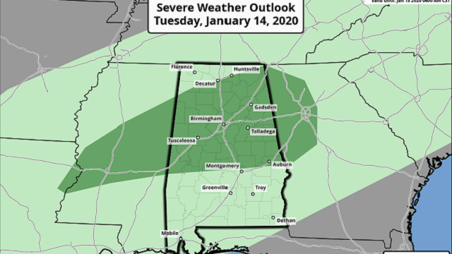
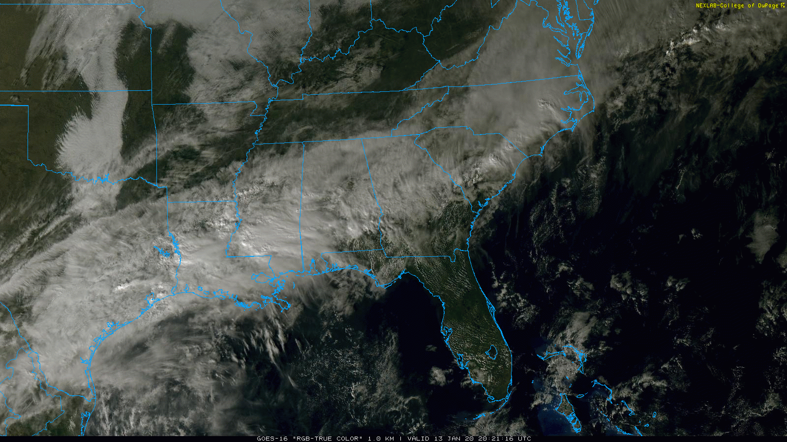
UNSETTLED WEATHER: Rain is increasing over the state this afternoon; we note a few embedded thunderstorms over west Alabama, but they are below severe limits. The main issue with stronger storms through tonight will come from heavy rain, although some hail can’t be ruled out. The Storm Prediction Center maintains a low-end, marginal risk (level 1 out of 5) of severe storms tonight for north Alabama.
We will forecast occasional showers and a few thunderstorms both Tuesday and Wednesday. Stronger storms are possible over the northern half of the state Tuesday; the SPC again has a marginal risk (level 1 of 5) defined.
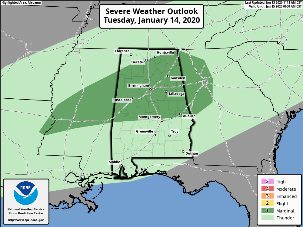
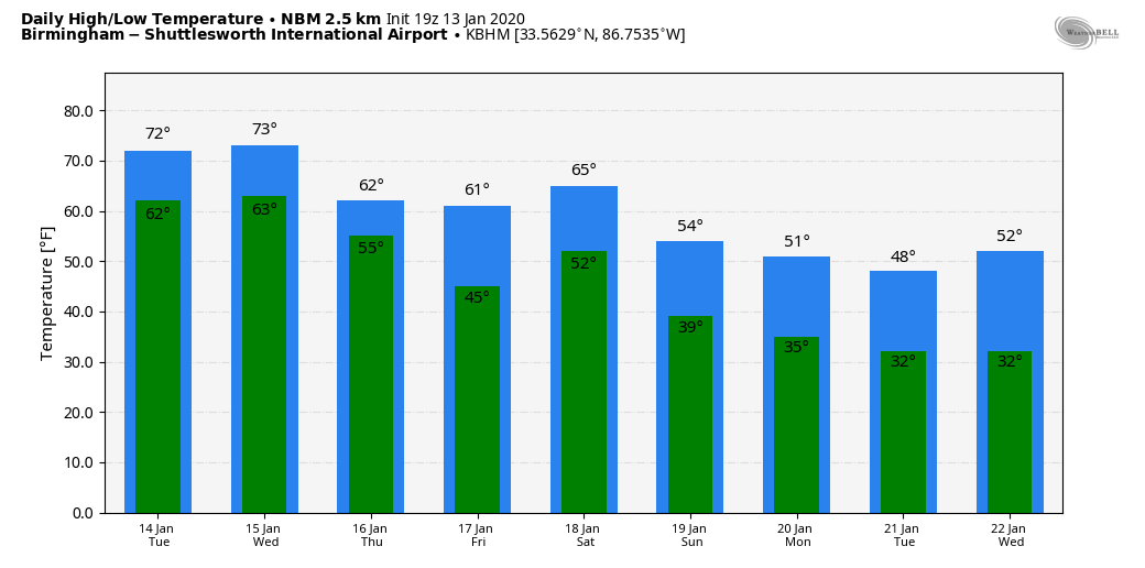
The main threats will come from small hail and gusty winds, but, despite good instability, the overall dynamic forcing is pretty weak. The rain won’t be continuous, and the sun could pop out at times. Rain amounts tonight through Wednesday will be in the 1- to 2-inch range for the northern half of the state, with lighter amounts over south Alabama. Some localized flooding is possible, but widespread problems are not expected for now. The temperatures will stay mild, with highs in the 65- to 71-degree range both days.
THURSDAY/FRIDAY: Cooler and slightly drier air will slip into the state Thursday and Friday; the best chance of showers will be over the southern quarter of the state, and even there rain amounts probably won’t be too heavy. Highs will drop into the upper 50s over north Alabama; 60s continue to the south.
THE ALABAMA WEEKEND: A cold front will bring another chance of showers and thunderstorms Saturday, but this time severe storms are not expected, with the main dynamic support well to the north and very limited instability. Sunday will be dry and colder, with a high back in the 50s.
NEXT WEEK: The pattern favors colder weather for the eastern and southern part of the nation next week and for the rest of January. Highs will be in the upper 40s and low 50s for much of the week, and for now no major rain events seem likely, although wet weather could return by the end of the week.
SATURDAY’S STORM SURVEYS: National Weather Service survey teams have identified five tornadoes in Alabama so far from Saturday’s severe storm event:
- Pickens County (near Carrollton), EF-2
- Marshall County (Union Grove), EF-2
- Barbour County (southwest of Eufaula), EF-1
- Cullman/Marshall counties (near Joppa), EF-1
- Cullman County (Holly Pond), EF-0
Thunderstorm wind damage was widespread across Alabama; around 200,000 Alabama Power customers lost service at some point over the weekend. Hundreds of trees were taken down.
ON THIS DATE IN 1982: Alabama was in the midst of a crippling ice storm. Freezing rain created a thick coating on all exposed objects. Trees snapped, pulling down power lines and putting as many as 750,000 Alabamians in the dark. The sound of tree limbs snapping under the weight of the ice was like shotguns.When it was all said and done, 20 Alabamians were dead and another 300 injured, and damage totaled $78 million.
BEACH FORECAST: Click here to see the AlabamaWx Beach Forecast Center page.
WEATHER BRAINS: You can listen to our weekly 90-minute show any time on your favorite podcast app. This is the show all about weather featuring many familiar voices, including the meteorologists at ABC 33/40.
CONNECT: You can find me on the major social networks:
Facebook
Twitter
Instagram
Pinterest
Snapchat: spannwx
For more weather news and information from James Spann and his team, visit AlabamaWx.


