James Spann: Drier weather for Alabama in days ahead
James Spann has the Alabama forecast for the end of the work week from Alabama NewsCenter on Vimeo.
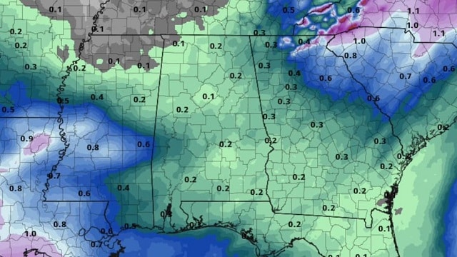
RADAR CHECK: We have a few lingering showers over the eastern half of the state early this morning; most of those should be gone by the time you read this. But we have a dense fog advisory for much of north and central Alabama this morning; that fog will dissipate over the next few hours.
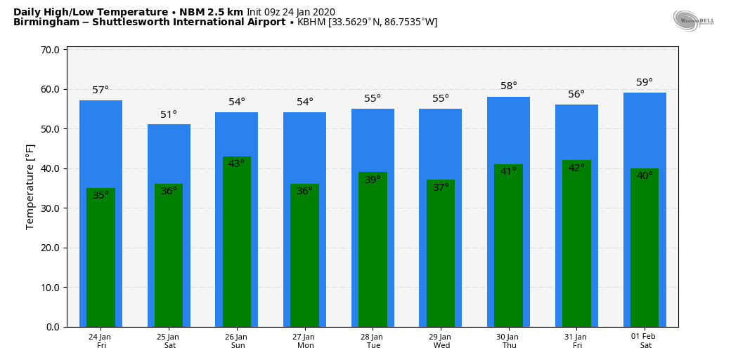
The sky becomes partly sunny as a slot of dry air punches into the state. We will mention a chance of isolated showers this afternoon over north Alabama as an upper trough passes overhead, but the moisture will be very limited and most places will be dry. The high today will be in the mid to upper 50s; the average high for Jan. 24 at Birmingham is 54.
THE ALABAMA WEEKEND: Saturday will feature a partly sunny sky; after starting the day in the 32- to 35-degree range, we expect a high around 50 degrees. On Sunday clouds will increase, but the daytime should be generally dry with a high in the low to mid 50s. We will mention a chance of scattered light rain Sunday night thanks to a wave passing through the northern Gulf of Mexico.
NEXT WEEK: Some light rain is possible Monday morning; otherwise Monday will be mostly cloudy with a high in the mid 50s. The latest model data is now suggesting Tuesday through Thursday will be dry with seasonal temperatures (highs in the 50s, lows in the 30s). Rain returns on Friday, Jan. 31.
THURSDAY’S RAIN: Rain totals from the ABC 33/40 team of Skywatchers:
- Dunnavant — 1.09 inches
- Thorsby — 1.08
- Alexander City — 0.85
- Remlap — 0.77
- Moody — 0.77
- Weaver — 0.73
- Morris — 0.67
- Heflin — 0.57
- Hueytown — 0.55
- Jacksonville — 0.38
- Carbon Hill — 0.21
- Cottondale — 0.12
ON THIS DATE IN 1967: A tornado outbreak across the central U.S. was the farthest north ever recorded in the winter up to that time. Severe weather occurred across a good portion of southeast and east-central Iowa. Two-inch hail fell at Armstrong, and more than two dozen tornadoes were reported. Five miles north of Fort Madison, a tornado caused one fatality and six other injuries. A tornado causing EF4 damage killed three people and injured 216 in St. Louis County, Missouri. Storms also affected parts of northern and central Illinois. One strong tornado in Mason County killed one person and injured three others. Another tornado moved across the Champaign-Urbana metropolitan area, injuring five people. Other strong tornadoes were reported across Carroll County in Mt. Carroll, where 12 people were injured, and near Gladstone in Henderson County. Funnel clouds were reported across the southwest section of Chicago. High winds gusting to 48 mph caused a wall of a building under construction to collapse, killing one and injuring four others. Iowa had never recorded a tornado in January before this outbreak. 32 total tornadoes occurred, 14 of them in Iowa. Nine twisters occurred in Missouri, eight in Illinois and one in Wisconsin.
BEACH FORECAST: Click here to see the AlabamaWx Beach Forecast Center page.
WEATHER BRAINS: You can listen to our weekly 90-minute show any time on your favorite podcast app. This is the show all about weather featuring many familiar voices, including the meteorologists at ABC 33/40.
CONNECT: You can find me on the major social networks:
Facebook
Twitter
Instagram
Pinterest
Snapchat: spannwx
For more weather news and information from James Spann and his team, visit AlabamaWx.


