James Spann: Rain returns to Alabama tonight
James Spann has the Alabama forecast for a new work week from Alabama NewsCenter on Vimeo.
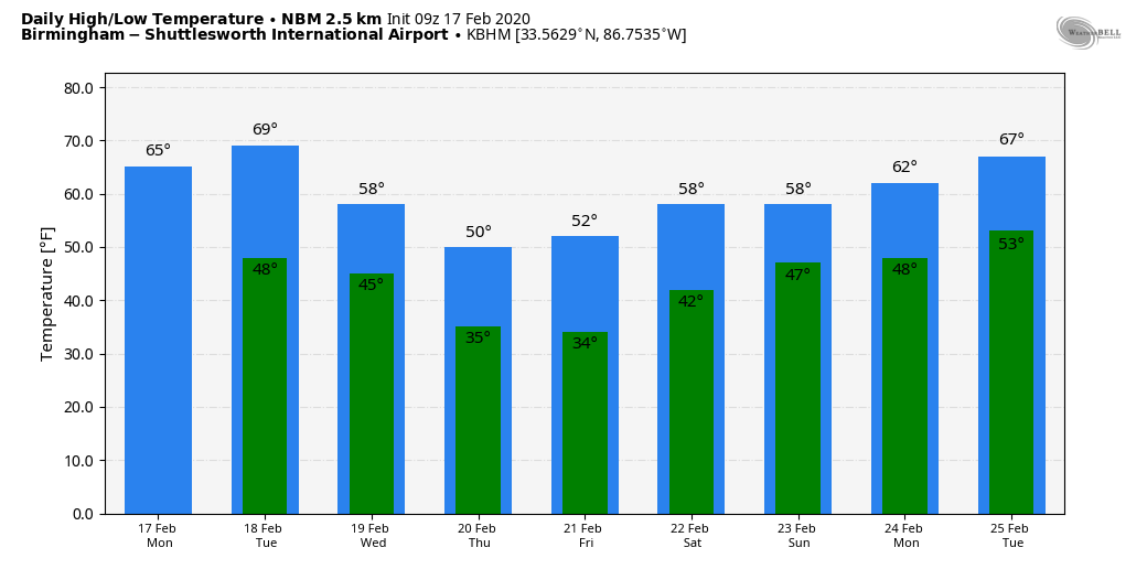
MORE RAIN THIS WEEK: The day today will be dry for most of the state; the sky will feature more clouds than sun, and temperatures rise into the 60s in most places this afternoon. Showers will enter west Alabama tonight and will spread eastward overnight.
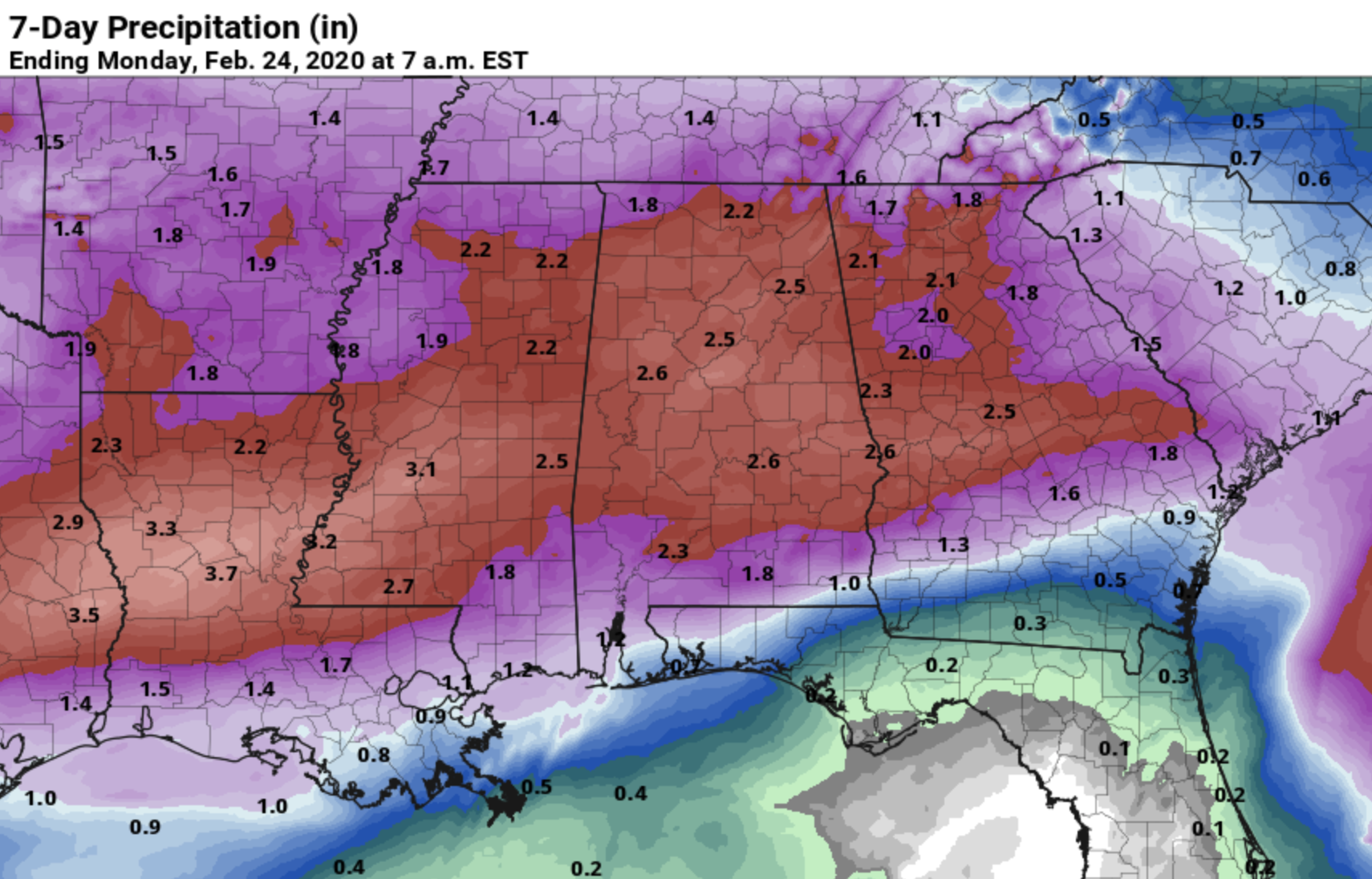
Rain should be widespread across Alabama Tuesday ahead of a cold front. There could be a rumble of thunder, but no severe storms are expected. The day will be mild for February, with a high between 65 and 70 degrees. The rain tapers off early Wednesday morning as the front pushes into south Alabama and becomes nearly stationary. We will mention a risk of scattered light rain Wednesday, but a decent part of the day will be dry. The sky will be mostly cloudy with a high in the 50s.
Then a wave forms on the stalled front, and rain becomes widespread again by Thursday. It will be a cold rain; most north and central Alabama communities will hold in the 40s all day. That batch of rain will end Thursday night.
Rain amounts between tonight and Thursday night are expected to be in the 2- to 3-inch range for most of the state. This probably won’t bring any major flash flooding problems, but a few isolated issues are possible.
FRIDAY AND THE WEEKEND: The sky becomes sunny Friday as dry air moves into the state; Friday’s high will be in the low 50s. Sunny weather continues Saturday; we start the day in the 30- to 35-degree range, followed by a high in the upper 50s. Some clouds move in Sunday, but for now we will maintain a dry forecast with a high in the low 60s.
NEXT WEEK: An active pattern continues across the southern U.S., and we will most likely deal with multiple rain-producing systems. The first one bring a chance of showers Monday.
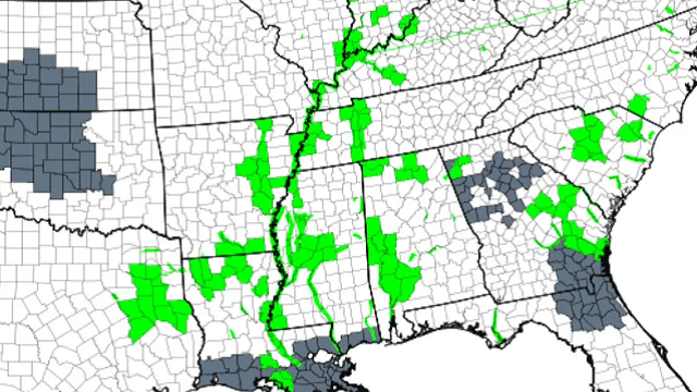
RIVER FLOODING: Flood warnings remain in effect for the Tombigbee and lower Black Warrior Rivers in west Alabama. At Demopolis, where the flood state is 68 feet, the river was 84.8 feet early this morning. Levels are expected to begin falling later this week.
ON THIS DATE IN 2008: Thirteen tornadoes moved through central and east Alabama. One was an EF-3 that tore through parts of Prattville and Millbrook. The tornado touched down near the wastewater treatment facility southwest of Prattville. It tracked northeastward and crossed U.S. Highway 82, U.S. Highway 31 and Cobbs Ford Road. The southern and eastern parts of Prattville sustained significant damage. The highest winds likely occurred along Cobbs Ford Road/East Main Street near McQueen Smith Road and in the Silver Hills subdivision. An estimated 200 homes and 40 businesses were damaged or destroyed.
BEACH FORECAST: Click here to see the AlabamaWx Beach Forecast Center page.
WEATHER BRAINS: You can listen to our weekly 90-minute show any time on your favorite podcast app. This is the show all about weather featuring many familiar voices, including the meteorologists at ABC 33/40.
CONNECT: You can find me on the major social networks:
Facebook
Twitter
Instagram
Pinterest
Snapchat: spannwx
For more weather news and information from James Spann and his team, visit AlabamaWx.


