James Spann: Severe storms possible Tuesday over south Alabama
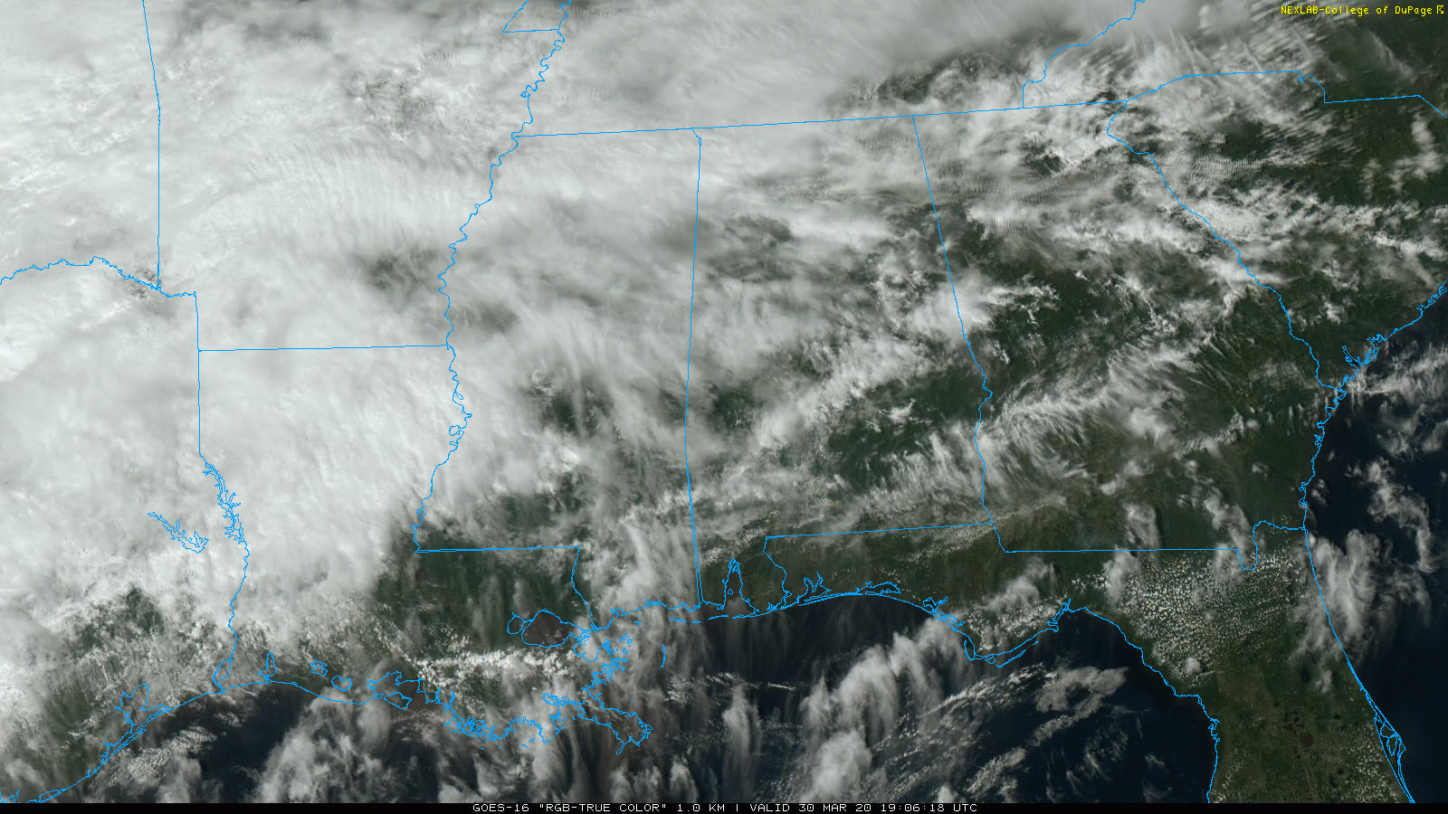
RADAR CHECK: Light rain is falling over the Tennessee Valley region of far north Alabama. Otherwise the weather is mostly dry across the state this afternoon. Temperatures are in the 60s where rain is falling and in the 70s elsewhere. Clouds will increase statewide tonight, with rain increasing after midnight.
TUESDAY: For north Alabama, Tuesday will be a cloudy, cool day with rain during the morning. But to the south the air will be unstable, and severe thunderstorms are possible over the southern half of the state. The Storm Prediction Center maintains a slight risk (level 2 out of 5) of severe thunderstorms for areas south of a line from Linden to Clanton to Opelika, with a marginal risk (level 1 of 5) as far north as Jasper and Jacksonville.
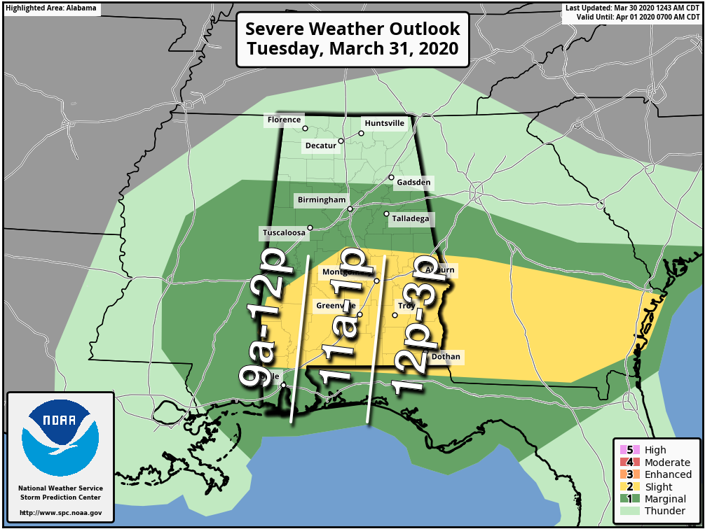
We believe the core severe weather threat will be south of U.S. 80, mostly from 9 a.m. to 3 p.m. Heavier storms will be capable of producing hail, strong winds and an isolated tornado or two. If you live in south Alabama, but sure you have a way of hearing severe weather warnings if they are needed.
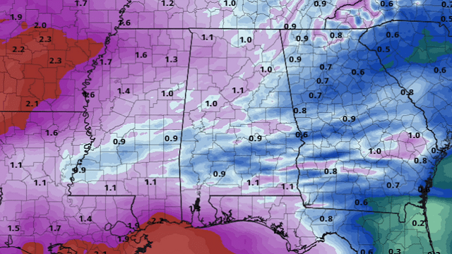
Rain amounts statewide should be around one-half inch; no flooding is expected.
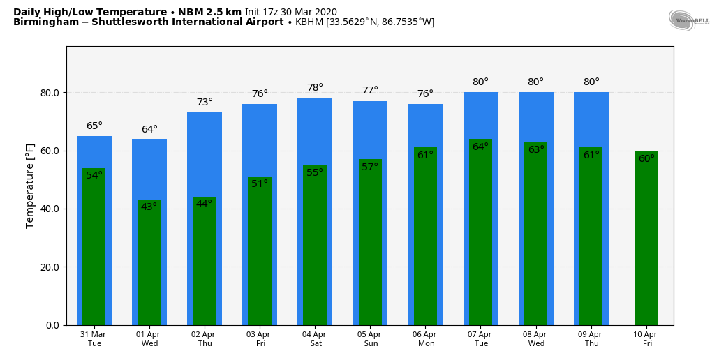
REST OF THE WEEK: Cool, dry air returns to the state Tuesday night; some north Alabama communities will dip into the upper 30s early Wednesday morning. Look for mostly sunny days and fair nights through Friday; the high will be in the mid 60s Wednesday, followed by low 70s Thursday and mid 70s Friday.
THE ALABAMA WEEKEND: Models have changed their tune a bit this afternoon, now suggesting most of Saturday will be warm and dry with a high around 80 degrees. A few showers are possible Sunday, but probably not very widespread. Sunday’s high will be in the 77- to 80-degree range.
NEXT WEEK: Monday looks relatively wet, followed by a trend toward drier weather for the rest of the week. There’s no sign of the late season frost/freeze we expect during the first half of April so far.
STORMS THIS PAST WEEKEND: Severe storms before dawn produced hail to 3 inches in diameter over parts of Lamar and Fayette counties. Scattered wind damage was reported over parts of Winston and Cullman counties.
ON THIS DATE IN 2016: Early in the evening, a localized but significant tornado event impacted Oklahoma and Arkansas, including an EF2 that caused heavy damage to homes, businesses and industrial buildings in the northern part of Tulsa, injuring four people.
BEACH FORECAST: Click here to see the AlabamaWx Beach Forecast Center page.
WEATHER BRAINS: You can listen to our weekly 90-minute show any time on your favorite podcast app. This is the show all about weather featuring many familiar voices, including the meteorologists at ABC 33/40.
CONNECT: You can find me on all of the major social networks:
Facebook
Twitter
Instagram
Pinterest
Snapchat: spannwx
For more weather news and information from James Spann and his team, visit AlabamaWx.com.


