James Spann: Showers for Alabama late tonight; severe storms possible Sunday
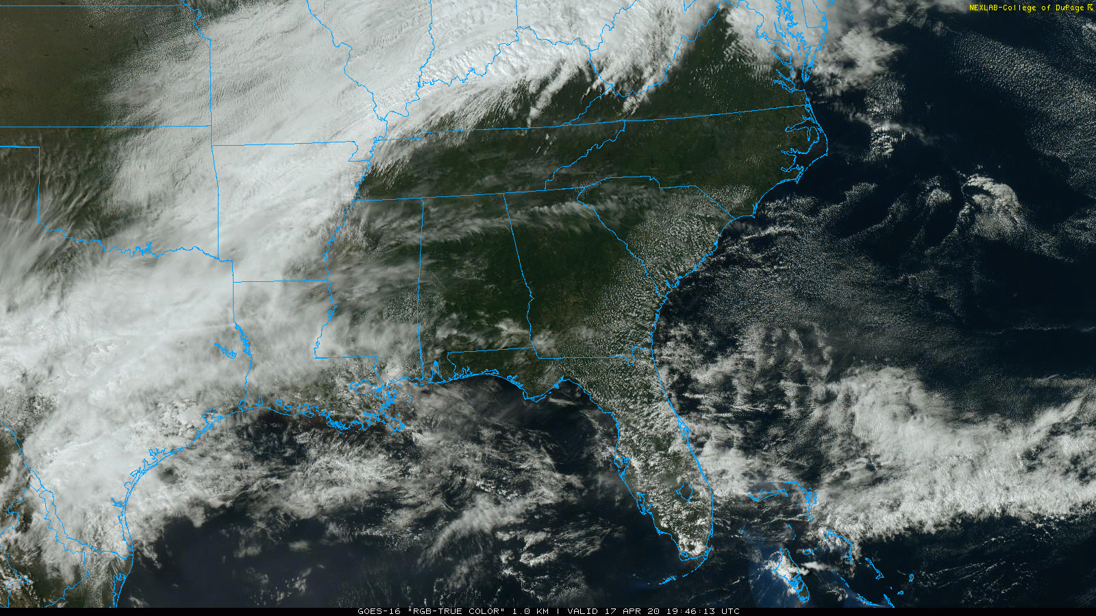
BEAUTIFUL AFTERNOON: We are enjoying a mostly sunny day across Alabama with just a few high, thin cirrus clouds; temperatures are mostly in the mid 70s, right at seasonal averages for mid-April. Clouds will increase tonight, and a few showers are likely after midnight as a cold front passes through. There could be a rumble of thunder somewhere, but no severe storms, and rain amounts will be light. The rain should be over by 8 a.m. Saturday for most places, and the sky becomes mostly sunny by afternoon. Saturday will be a few degrees cooler with a high between 68 and 72. Clouds will increase Saturday night.
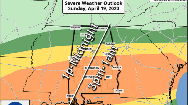
SEVERE WEATHER THREAT SUNDAY: The surface front over south Alabama will slowly lift northward during the day Sunday, and rain is likely during the morning with a few elevated thunderstorms. Those storms could produce some small hail and gusty winds, but the severe weather threat comes later in the day as unstable air works in from the south.
The Storm Prediction Center maintains an enhanced risk (level 3 out of 5) of severe thunderstorms defined for areas south of a line from Tuscaloosa to Columbiana to Roanoke, with a slight risk (level 2 of 5) as far north as Sulligent, Oneonta and Cedar Bluff. A marginal risk (level 1 of 5) extends northward to near the Tennessee state line.
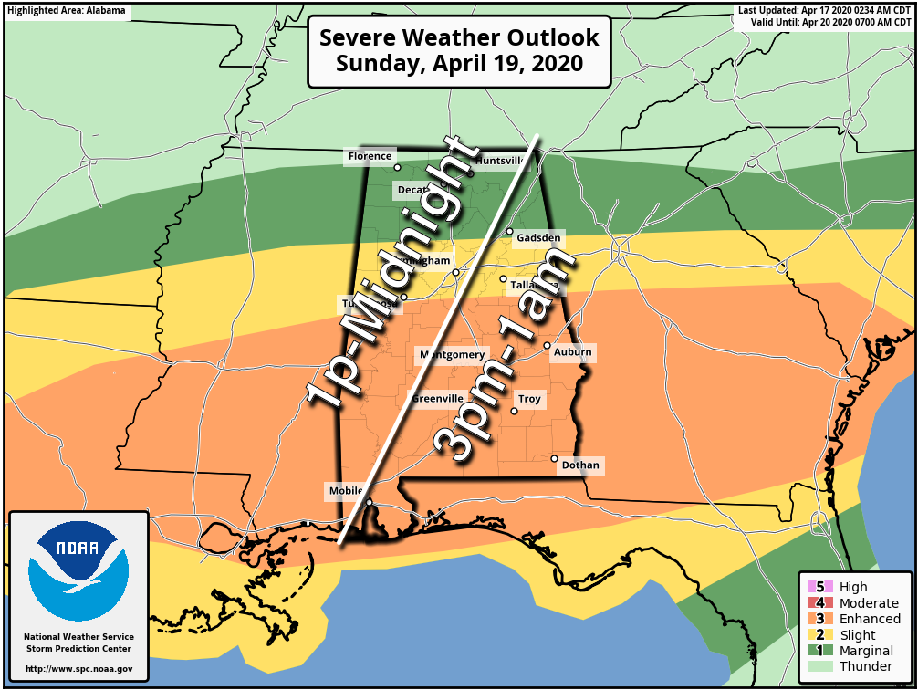
TIMING: The main severe weather threat will come from 1 p.m. Sunday through 1 a.m. Monday. There will be multiple waves of rain and storms during this window. Again, rain is likely Sunday morning, but severe storms are not expected then.
PLACEMENT: This is the challenging part of the forecast. The northward extent of the unstable air will represent the northward edge of the severe weather threat. There’s a safe bet it makes it as far north as I-20, but there is a chance the northern part of the state could remain in stable air through the event (areas north of Birmingham). So, for now, the core threat will be over the southern two-thirds of the state, roughly from I-20 south.
THREATS: In the severe weather threat area, all modes of severe weather will be possible, including large hail, damaging winds and a few tornadoes. A strong tornado (EF-2 or higher) can’t be ruled out in the enhanced risk area.
FLOODING: Rain will be heavy at times; amounts of 2-4 inches are likely, with isolated heavier amounts. Flash flooding could develop.
This event, most likely, won’t be as productive as the one last Sunday (Alabama had 24 confirmed tornadoes with that event), as the dynamic support and wind fields are not as strong. But this is still a significant threat, and everyone will need to be a in a position to hear severe weather warnings and have a good action plan if you get in a tornado warning polygon. And don’t forget to pay attention to severe thunderstorm warnings.
NEXT WEEK: The sky becomes partly sunny Monday with a high in the low 70s. Tuesday will be dry and mild; then another dynamic weather system will bring rain and storms back to the state late Wednesday into Thursday. It remains to be seen if this will be a significant severe weather threat; it’s just something to watch for now.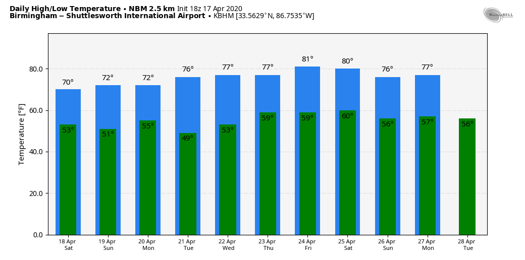
ON THIS DATE IN 1922: Southern Illinois and western Indiana saw two rounds of severe weather, including tornadoes. The first significant tornado occurred just before midnight on April 16 near Oakdale, Illinois. This tornado killed four and injured 22 others. Five additional tornadoes took place between midnight and 3 a.m. on April 17. During the mid-morning and early afternoon, two estimated F4 tornadoes caused devastation in Hedrick and near Orestes in Indiana. A postcard from one farm near Orestes was dropped near Mt. Cory, Ohio, 124 miles away.
WEATHER BRAINS: You can listen to our weekly 90-minute show anytime on your favorite podcast app. This is the show all about weather featuring many familiar voices, including the meteorologists at ABC 33/40.
CONNECT: You can find me on all of the major social networks:
Facebook
Twitter
Instagram
Pinterest
Snapchat: spannwx
For more weather news and information from James Spann and his team, visit AlabamaWx.


