James Spann: Classic summer weather for Alabama while tropics see activity

James Spann: Summertime pattern sets in for Alabama through the weekend from Alabama NewsCenter on Vimeo.
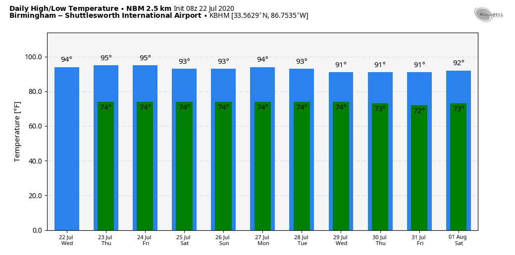
SUN, HEAT, STORMS: More classic summer weather is ahead for Alabama today through the weekend. Partly sunny, hot, humid days with scattered showers and storms, mostly during the afternoon and evening hours, when the air is most unstable. Unfortunately there is no way of knowing the exact placement and coverage of the storms that fire up on a daily basis this time of the year; odds of any one spot getting wet today will be 25/30% … probably not as many as what we experienced yesterday. The high will be in the 92-95 degree range this afternoon; the average high for July 22 at Birmingham is 91.
The probably of one location seeing an afternoon shower or storm tomorrow through the weekend will be 20/25% each day, and highs will remain in the low to mid 90s. Most of the scattered showers and thunderstorms will come from 1 p.m. until 9 p.m.
NEXT WEEK: Not much change, although some global models suggests a weak front could approach Alabama by mid-week, perhaps enhancing coverage of showers and thunderstorms by Wednesday. See the Weather Xtreme video for maps, graphics, and more details.
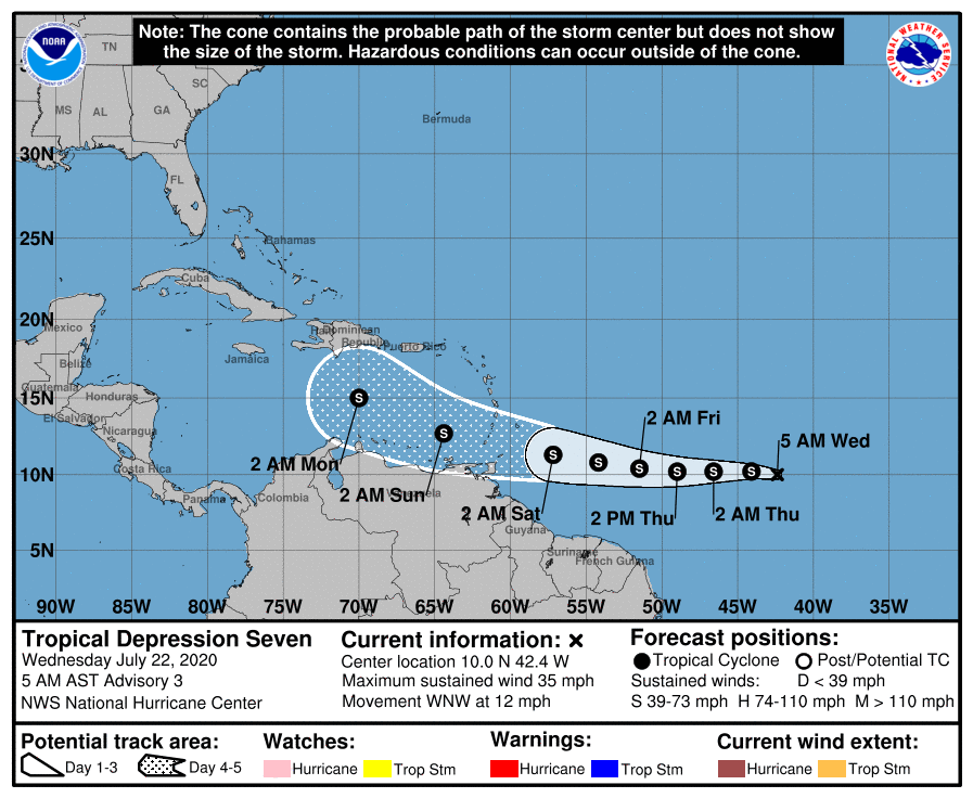
TROPICS: The “wave train” is beginning to crank up as we head toward the peak of the tropical season, which comes in August and September. Tropical Depression Seven, in the Atlantic between the coast of Africa and the Lesser Antilles, should become Tropical Storm Gonzalo this morning. This compact system will move across the Windward Islands Saturday, and into the open Caribbean Sunday. Although the cyclone is likely to remain in an environment of fairly low shear, the influences of dry air and large-scale subsidence (sinking motion) could inhibit strengthening in a few days. It remains to be seen if this will survive, or ultimately impact the Gulf of Mexico or the U.S. Just something to watch for now.
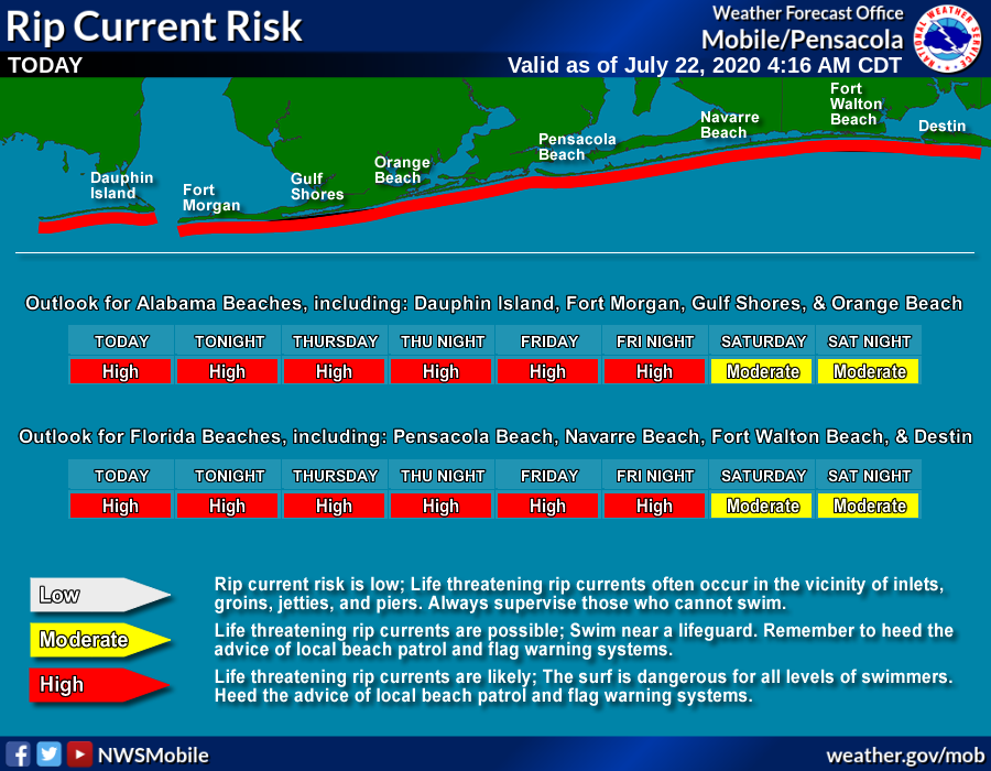
A tropical wave is moving through the Central Gulf of Mexico; it has some potential to become a tropical depression over the next 24-48 hours as it moves westward. One way or another, the main impact will be potential for heavy rain over parts of Texas late in the week. While this wave will remain south of Alabama and the Central Gulf Coast, it will bring the danger of rip tides in the area from Gulf Shores over to Panama City Beach through the rest of the week.
BIG SHAKER: A major, magnitude 7.8 struck off the southeast coast of the Alaskan peninsula early this morning. The quake, whose focus was at a depth of six miles, prompted the US National Tsunami Warning Center to issue a tsunami warning for the region, but it has been cancelled.
HIT AND MISS: Summer soakers brought heavy rain to parts of Alabama yesterday, but others were bone dry. A good example was in East Alabama; our Skywatcher at Heflin reported 2.17″ of rain, but just one county over, Jacksonville had 0.00″.
ON THIS DATE IN 1988: Dust devils are not a unique phenomenon, but usually they stay minimal. This was not the case in Dickinson County, Iowa where a powerful dust devil developed on the edge of Lake Okoboji. It picked up whole sections of several docks and swept away all of the loose dirt in the area. Estimated winds exceeded 60 mph.
BEACH FORECAST: Click here to see the AlabamaWx Beach Forecast Center page.
WEATHER BRAINS: Don’t forget you can listen to our weekly 90 minute show anytime on your favorite podcast app. This is the show all about weather featuring many familiar voices, including our meteorologists here at ABC 33/40.
CONNECT: You can find me on all of the major social networks…
Facebook
Twitter
Instagram
Pinterest
Snapchat: spannwx
Look for the next Weather Xtreme video here this afternoon… enjoy the day!
For more weather news and information from James Spann and his weather team, visit AlabamaWx.com.


