James Spann: Occasional showers, more clouds than sun for Alabama
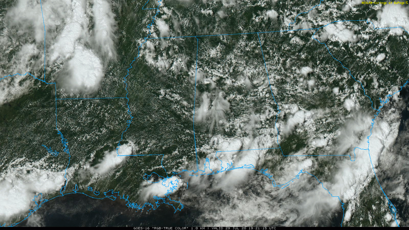
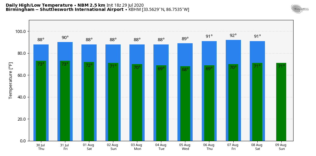
COMFORTABLE SUMMER DAY: While humidity values remain very high, temperatures are well below average for late July across Alabama today due to clouds and showers. The average high for the date is 91 (based on data for Birmingham), but most places are only in the upper 70s and low 80s. Occasional showers will continue across the state through tonight in the tropical air.
THURSDAY THROUGH THE WEEKEND: The weather won’t change much Thursday through Saturday; expect mostly cloudy days with occasional showers and a few thunderstorms. While most of the rain will come from noon until midnight, we can’t rule out some late-night or morning rain as well. Highs will remain mostly in the 80s with only a limited amount of sun. Showers should be more scattered and fewer in number Sunday with a high between 87 and 90 degrees.
NEXT WEEK: Looks like fairly routine summer weather through the week — partly sunny, hot, humid days with random, scattered, mostly afternoon and evening showers and storms. The tropical system most likely won’t affect Alabama at all since we will be on the drier, west side of the circulation.
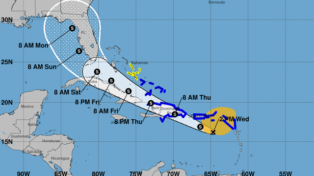
TROPICS: The tropical wave in the far eastern Caribbean is having a hard time getting organized; it is still “Potential Tropical Cyclone Nine” this afternoon. A recent Air Force Reserve reconnaissance aircraft was still unable to find a well-defined circulation. Therefore, the system has not yet become a tropical depression or storm. The latest forecast track from the National Hurricane Center takes it over Hispaniola Thursday and then into the Florida Peninsula (not the Panhandle) Sunday and Sunday night.
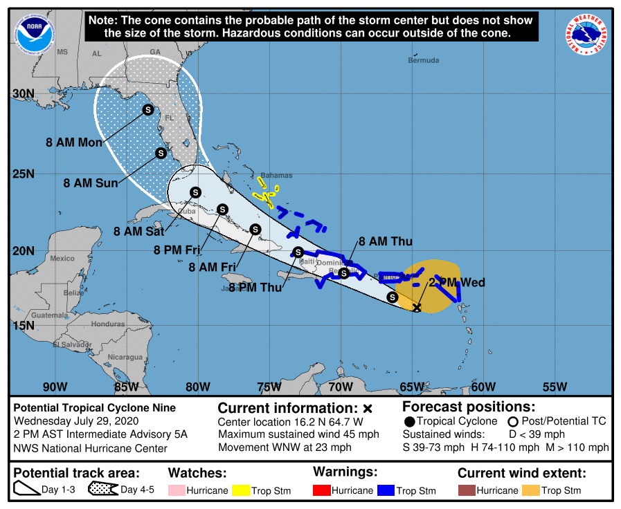
Given the expected land interaction and less-than-ideal upper-level environment, the NHC continues to expect the system will remain below hurricane strength over the next five days. Many questions remain about potential impact to Florida, and it is too early to answer most of those questions. But, as you look at the track, remember most of the rain (not necessarily all) will be along and east of the track center; the west side is the “dry side” with an offshore flow. Sunday certainly looks like a wet, windy day for the Florida Peninsula (not the Panhandle), but this could change. A good thing is that this won’t be stalling; it will keep moving along in a rather brisk upper-air pattern for summer.
For now we expect minimal impact on places like Gulf Shores, Pensacola and Destin.
ON THIS DATE IN 1960: Severe thunderstorms brought damaging winds, possibly as high as 100 mph, to central Oklahoma. Eight planes and several hangars were damaged at Wiley Post Airfield, while two aircraft and additional hangars were damaged at Will Rogers World Airport. The winds caused seven injuries in the area, including two youths who were injured by flying debris.
BEACH FORECAST: Click here to see the AlabamaWx Beach Forecast Center page.
WEATHER BRAINS: You can listen to our weekly 90-minute show anytime on your favorite podcast app. This is the show all about weather featuring many familiar voices, including the meteorologists at ABC 33/40.
CONNECT: You can find me on the major social networks:
Facebook
Twitter
Instagram
Pinterest
Snapchat: spannwx
For more weather news and information from James Spann and his team, visit AlabamaWx.


