James Spann: Isolated tornadoes possible this afternoon over northwest Alabama
James Spann forecasts a low-end tornado threat for northern Alabama today from Alabama NewsCenter on Vimeo.
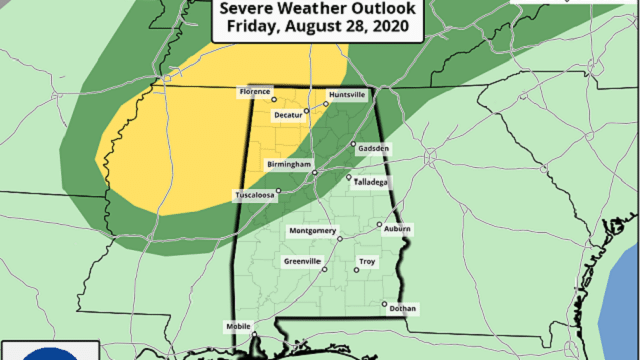
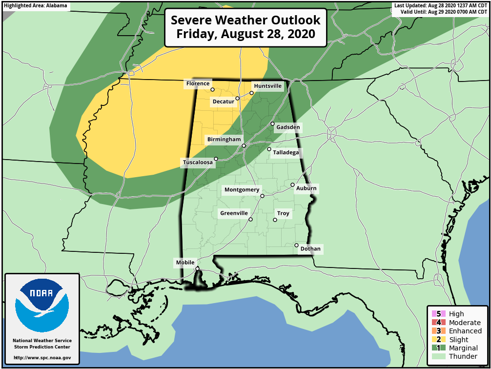
ACTIVE DAY: The remnant circulation of former Hurricane Laura will turn eastward today, passing north of Alabama. We have a very moist, tropical air mass in place this morning, and as the air heats and becomes more unstable this afternoon there is a chance of a few stronger storms in the spiral bands wrapping into the circulation to the north. With fairly high storm relative helicity values, a few storms might show some rotation, and there is the risk of a few isolated, brief tornadoes. The Storm Prediction Center has defined a slight risk (level 2 of 5) today for areas north of a line from Huntsville to Jasper to Reform. A marginal risk (level 1 of 5) extends down to Jacksonville, Calera and Livingston.
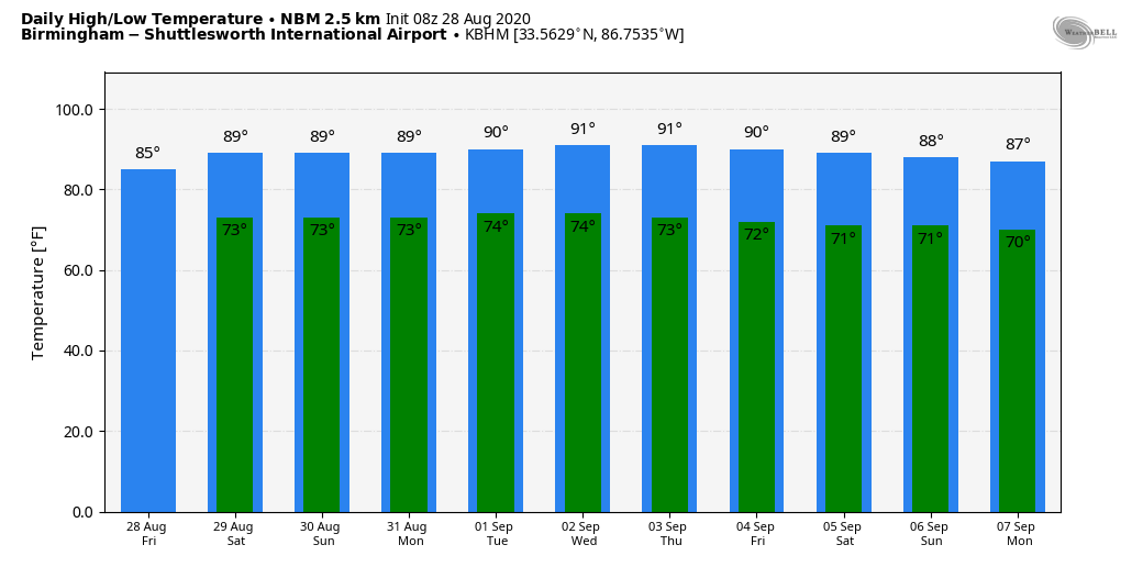
The main risk of a tornado or two will come from about noon until 7 p.m., when the air is most unstable. Any tornadoes that form will most likely be short-lived. Just be weather aware today and pay attention to warnings if they are issued. Otherwise, the day will be mostly cloudy with a few passing showers or thunderstorms likely; the high will be in the low to mid 80s.
THE ALABAMA WEEKEND: Models continue to suggest the air will be a little drier Saturday over the northern third of the state, meaning fewer showers. But the air will be a bit more unstable, so where storms do form Saturday afternoon they could be strong. Then moisture levels rise again Sunday, with scattered to numerous showers and storms likely. The weekend won’t be a washout by any means, but you will deal with a passing shower or thunderstorm from time to time if you have something planned outdoors. Highs will be between 86 and 90 degrees both days.
NEXT WEEK: A number of showers and storms are still expected Monday and Tuesday, but they should become fewer in number over the latter half of the week as the air becomes drier. Afternoon highs for the week will be between 88 and 92.
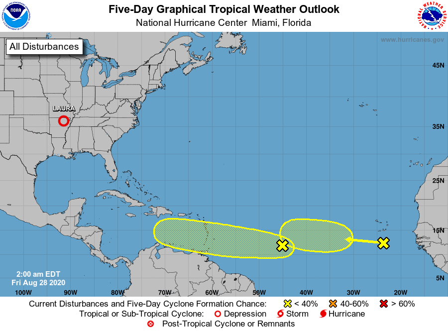
TROPICS: The National Hurricane Center is monitoring two tropical waves in the main development region of the Atlantic, one in the eastern Atlantic and one between Africa and the Lesser Antilles. Both, for now, have a low chance (30%) of development over the next five days — just something to watch. The Gulf of Mexico will be quiet for the next five days.
ON THIS DATE IN 1990: Between 3:15 p.m. and 3:45 p.m. a devastating F5 tornado ripped a 16.4-mile-long path through portions of Kendall and Will counties in northern Illinois. A total of 29 people were killed and 350 more were injured.
ON THIS DATE IN 2005: Hurricane Katrina attained Category 5 status in the morning and reached its peak strength at 1 p.m., with maximum sustained winds of 175 mph and a minimum central pressure of 902 millibars.
BEACH FORECAST: Click here to see the AlabamaWx Beach Forecast Center page.
WEATHER BRAINS: You can listen to our weekly 90-minute show anytime on your favorite podcast app. This is the show all about weather featuring many familiar voices, including the meteorologists at ABC 33/40.
CONNECT: You can find me on the major social networks:
Facebook
Twitter
Instagram
Pinterest
Snapchat: spannwx
For more weather news and information from James Spann and his team, visit AlabamaWx.