James Spann: Cooler air moves into Alabama over the weekend
James Spann forecasts fall weather just days ahead for Alabama from Alabama NewsCenter on Vimeo.
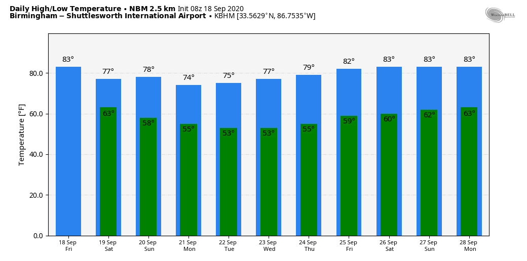
DRY PATTERN: Look for a partly sunny sky across Alabama today with a high this afternoon in the low to mid 80s. The average high at Birmingham for Sept. 18 is 85. The sky will stay fair tonight; it will be a very pleasant night for high school football games, with temperatures falling through the 70s.
THE ALABAMA WEEKEND: Cooler air drops into the state. With a mix of sun and clouds Saturday we expect a high between 75 and 79 degrees, and on Sunday the sky will be mostly sunny with a high not too far from 80 degrees. Mornings will be very pleasant, with low temperatures between 58 and 62 degrees.
NEXT WEEK: Delightful early fall weather continues with sunny, pleasant days and clear, cool nights. Highs will be in the upper 70s Monday through Wednesday, followed by low 80s Thursday and Friday. Lows will be mostly in the 50s, although some of the cooler spots across north Alabama could reach the upper 40s for the first time this season by Tuesday and Wednesday mornings. The European global model tries to bring in some rain toward the end of the week with a tropical system, but the American model (the GFS) is dry, and we will keep the forecast rain-free for now.
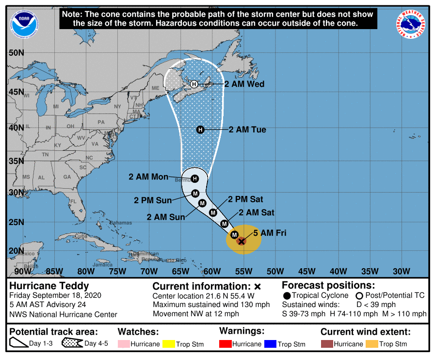
TROPICS: Teddy is a major hurricane with winds of 130 mph in the middle of the Atlantic; it will weaken a bit late in the weekend and is forecast to be near Bermuda late Sunday night or Monday morning. From there, it heads toward the Canadian Maritimes, staying east of the U.S.
A tropical wave in the eastern Atlantic, Invest 98L, has a medium chance of development over the next few days; if anything forms it will most likely gain latitude in four to five days, recurving into the open Atlantic. Most likely it will be no threat to land.
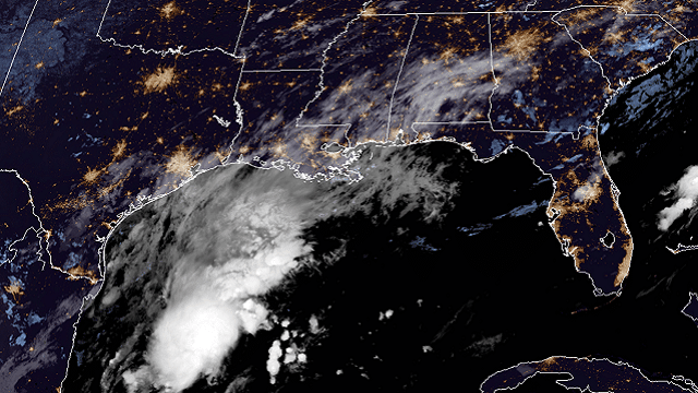
TROPICAL DEPRESSION 22: A new tropical depression formed in the southwest Gulf of Mexico late Thursday; winds are 35 mph. It is forecast to become Tropical Storm Wilfred later today, moving to the north/northeast, followed by a sharp turn to the west Saturday night. The National Hurricane Center forecasts Wilfred to become a hurricane briefly on Sunday before weakening again to a tropical storm early next week just off the Texas coast.
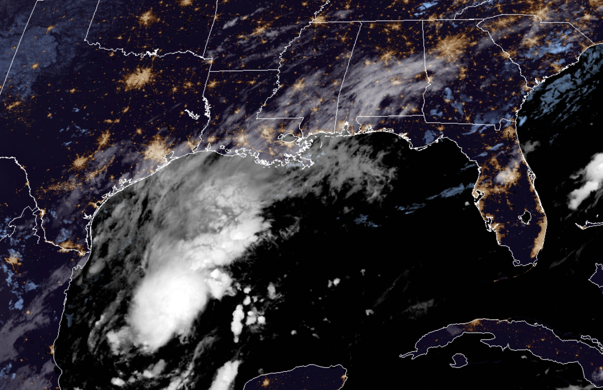
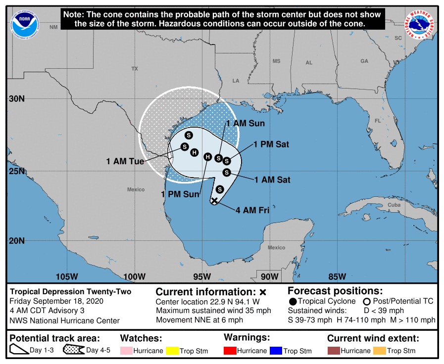
Steering currents will be weak; Wilfred could drift into Texas, dissipating inland, or it could move northeast in the direction of the Louisiana coast. There is no way of knowing the ultimate destination of the system now.
ON THIS DATE IN 1926: The great “Miami Hurricane” produced winds of 138 mph that drove ocean waters into Biscayne Bay, drowning 135 people. The eye of the hurricane passed over Miami, at which time the barometric pressure reached 27.61 inches. Tides up to 12 feet high accompanied the storm, which claimed a total of 372 lives.
BEACH FORECAST: Click here to see the AlabamaWx Beach Forecast Center page.
WEATHER BRAINS: You can listen to our weekly 90-minute show anytime on your favorite podcast app. This is the show all about weather featuring many familiar voices, including the meteorologists at ABC 33/40.
CONNECT: You can find me on the major social networks:
Facebook
Twitter
Instagram
Pinterest
Snapchat: spannwx
For more weather news and information from James Spann and his team, visit AlabamaWx.


