James Spann: Small risk of showers for Alabama Wednesday
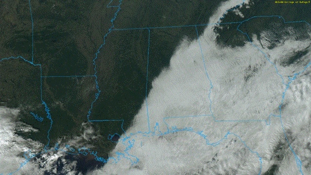
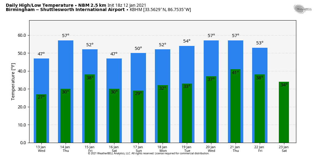
THIS AFTERNOON: The sun is shining brightly this afternoon north and west of a line from Butler to Tuscaloosa to Lake Guntersville, but to the south and east clouds are hanging tough. Temperatures are only in the 30s under the cloud cover, but in the 40s where the sky has cleared. Most places will see a freeze tonight, with lows early Wednesday ranging from 25 to 33.
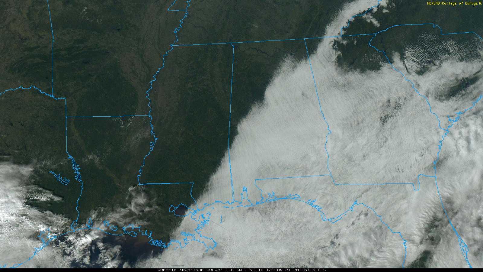
An upper trough will pass over the state Wednesday. It could bring a few isolated showers, but moisture is very limited and most places will stay dry. Otherwise, look for a mix of sun and clouds with a high in the low 50s. Thursday will feature a partly sunny sky with a high between 54 and 59 degrees; it will be the warmest day of the week.
A cold front will pass through the state early Friday morning in mostly dry fashion; we expect nothing more than a few sprinkles. Otherwise, Friday will be mostly cloudy, breezy and colder, with temperatures falling into the 40s during the day.
THE ALABAMA WEEKEND: Most of the weekend looks rain-free with below-average temperatures. Morning lows will be in the 27- to 32-degree range; the high will be in the upper 40s Saturday and close to 50 Sunday. Clouds will increase Sunday night, and a passing disturbance could bring some scattered light rain, mainly to the southern half of the state.
NEXT WEEK: The pattern continues to look fairly quiet. Some rain is likely Thursday thanks to a low in the Gulf of Mexico; otherwise the week looks dry with seasonal temperatures. There’s still no sign of any bitterly cold Arctic air, winter storms, severe thunderstorms or heavy rain around here for the next seven to 10 days.
ON THIS DATE IN 1982: Birmingham experienced one of its worst winter storms of the 20th century as snow swept into central Alabama about midday. Morning forecasts had called for a winter storm watch for occasional sleet and freezing rain that would arrive by sundown. But freezing rain and snow arrived about eight hours earlier than anticipated in the Birmingham area that turned roads into skating rinks. Thousands of motorists had to abandon their vehicles on roads and hike home or spend the night in shelters. Brookwood Village mall became a huge shelter. So many wrecks occurred that the Birmingham Police Department could not answer the calls for accident investigation.
As temperatures hovered near the freezing mark through the night, freezing rain created a thick coating on all exposed objects. Trees snapped, pulling down power lines and putting as many as 750,000 Alabamians in the dark. A state of emergency was declared and National Guard Armories were opened to serve as shelters. It was a catastrophic ice storm; when it was all said and done, 20 Alabamians were dead and another 300 injured, and damage totaled $78 million.
BEACH FORECAST: Click here to see the AlabamaWx Beach Forecast Center page.
WEATHER BRAINS: You can listen to our weekly 90-minute show anytime on your favorite podcast app. This is the show all about weather featuring many familiar voices, including the meteorologists at ABC 33/40.
CONNECT: You can find me on all of the major social networks:
For more weather news and information from James Spann and his team, visit AlabamaWx.


