James Spann: Dangerous severe weather threat for Alabama Wednesday afternoon, night
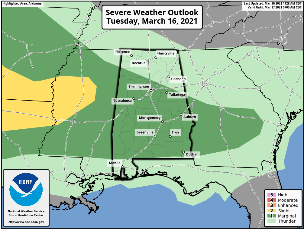
THIS AFTERNOON: Large areas of rain continue over the southern two-thirds of Alabama this afternoon. Strong storms are southeast of Montgomery and flash flooding persists over parts of Choctaw, Clarke and Wilcox counties in the southwest part of the state. The Storm Prediction Center maintains a low-end marginal risk (level 1 out of 5) of severe thunderstorms through tonight over a decent part of the state.
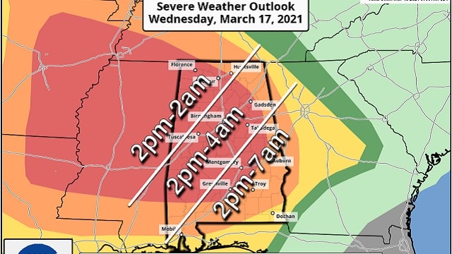
DANGEROUS SEVERE WEATHER THREAT WEDNESDAY: The SPC maintains a moderate risk (level 4 of 5) for a good part of Alabama, including places like Birmingham, Montgomery, Tuscaloosa, Anniston, Gadsden and Florence. An enhanced risk (level 3 of 5) covers most of the rest of the state.

A negative-tilt upper trough with strong wind fields will help to spin up a surface low over Arkansas. Warm, moist, unstable air will cover most of the state with steep lapse rates and strong veering of the wind with altitude (helicity). The SPC notes it could upgrade the risk to high (level 5 of 5) for Wednesday on the next update late tonight.
TIMING: Thunderstorms are likely Wednesday morning over the northern quarter of the state along a northward-moving warm front; some of these could be strong. For now the severe weather risk looks low, but when it comes to thunderstorms you have to expect the unexpected, so we will be watching them closely. For most of the state, the risk of severe storms will begin Wednesday afternoon, continuing well into Wednesday night. Parts of southeast Alabama could see storms lingering through midmorning Thursday.
The afternoon storms Wednesday will be widely scattered, most likely, but where they form they could be severe. The more organized thunderstorms arrive Wednesday night.
THREATS: Thunderstorms will be capable of producing large hail, damaging winds and tornadoes. Atmospheric conditions support a few strong, violent, long-track tornadoes in the moderate risk area.
RAIN: Additional rain amounts of 1-2 inches are likely. Some isolated flooding is possible.
GET READY NOW: Here are some important points about preparedness:
- Have at least two ways of hearing warnings. Every Alabama home and business needs a NOAA Weather Radio; the model most used is the Midland WR-120, available at most big box retailers. Weather radio receivers do not rely on cellular networks and are very reliable. The second way is your phone; be sure Wireless Emergency Alerts are enabled, and have a reliable app like the ABC 33/40 Weather app, which also pushes warnings. Never rely on an outdoor siren. NEVER.
- Know your safe place. In a site-built home, it is a small room on the lowest floor, near the center of the house, away from windows. In that safe place, have helmets for everyone (this means adults too). We also recommend a portable airhorn for everyone (to alert first responders if you need help), and hard-soled shoes in case you have to walk over a tornado debris field.
- You can’t stay in a mobile home during a tornado warning. Know where you are going and how to get there quickly. If there is no community shelter nearby, go to a business like a gas station, convenience store or restaurant that is open 24/7.
- Be sure you can find your home on a map. Identify the county you are in and the ones surrounding you. Map skill is very important on severe weather days.
Please help us by spreading the word about this serious threat. Many folks don’t pay close attention to the weather; tell your relatives, friends and neighbors and help us get them ready. We don’t share this to scare anyone; we simply have a responsibility to let you know the danger.
For those with a weather phobia or high anxiety, understand even on a big severe-weather day odds of any one home being hit by a tornado are still very low. Just be sure you can hear warnings, have a good plan and we will get through the day together.
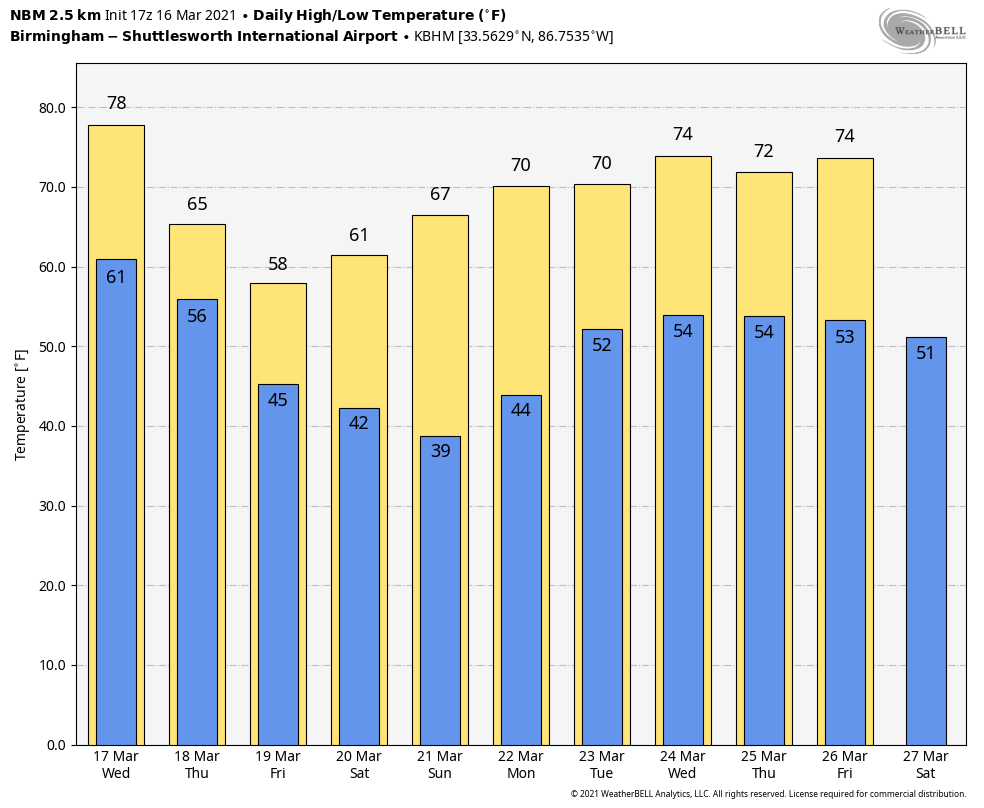
THURSDAY THROUGH THE WEEKEND: Storms will end Thursday morning, but clouds will linger much of the day with highs back in the 60s. Friday will be mostly cloudy with just a small risk of a shower. The high will be between 60 and 65 degrees.
Saturday will be dry with a partly sunny sky; the high will be between 57 and 62 degrees. We drop into the 30s Sunday morning with potential for frost; colder spots could see a light freeze. During the day Sunday, with sunshine in full supply, we rise into the mid 60s.
NEXT WEEK: The latest global model set suggests a chance of rain and storms Tuesday and then again Friday. Both seem to have some potential for strong storms, but it is way too early to determine whether severe thunderstorms will be an issue.
ON THIS DATE IN 1942: A deadly tornado outbreak occurred over the central and southern U.S. on March 16-17. The outbreak killed 153 people and injured at least 1,284. The best estimate indicates this event contained 13 F3 tornadoes, six F4s and one F5. The F5 tornado occurred north of Peoria, Illinois, in the towns of Alta and Chillicothe, before crossing the Illinois River and striking the town of Lacon. A quarter of the homes in Lacon were destroyed and debris was carried for 25 miles.
BEACH FORECAST: Click here to see the AlabamaWx Beach Forecast Center page.
WEATHER BRAINS: You can listen to our weekly 90-minute show any time on your favorite podcast app. This is the show all about weather featuring many familiar voices, including the meteorologists at ABC 33/40.
CONNECT: You can find me on the major social networks:
For more weather news and information from James Spann and his team, visit AlabamaWx.


