James Spann: Strong, possibly severe storms for Alabama Wednesday
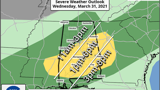
CLOUDS MOVING IN: Clouds will continue to increase across Alabama this evening, and scattered showers are possible statewide tonight. On Wednesday, with the approach of a cold front, a line of strong thunderstorms will move across the state. The Storm Prediction Center has defined a slight risk (level 2 of 5) for areas south of I-59 (south of a line from Tuscaloosa to Birmingham to Gadsden), with a marginal risk (level 1 of 5) north to the Tennessee state line.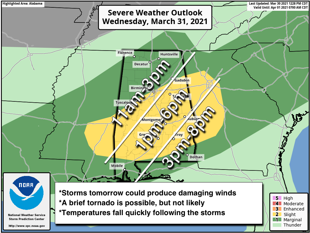
TIMING: The line of storms will enter the northwest corner of the state early Wednesday morning, around 6-7 a.m. It will reach the I-59 corridor (Tuscaloosa, Birmingham, Gadsden) around noon, then move near Montgomery around 3 p.m. The line will be close to Dothan by 5-6 p.m.
THREATS: The main threat will come from strong, potentially damaging straight-line winds. Keep in mind with saturated soil conditions, trees could come down easily where winds exceed 40-50 mph. Also, some small hail is possible. A brief, isolated tornado is possible, but not especially likely.
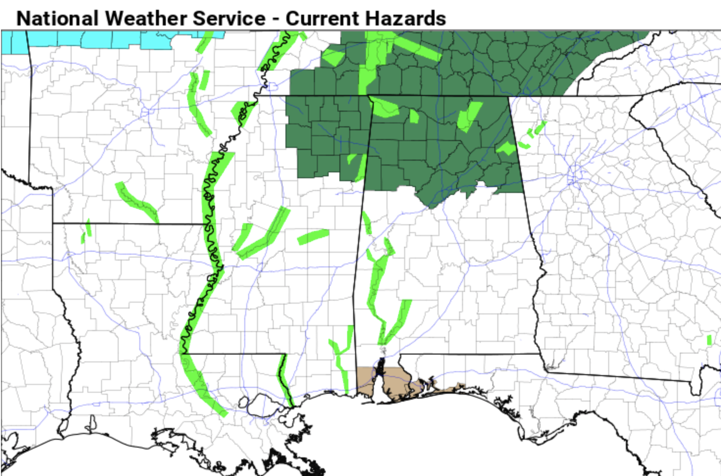
FLOODING: A Flash Flood Watch is in effect along and north of a line from Millport to Birmingham to Ranburne. Rain amounts could exceed 1 inch across north Alabama, and with saturated soil conditions some flooding could develop.
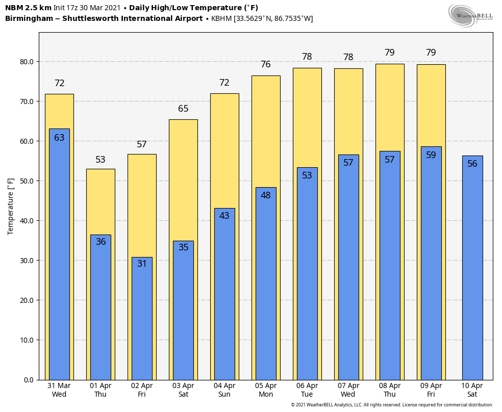
TEMPERATURE DROP: Once the line of storms passes, temperatures will drop from the 70s into the 40s in a short amount of time with a brisk north wind. Be ready for the change; it will feel cold over north Alabama Wednesday afternoon.
LATE-SEASON FREEZE: It is possible some locations over the northern half of the state will experience a freeze Thursday, Friday and Saturday mornings. The coldest morning will be Friday, when the wind will be calm; most communities will drop into the 20s. The weather will be dry Thursday through the weekend with sunny days and clear nights. The highs Thursday and Friday will be between 55 and 59 degrees, followed by mid 60s Saturday and mid 70s Sunday.
NEXT WEEK: The weather stays dry Monday and Tuesday with the warming trend continuing. New global model data suggests rain could return as early as Tuesday night and Wednesday. It’s too early to know whether severe storms will be an issue.
SURVEY UPDATE: National Weather Service Birmingham has confirmed 10 tornadoes in its County Warning Area (CWA) last Thursday. Four of them were rated EF-3. One of them was on the ground for 80 miles; it first touched down near Sawyerville in Hale County and lifted near Wilsonville. The path was very similar to the May 27, 1973 tornado; both hit the NWS radar site near Brent (it was decommissioned in the mid 1990s).
ON THIS DATE IN 1805: New York’s City’s Battery Park was strewn with 24-inch snow rollers from a ferocious March 26-28 storm. Snow rollers are natural snowballs that are formed when winds blow over a snow-covered surface.
BEACH FORECAST: Click here to see the AlabamaWx Beach Forecast Center page.
WEATHER BRAINS: You can listen to our weekly 90-minute show any time on your favorite podcast app. This is the show all about weather featuring many familiar voices, including the meteorologists at ABC 33/40.
CONNECT: You can find me on the major social networks:
For more weather news and information from James Spann and his team, visit AlabamaWx.


