James Spann: Rain returns to Alabama today
James Spann has the midweek forecast for Alabama from Alabama NewsCenter on Vimeo.
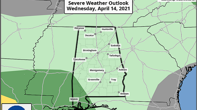
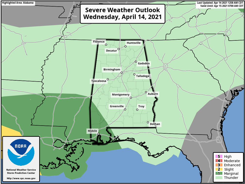
RAIN RETURNS: Today will be cloudy and considerably cooler; most places won’t get past the low 70s. Rain will move into the state by late morning into midday. A few thunderstorms are possible this afternoon; the Storm Prediction Center maintains a marginal risk (level 1 of 5) for Mobile, Baldwin and Washington counties, but severe weather won’t be an issue for most of the state. Periods of rain will continue through tonight.
Rain amounts will be less than one-half inch for the northern half of Alabama, with totals to 1 inch for the southern counties. Some lingering rain is possible early Thursday, especially for the southern part of the state; then the sky becomes partly to mostly sunny Thursday afternoon as drier air works in. Thursday’s high will be between 66 and 71 degrees.
FRIDAY AND THE WEEKEND: Clouds will increase again Friday, and periods of mostly light rain are likely Friday night into Saturday morning. Heavier rain totals will be over south Alabama, and most of the rain will come from about midnight Friday night through noon Saturday. Saturday afternoon will be dry, but clouds will linger. Temperatures will remain below average, with highs in the mid to upper 60s Friday and Saturday.
Sunday will be dry with a mix of sun and clouds; the high will be somewhere between 66 and 72 degrees.
NEXT WEEK: A period of quiet weather is likely for Alabama. Much of the week looks dry with temperatures a bit below seasonal averages.
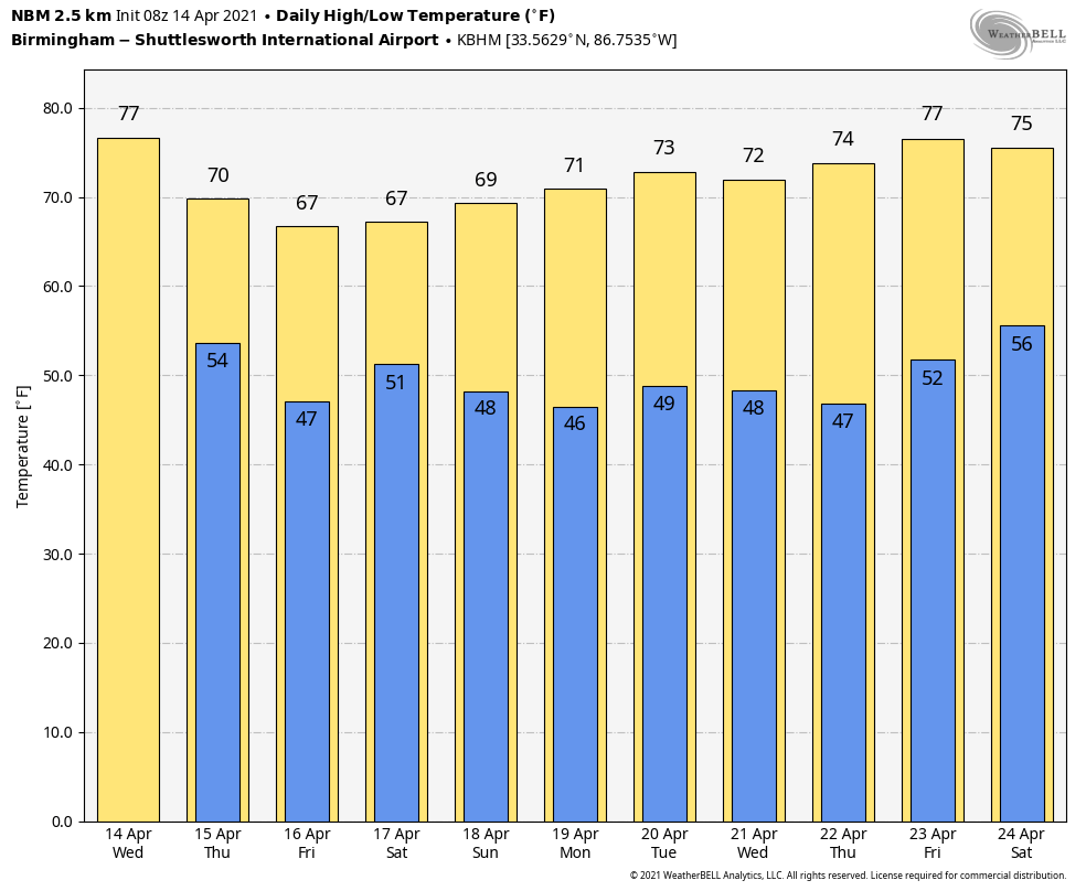
FOOTBALL WEATHER: Both Auburn and Alabama will hold their annual spring scrimmage games Saturday. The game in Tuscaloosa kicks off at noon; kickoff in Auburn is set for 1. Some light rain is likely Saturday morning across the state, but we believe the weather at both stadiums will be dry by afternoon with lingering clouds. Temperatures will be between 65 and 69 degrees in Tuscaloosa and Auburn Saturday afternoon.
ON THIS DATE IN 1935: Black Sunday refers to a particularly severe dust storm that occurred on April 14, 1935, as part of the Dust Bowl. During the afternoon, the residents of the Plains States were forced to take cover as a dust storm or “black blizzard” blew through the region. The storm hit the Oklahoma Panhandle and northwestern Oklahoma first and moved south for the remainder of the day. It hit Beaver around 4 p.m., Boise City around 5:15 p.m. and Amarillo, Texas, at 7:20 p.m. The conditions were the most severe in the Oklahoma and Texas panhandles, but the storm’s effects were felt in surrounding areas.
ON THIS DATE IN 2019: Eleven tornadoes touched down across Alabama. All were rated EF-0/1 and there were no fatalities or injuries. These tornadoes moved through communities such as Troy, Glencoe, Gallion and Phenix City. One EF-0 tornado moved through Highland Lakes in Shelby County.
BEACH FORECAST: Click here to see the AlabamaWx Beach Forecast Center page.
WEATHER BRAINS: You can listen to our weekly 90-minute show any time on your favorite podcast app. This is the show all about weather featuring many familiar voices, including the meteorologists at ABC 33/40.
CONNECT: You can find me on the major social networks:
For more weather news and information from James Spann and his team, visit AlabamaWx.


