James Spann: Wet weather for Alabama at times through Wednesday; drier air arrives Friday
James Spann forecasts more rain for Alabama from Alabama NewsCenter on Vimeo.
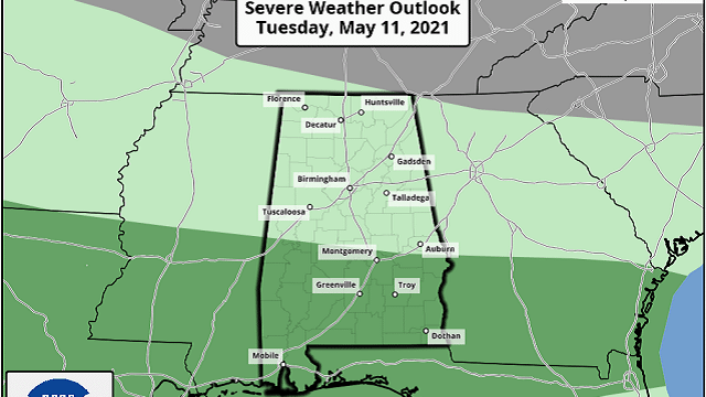
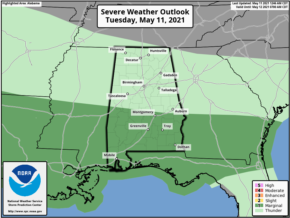
RADAR CHECK: A batch of rain and thunderstorms is pushing into northwest Alabama early this morning; otherwise the sky is cloudy statewide. A stalled surface front is parked just north of I-20. North of the front temperatures are in the low 50s; south of the front we are seeing temperatures in the mid to upper 60s. Look for occasional rain and a few thunderstorms statewide through tonight; the Storm Prediction Center maintains a marginal risk of severe thunderstorms for roughly the southern half of the state, where some small hail and strong, gusty winds are possible.
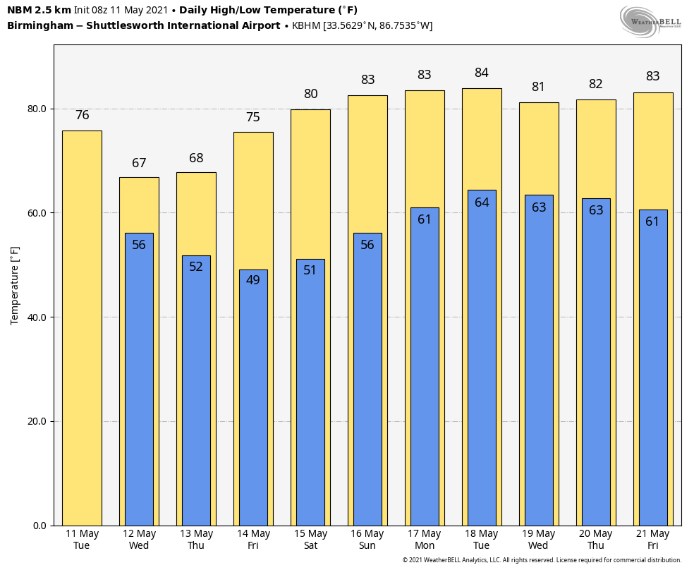
The front gets a nudge southward Wednesday; the most widespread rain will be over the southern half of the state, but scattered showers are possible over north Alabama. Highs will be in the low to mid 60s for north and central Alabama, almost 20 degrees below average for mid-May. Some lingering light rain or drizzle is possible Thursday morning; otherwise the day will be mostly cloudy and cool with highs remaining in the 60s. Some clearing is possible late Thursday afternoon, but more likely Thursday night as dry air moves into the state.
FRIDAY AND THE WEEKEND: Look for dry weather on these three days with a warming trend, sunny days and fair nights. The high will be in the mid 70s Friday, then close to 80 Saturday, followed by low 80s Sunday. A very nice weekend ahead.
NEXT WEEK: New global data shows moisture moving back into the state Monday with a risk of scattered showers. An approaching cold front will bring a round of showers and thunderstorms Tuesday, followed by dry air for the latter half of the week.
TROPICS: Tropical Depression Andres, in the eastern Pacific, is weakening and is expected to become a remnant low this morning well west of the coast of Mexico. The eastern Pacific hurricane season begins this week; the Atlantic basin season begins June 1.
ON THIS DATE IN 1934: A tremendous dust storm affected the Plains as the Dust Bowl era was in full swing. According to The New York Times, dust “lodged itself in the eyes and throats of weeping and coughing New Yorkers,” and even ships 300 miles offshore saw dust collect on their decks.
ON THIS DATE IN 1953: A violent F5 tornado ripped through downtown Waco, Texas, killing 114 people and injuring nearly 600 more. More than 850 homes, 600 businesses and 2,000 cars were destroyed or severely damaged. Losses were estimated at $41 million. The tornado was the deadliest in Texas history and the 10th deadliest in the U.S.
ON THIS DATE IN 2008: An EF-1 tornado touched down in Cleburne County in east Alabama, just south of Heflin. Hundreds of trees were either snapped off or uprooted along the path. Several structures sustained damage and at least six were destroyed. At least 35 homes sustained varying degrees of damage. No injuries were reported.
BEACH FORECAST: Click here to see the AlabamaWx Beach Forecast Center page.
WEATHER BRAINS: You can listen to our weekly 90-minute show any time on your favorite podcast app. This is the show all about weather featuring many familiar voices, including the meteorologists at ABC 33/40.
CONNECT: You can find me on the major social networks:
For more weather news and information from James Spann and his team, visit AlabamaWx.


