James Spann: Scattered storms for Alabama today; drier Friday, Saturday
James Spann forecasts one more day of scattered rain, storms for Alabama from Alabama NewsCenter on Vimeo.
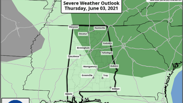
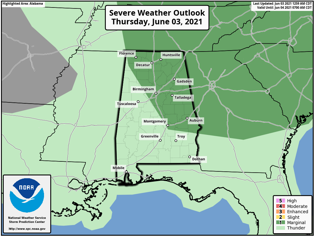
RADAR CHECK: A band of thunderstorms is moving through north Alabama early this morning with brief, heavy rain and frequent lightning. They are under severe limits, however. Otherwise, it is warm and humid across the state as the day begins. Additional scattered showers and thunderstorms will form later today and, like Wednesday, some of the heavier storms could produce small hail and strong, gusty winds this afternoon. The Storm Prediction Center has defined a marginal risk (level 1 of 5) for parts of north and east Alabama, east of a line from Muscle Shoals to Montgomery to Eufaula.
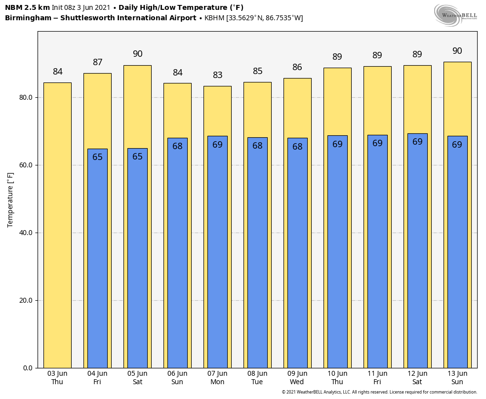
Away from the scattered storms, today will feature a mix of sun and clouds with a high in the low to mid 80s, much like Wednesday.
FRIDAY AND THE WEEKEND: Precipitable water values will drop across Alabama Friday and Saturday, meaning the weather will trend drier and a little hotter. Showers both days should be few and far between, and with a partly to mostly sunny sky the high will be in the mid to upper 80s; some spots could touch 90 degrees Saturday afternoon.
On Sunday moisture levels rise again, and scattered showers and storms will become more numerous by the afternoon and evening. Still, it won’t rain everywhere, and the high will be in the mid 80s.
NEXT WEEK: Look for warm, humid days with some sun each day, along with the usual risk of random, scattered, mostly afternoon and evening showers and thunderstorms. Odds of any one spot getting wet most days will be 40-50%, and highs will be in the mid to upper 80s, not far from seasonal averages.
TROPICS: All remains quiet across the Atlantic basin, and tropical storm formation is not expected through the weekend.
ON THIS DATE IN 1860: Iowa’s infamous Camanche Tornado, likely an F5 storm, killed 92 and injured 200. Every home and business were destroyed. It was one of the most damaging families of tornadoes ever to strike the U.S. and resulted in more farm fatalities than any other tornado except for the Tri-State tornado.
ON THIS DATE IN 1993: Early morning severe thunderstorms dumped huge hailstones across northern Oklahoma. Hail, up to 6 inches in diameter in Enid, went through roofs of homes, damaged three jets at Vance Air Force Base and did $500,000 in damage at a car dealership.
BEACH FORECAST: Click here to see the AlabamaWx Beach Forecast Center page.
WEATHER BRAINS: You can listen to our weekly 90-minute show any time on your favorite podcast app. This is the show all about weather featuring many familiar voices, including the meteorologists at ABC 33/40.
CONNECT: You can find me on the major social networks:
For more weather news and information from James Spann and his team, visit AlabamaWx.


