James Spann: Scattered to numerous showers, storms continue in Alabama
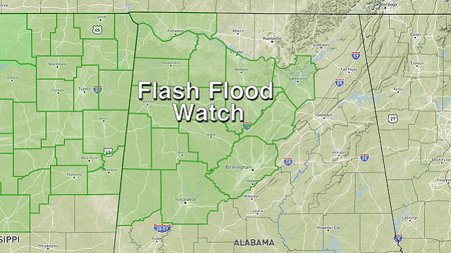
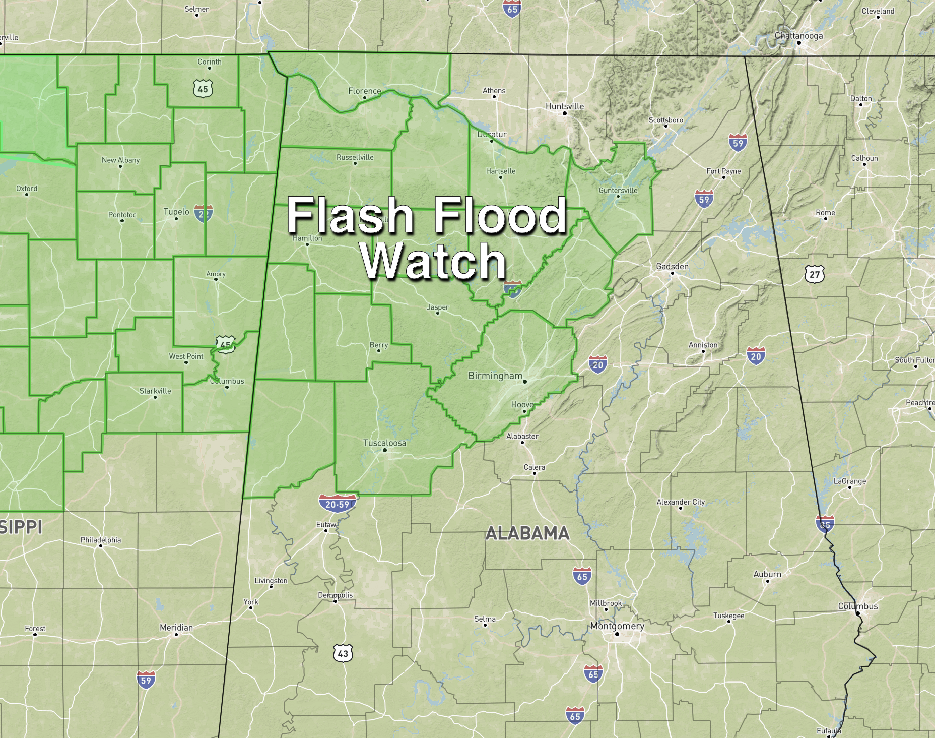
RADAR CHECK: Showers and thunderstorms continue to increase across Alabama this afternoon as they move east-northeast. Stronger storms are producing very heavy amounts of rain, and a Flash Flood Watch is in effect for parts of north and west Alabama, where the ground is saturated from recent rains.
Strong, gusty winds and some small hail are also possible in the heavier storms across the state through the evening. Away from the showers and thunderstorms, temperatures are mostly in the low to mid 80s.
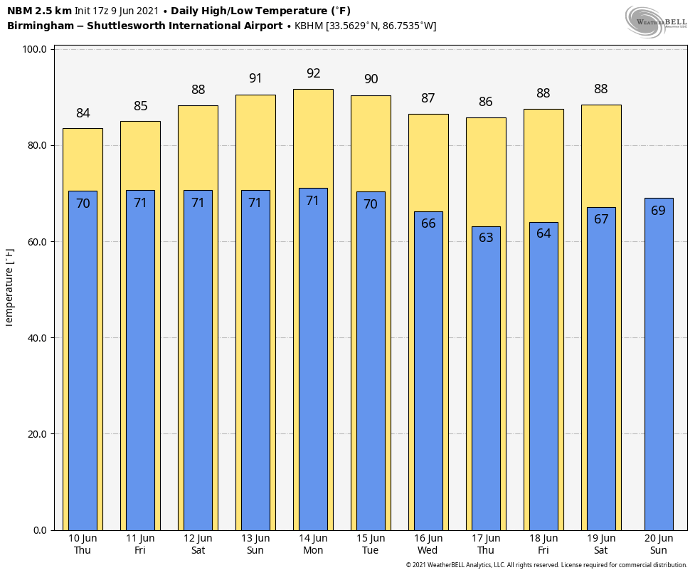
THURSDAY/FRIDAY: The weather won’t change much. We are forecasting scattered to numerous showers and storms both days with some sun at times. Like recent days, heavier thunderstorms will be very efficient rain producers. Highs will be in the low to mid 80s, a little below average for mid-June in Alabama.
THE ALABAMA WEEKEND: We will begin a trend toward drier weather conditions over the weekend as precipitable water values begin to drop. Still, we will have scattered showers and storms both days with a partly sunny sky. Odds of any one spot getting wet are around 30% Saturday, dropping to 20% Sunday. Highs will be between 85 and 89 degrees.
NEXT WEEK: While we will have some risk of afternoon showers daily, they should be widely spaced as a drier air mass continues to cover the Deep South through the week. Highs will rise into the low 90s early in the week, then drop back into the 80s by Thursday and Friday.
TROPICS: The Atlantic basin is quiet this afternoon, but a broad trough of low pressure is expected to develop over the southwestern Caribbean Sea during the next day or two following the passage of a tropical wave. Significant development of this system appears unlikely as it drifts west-northwestward or northwestward toward Central America. Regardless of development, the system could produce heavy rainfall across northern Colombia and portions of Central America from Honduras southward late this week and over the weekend.
Global models continue to suggest potential tropical depression or storm development in the western Gulf of Mexico in seven to 10 days. Most likely, the main impact will be lots of rain for parts of Texas and Louisiana, but it is way too early to be specific. We will be watching model trends closely.
ON THIS DATE IN 1966: Hurricane Alma made landfall over the eastern Florida panhandle, becoming the earliest hurricane to make landfall on the United States mainland.
BEACH FORECAST: Click here to see the AlabamaWx Beach Forecast Center page.
WEATHER BRAINS: You can listen to our weekly 90-minute show any time on your favorite podcast app. This is the show all about weather featuring many familiar voices, including the meteorologists at ABC 33/40.
CONNECT: You can find me on the major social networks:
For more weather news and information from James Spann and his team, visit AlabamaWx.


