James Spann: Routine August weather continues in Alabama; eyes on PTC 6
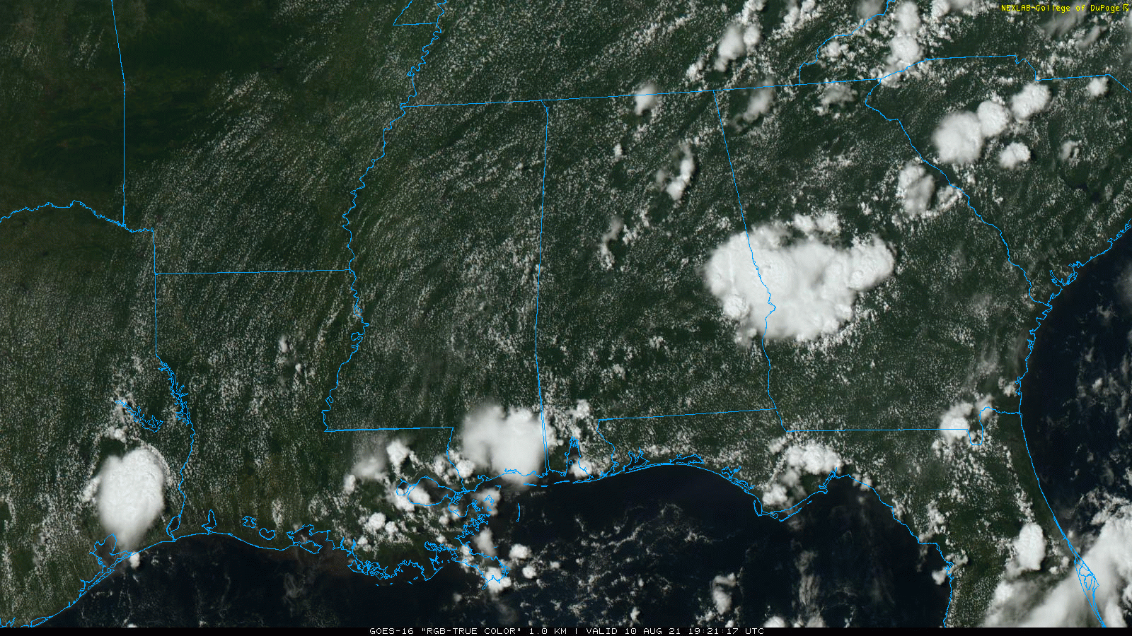
RADAR CHECK: We have the usual array of small, random, scattered showers and thunderstorms across Alabama this afternoon. The showers are short lived and moving slowly to the east. Away from them, the sky is partly sunny with temperatures mostly in the low 90s. Scattered showers will end after sunset.
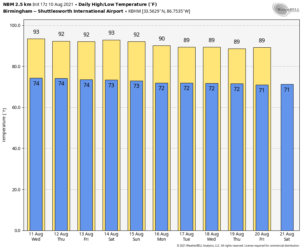
REST OF THE WEEK: A broad upper ridge will stay in place across the Deep South, and the weather won’t change much through Friday. Expect partly sunny, hot, humid days with highs in the low 90s and scattered, mostly afternoon and evening showers and thunderstorms. The chance of any one spot getting wet daily will be 35-45 percent.
THE ALABAMA WEEKEND: Look for a mix of sun and clouds Saturday and Sunday with scattered showers and storms, mostly between noon and 10 p.m. Highs will be between 88 and 91 degrees both days, at or slightly below average for mid-August in Alabama.
NEXT WEEK: The weather early in the week will be determined by the track of a tropical system that is expected to move into Florida from the eastern Gulf of Mexico. For the moment, it looks like Alabama could be on the drier, west side of the circulation, but that is very uncertain. The rest of the week will continue to feature pretty routine summer weather with a mix of sun and scattered storms. Highs will be between 86 and 90 degrees.
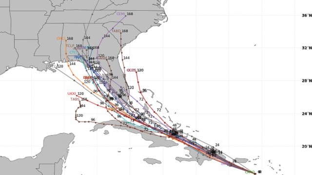
PTC 6: Potential Tropical Cyclone Six in the Caribbean is forecast to become Tropical Storm Fred during the next 12 hours. The system will move over Hispaniola Wednesday and then across the northern coast of Cuba Thursday and Friday. The latest National Hurricane Center forecast has Fred in the eastern Gulf of Mexico, west of Tampa Bay, Sunday morning.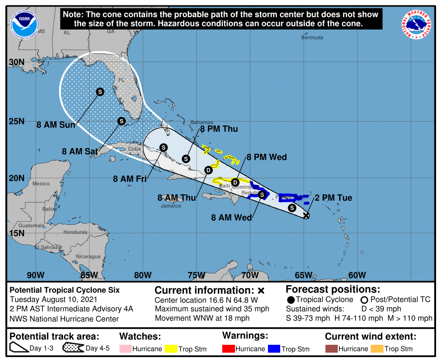
Model guidance suggests the system could move into the eastern Florida Panhandle Monday.
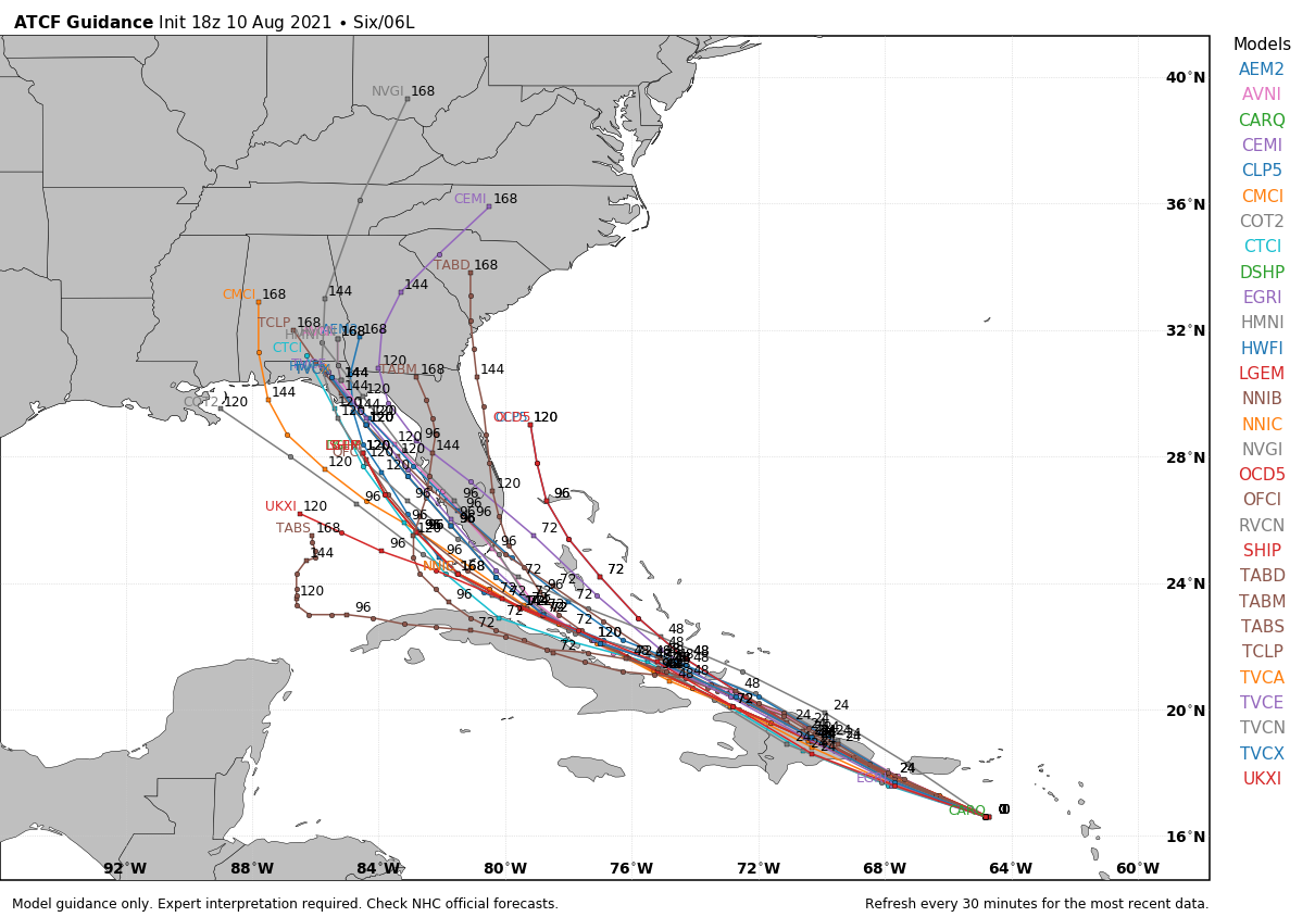
Some important points:
- Intensification in the short term will be limited by land interaction, dry air and shear.
- There is a chance the system could dissipate over the mountainous island of Hispaniola.
- If the system survives and enters the Gulf of Mexico, there is some chance it could become a hurricane by Sunday or Monday; there is abundant latent heat energy available in the Gulf.
- There is no way of knowing at this point the final destination and intensity. With NHC forecasts the average track errors four and five days out are 175 miles and 200 miles, respectively.
- If you have a beach trip planned next week, there is no need to cancel or change plans at this point. Just keep an eye on it.
Elsewhere in the tropics, a disturbance in the eastern Atlantic has a 20% chance of becoming a tropical depression or storm during the next five days as it moves to the west/northwest.
ON THIS DATE IN 1856: A hurricane destroyed Isle Dernieres or Last Island, a pleasure resort south-southwest of New Orleans. The highest points of the island were under 5 feet of water. The resort hotel was destroyed, along with the island’s gambling establishments. More than 200 people perished, and the island lost all its vegetation and split in half. Only one cow remained on the island after the catastrophe. The Last Island is now just a haven for pelicans and other seabirds.
BEACH FORECAST: Click here to see the AlabamaWx Beach Forecast Center page.
WEATHER BRAINS: You can listen to our weekly 90-minute show any time on your favorite podcast app. This is the show all about weather featuring many familiar voices, including the meteorologists at ABC 33/40.
CONNECT: You can find me on the major social networks:
For more weather news and information from James Spann and his team, visit AlabamaWx.


