James Spann: Rain over east Alabama as Fred moves northeast
James Spann forecasts rain mostly for east Alabama Tuesday from Alabama NewsCenter on Vimeo.
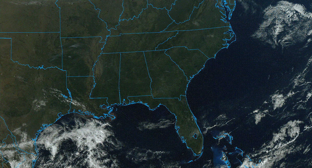
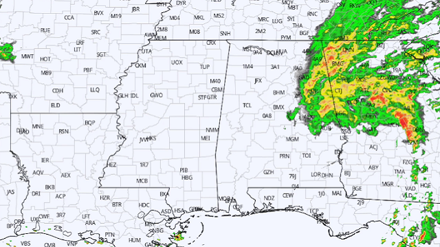
RADAR CHECK: Rain is widespread this morning over east Alabama, generally east of a line from Fort Payne to Gadsden to Talladega to Alexander City. This rain shield is on the west side of the circulation of Tropical Depression Fred, which is moving into Georgia north of Columbus. The rain over east Alabama will taper off by mid to late morning; otherwise today will feature more clouds than sun over the northern half of Alabama with just a few scattered showers this afternoon. South Alabama will experience a good supply of sunshine; highs today will be in the 80s for the northern counties, and close to 90 to the south.
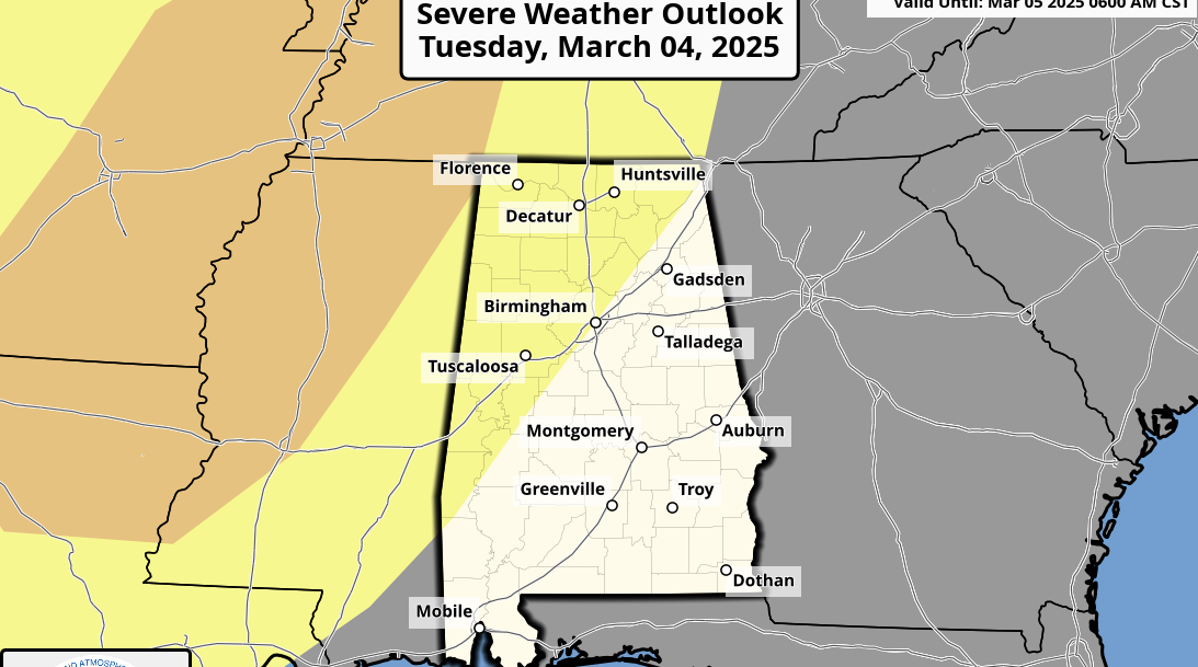
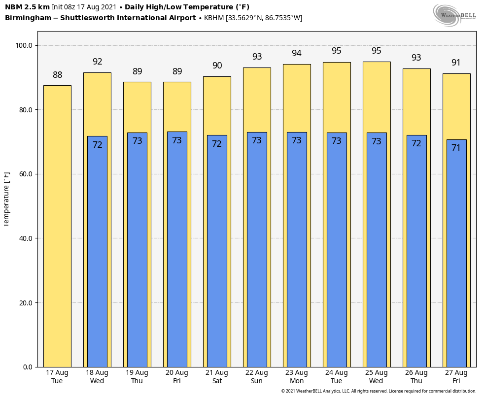
REST OF THE WEEK: Look for a high in the upper 80s Wednesday with a partly sunny day and a few afternoon storms possible; a few strong thunderstorms are likely over the Tennessee Valley, where the Storm Prediction Center has defined a marginal risk (level 1 of 5) due to the potential of strong, gusty winds.
On Thursday and Friday we expect scattered to numerous showers and thunderstorms with a mix of sun and clouds; the chance of any one spot getting wet on these days will be 55-65%. Afternoon highs will be between 86 and 89 degrees.
THE ALABAMA WEEKEND: An upper ridge begins to build into the Deep South, meaning the weather trends hotter and drier. A few scattered storms are possible Saturday afternoon, but much of the state will be dry Sunday with only isolated showers. The high will be close to 90 Saturday, followed by low 90s Sunday.
NEXT WEEK: Hot weather headlines the forecast through the week with highs in the low 90s most days; a few spots could reach the mid 90s. The upper ridge will keep afternoon showers and storms to a minimum at least for the first half of the week with a good supply of sunshine daily.
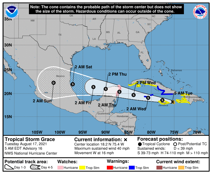
GRACE: Tropical Storm Grace, with 40 mph winds, will move over the northern coast of Jamaica today. From there it will cross the Yucatan Peninsula Thursday and wind up on the coast of Mexico well south of Brownsville, Texas, Saturday. For now the National Hurricane Center is forecasting Grace to remain below hurricane strength. The system does not pose a threat to the U.S. as it remains well to the south.
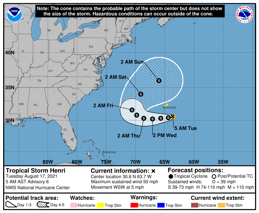
HENRI: Tropical Storm Henri has winds of 50 mph in the Atlantic southeast of Bermuda. The system will loop around the island over the next few days and finally move out into the open North Atlantic. It’s no threat to the U.S.
The rest of the Atlantic basin is quiet.
ON THIS DATE IN 1969: Hurricane Camille made landfall along the Mississippi Gulf Coast near Waveland. Camille is one of only four Category 5 hurricanes ever to make landfall in the continental United States (Atlantic basin) – the others being the 1935 Labor Day Hurricane, which hit the Florida Keys; Hurricane Andrew in 1992, which hit south Florida; and Hurricane Michael in 2018, which hit the Florida Panhandle. (It is worth mentioning that the 1928 San Felipe Hurricane made landfall as a Category 5 hurricane on Puerto Rico.)
Camille ranks as the second most intense hurricane to strike the continental U.S., with 900 millibars of pressure and landfall intensity of 150 knots. Camille ranks just below the 1935 Labor Day Hurricane, with 892 millibars and 160 knots, while slightly stronger than Hurricane Andrew with 922 millibars and 145 knots and Hurricane Michael with 919 millibars and 140 knots. The actual maximum sustained winds of Hurricane Camille are not known as the hurricane destroyed all the wind-recording instruments in the landfall area. Re-analysis data found peak winds of 150 knots (roughly 175 mph) along the coast. A devastating storm surge of 24.6 feet occurred west of our area in Pass Christian, Mississippi.
BEACH FORECAST: Click here to see the AlabamaWx Beach Forecast Center page.
WEATHER BRAINS: You can listen to our weekly 90-minute show any time on your favorite podcast app. This is the show all about weather featuring many familiar voices, including the meteorologists at ABC 33/40.
CONNECT: You can find me on the major social networks:
For more weather news and information from James Spann and his team, visit AlabamaWx.