James Spann: Rain moves into Alabama tonight; turning much colder Thursday
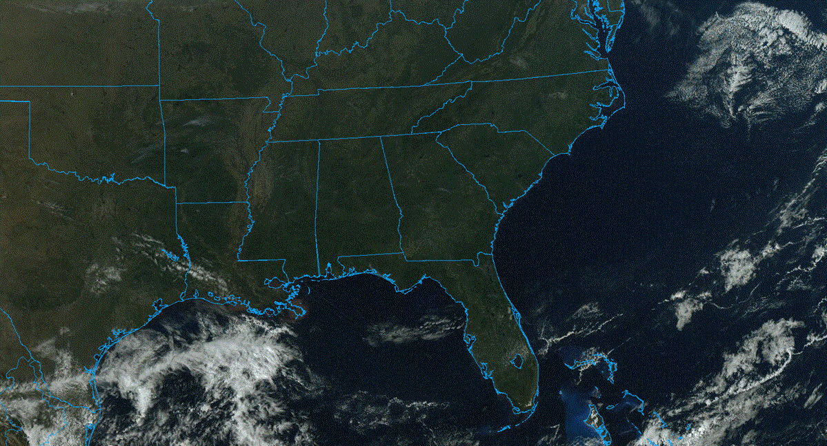
MILD WINTER DAY: Temperatures are in the 60s across Alabama this afternoon; it will be the warmest day this week, and probably the warmest day for the rest of January. Clouds are increasing over the northern counties and rain is entering the northwest corner of Alabama this afternoon ahead of a cold front. Rain will expand southward tonight; there could be some thunder, but severe storms are not expected here. There is a risk of severe storms west of Alabama tonight across parts of east Texas, Louisiana, south Arkansas and Mississippi.
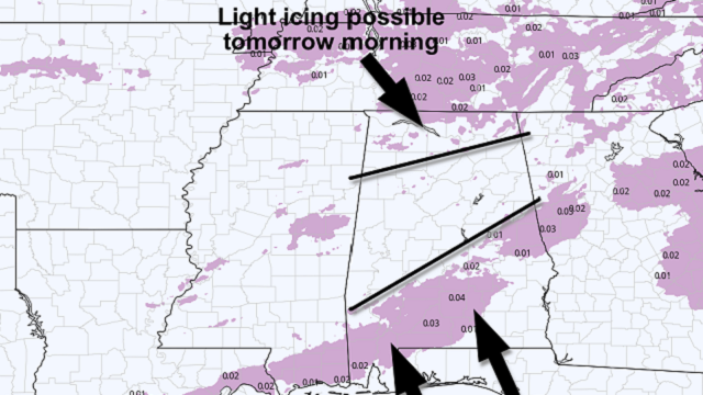
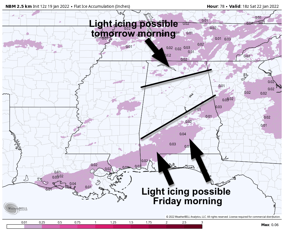
COLD AIR RETURNS: Thursday will be sharply colder with temperatures holding in the 30s all day over the northern half of the state. There is a window for a little light freezing rain or freezing drizzle over the northern third of Alabama Thursday morning. Some light bridge icing is possible generally north of a line from Hamilton to Cullman to Fort Payne. This isn’t a major icing event, but a few slick spots could form on bridges where temperatures fall below 32 degrees Thursday morning north of Birmingham.
Rain will end from north to south during the day Thursday as the front pushes down to near the Gulf Coast by afternoon.
FRIDAY: A wave of low pressure is expected to form along the front in the northern Gulf Friday, but models continue to trend drier. A little light freezing rain or drizzle is possible over south Alabama Friday morning in the broad zone from Mobile to Montgomery to Lafayette, but amounts should be light and bridge icing should be pretty limited.
For the northern half of the state, Friday will be cloudy and cold, with temperatures in the 30s all day. A few snow flurries are possible over the eastern counties, but no accumulation or impact is expected.
THE ALABAMA WEEKEND: Look for a good supply of sunshine both days. Lows will be well down in the 20s; the high will be in the mid to upper 40s Saturday and between 47 and 51 degrees Sunday.
NEXT WEEK: Monday will be dry with a high in the 50s; then a wave will bring rain to the state Tuesday with temperatures in the 40s most of the day. The latter half of the week looks dry with below-average temperatures.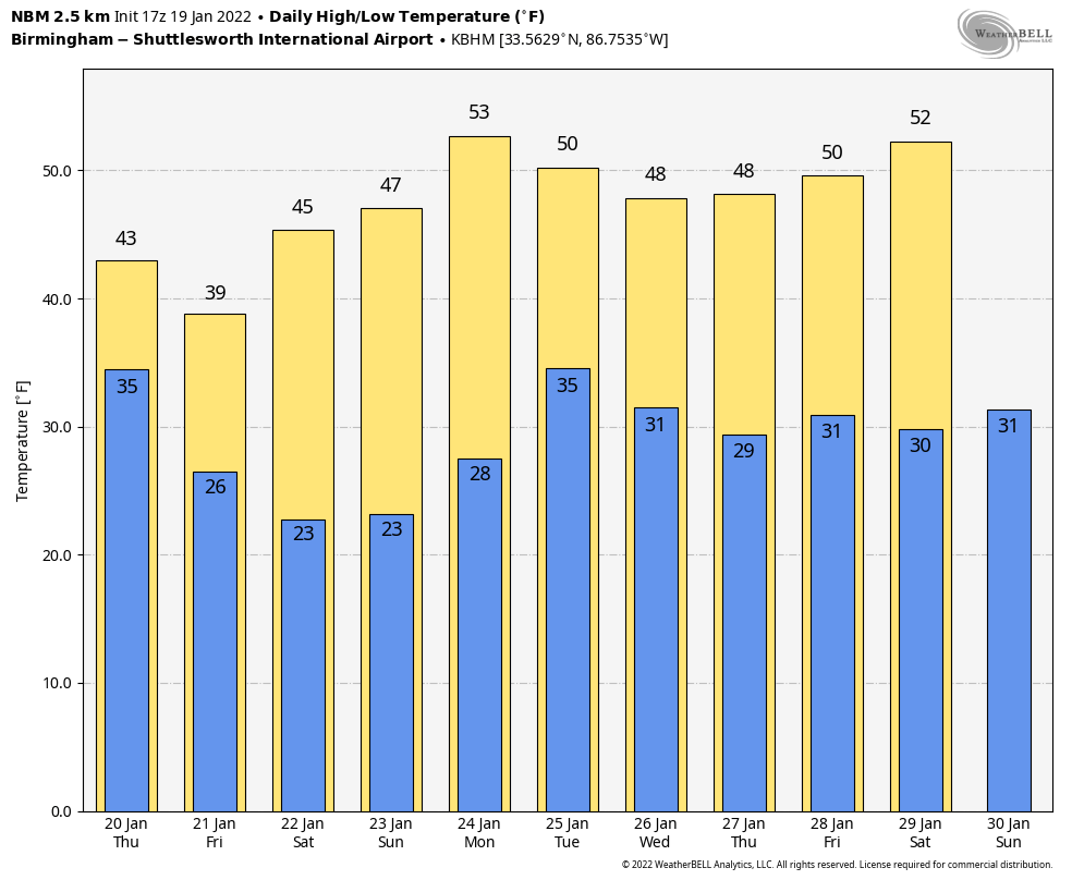
ON THIS DATE IN 1961: Eight inches of snow fell and caused crippling traffic jams around the Washington, D.C., area on the eve of John Kennedy’s inauguration. The president-elect had to cancel dinner plans and, in a struggle to keep other commitments, reportedly had only four hours of sleep. Former President Herbert Hoover was unable to fly into Washington National Airport due to the weather, and he had to miss the swearing-in ceremony.
ON THIS DATE IN 2008: A winter storm brought 3 to 5 inches of snow across parts of Marengo, Dallas, Perry and Chilton counties in central Alabama. Amounts in the Birmingham metro were generally less than one-half inch.
BEACH FORECAST: Click here to see the AlabamaWx Beach Forecast Center page.
WEATHER BRAINS: You can listen to our weekly 90-minute show any time on your favorite podcast app. This is the show all about weather featuring many familiar voices, including the meteorologists at ABC 33/40.
CONNECT: You can find me on the major social networks:
For more weather news and information from James Spann and his team, visit AlabamaWx.