James Spann: Colder in Alabama Wednesday, mostly dry through the weekend
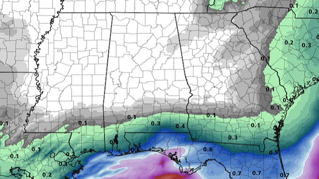
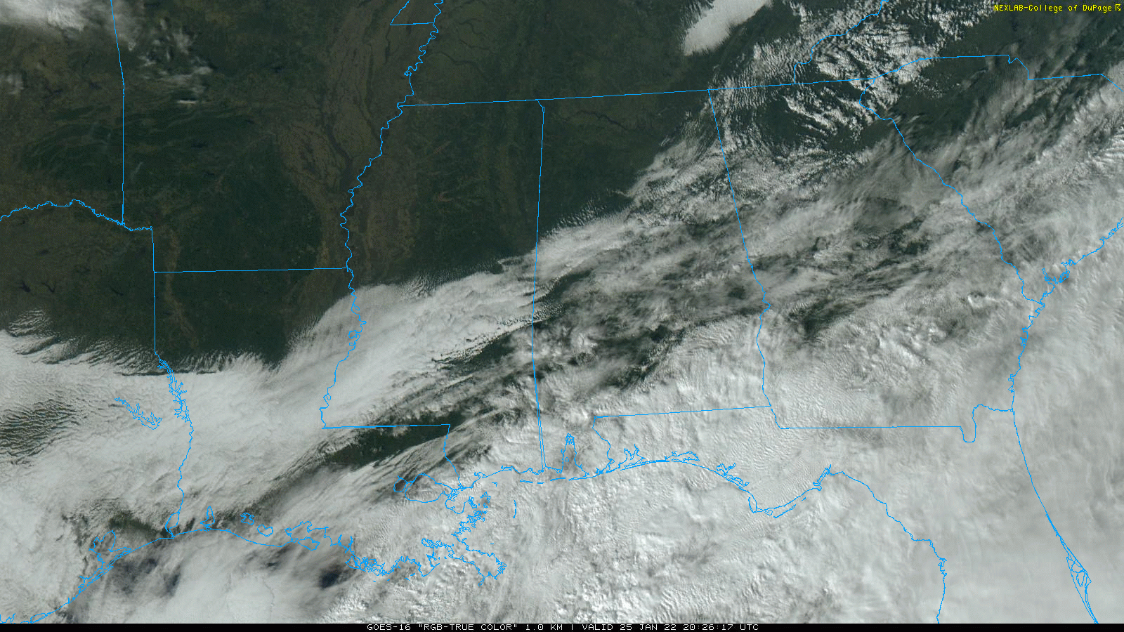
RADAR CHECK: Some light rain continues this afternoon over far south Alabama, in the broad zone from Mobile to Dothan. Clouds linger over the southern half of the state, but the sky has become mostly sunny over the northern counties as dry air is pushing southward. Rain will end across south Alabama this evening; the sky will be mostly clear tonight with a low in the mid 20s.
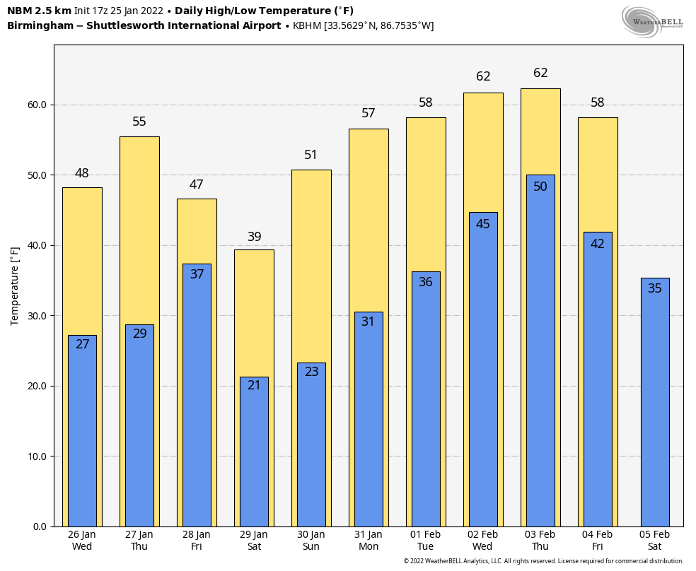
Wednesday will be sunny and colder, with a high between 45 and 50 degrees. Dry weather continues Thursday with a high in the 50s.
FRIDAY AND THE WEEKEND: A cold front and upper trough will pass through Alabama Friday, but it still looks like the air will be too dry for any meaningful chance of rain in Alabama. The sky will feature more clouds than sun, and the high Friday afternoon will be between 46 and 54 degrees. Saturday will be sunny but sharply colder. After starting the day around 20 degrees, the high will be between 36 and 42 degrees. Sunday will be another sunny day with a high back in the low to mid 50s.
NEXT WEEK: Monday will be dry with a high around 60 degrees. Showers could creep into far west Alabama Tuesday, and the latter half of the week looks unsettled, with some risk of rain daily as a cold front stalls out just northwest of Alabama.
ONE YEAR AGO TODAY: An EF-3 tornado moved through Fultondale, just north of downtown Birmingham, killing one person and injuring about 30 more. The parent storm was first tracked from near Interstate 55 in central Mississippi. As the storm moved across Mississippi and into west Alabama, it exhibited episodes of rotation, but none was strong enough to produce a tornado. As the storm entered Jefferson County, its structure became organized. A rotational signature quickly matured and a Tornado Warning was issued at 10:34 p.m. About 10 minutes later, the tornado started to produce damage.
The tornado began along Chapel Hills Parkway, where minor shingle damage occurred. It tracked northeastward across Ellard Road and directly over the Walker Chapel Road overpass on Interstate 65. It was at this interstate exit where the tornado began to intensify rapidly, snapping numerous power poles and causing substantial damage to a hotel. The tornado continued northeastward, crossing U.S. 31, causing mostly tree damage along the highway. As it moved into residential areas along Fulton Drive and Lykes Boulevard substantial damage occurred, with several homes being destroyed and at least one being swept off the foundation.
As the tornado continued toward the northeast, it paralleled Carson Road and caused substantial damage to homes along Meida Circle, Darlene Drive and New Castle Road. Buildings in an industrial area along Carson Road were damaged, including a fleet of vehicles at Hurst Towing. The damage along New Castle Road was widespread, with a few trees debarked or snapped halfway down the trunk, and debris from homes thrown considerable distances. The tornado was down for 10.4 miles, and the maximum path width was 900 yards.
BEACH FORECAST: Click here to see the AlabamaWx Beach Forecast Center page.
WEATHER BRAINS: You can listen to our weekly 90-minute show any time on your favorite podcast app. This is the show all about weather featuring many familiar voices, including the meteorologists at ABC 33/40.
CONNECT: You can find me on the major social networks:
For more weather news and information from James Spann and his team, visit AlabamaWx.


