James Spann: Nice warm-up for Alabama; rain returns later this week
James Spann forecasts a warmer week for Alabama from Alabama NewsCenter on Vimeo.
NICE WARM-UP: Temperatures are between 25 and 35 degrees across Alabama early this morning, but with sunshine in full supply we project a high in the low 60s in most locations this afternoon. The average high for Birmingham on Jan. 31 is 56.
Tuesday will feature a partly sunny sky with a high in the mid 60s. Clouds will increase Tuesday night.
RAIN RETURNS: Wednesday will be cloudy with a high in the 60s; rain will likely move into the northern half of the state during the afternoon and evening. On Thursday, the latest guidance suggests a decent part of the day could be dry with just a few scattered showers. Temperatures will rise to near 70 degrees Thursday afternoon; it will be the warmest day of the week.
Rain and thunderstorms will move in Thursday night into Friday morning ahead of a cold front. For now severe storms are not expected, but the rain could be heavy at times. Amounts between Wednesday afternoon and Friday will be 2-3 inches for much of the state. The rain will end over north Alabama Friday morning, but wet weather lingers over the southern counties through Friday evening. Friday will be cooler, with a high around 50 degrees.
THE ALABAMA WEEKEND: Saturday looks mostly cloudy and cool, with a high in the low to mid 50s. There is some evidence a wave could bring in a little light rain Sunday, with the higher precipitation probabilities over the southern half of Alabama. Sunday’s high will be between 50 and 55 degrees.
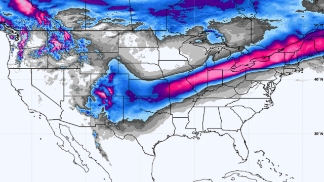
NEXT WEEK: Forecast confidence is not high next week as a complex southwest flow aloft will be in place across the state. Monday looks dry, but some risk of rain will likely return during midweek; it’s too early to be specific on amounts or timing.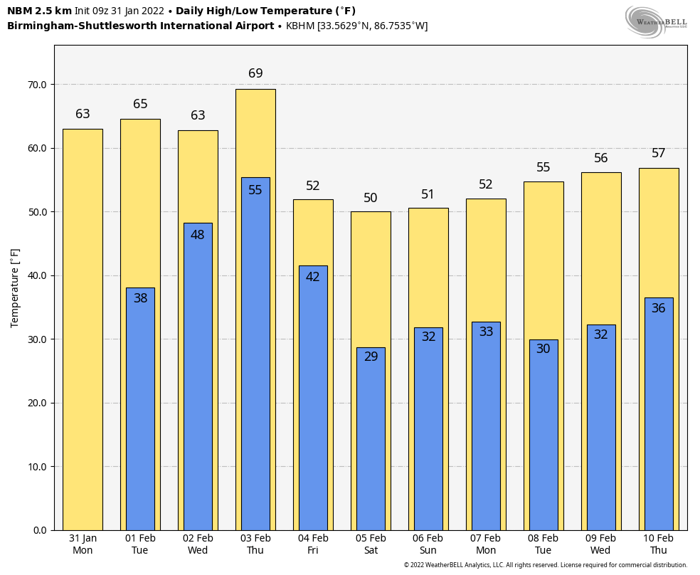 NORTH OF ALABAMA: A major winter storm will unfold this week from parts of north and west Texas to northern New England. Snow amounts of 8-12 inches are possible across parts of Missouri, Illinois and Indiana, and freezing rain and ice issues are possible as far south as Arkansas and west Tennessee.
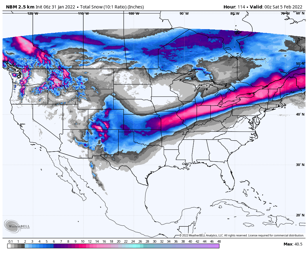 ON THIS DATE IN 1989: The barometric pressure at Norway, Alaska, reached 31.85 inches (1,078.4 millibars), establishing an all-time record for North America. The temperature at the time of the record was about 46 degrees below zero. The severe arctic cold began to invade the north-central U.S. The temperature at Grand Fall, Montana, plunged 85 degrees in 36 hours. Valentine, Nebraska, plummeted from 70 degrees to zero in just nine hours. Northwest winds gusted to 86 mph at Lander, Wyoming, and wind chill readings of 80 degrees below zero were reported in Montana.
BEACH FORECAST: Click here to see the AlabamaWx Beach Forecast Center page.
WEATHER BRAINS: You can listen to our weekly 90-minute show any time on your favorite podcast app. This is the show all about weather featuring many familiar voices, including the meteorologists at ABC 33/40.
CONNECT: You can find me on the major social networks:
For more weather news and information from James Spann and his team, visit AlabamaWx.


