James Spann: Unsettled weather ahead for Alabama this week
James Spann forecasts rain, some storms for Alabama this week from Alabama NewsCenter on Vimeo.
RADAR CHECK: Rain continues to increase early this morning across parts of central and south Alabama ahead of a northward-moving warm front. We expect periods of rain today, with the highest coverage over the northern two-thirds of the state. The high will be between 58 and 63 degrees over north and central Alabama, with 70s over the southern counties south of the warm front.
TUESDAY: Temperatures rise into the 70s statewide as the warm front continues the northward surge. A decent part of the day will be dry with only isolated showers, and the sun could peek out at times. But showers and storms are likely late Tuesday afternoon and night ahead of a wave of low pressure.
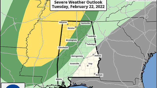
The Storm Prediction Center has defined a slight risk (level 2 out of 5) of severe thunderstorms west of a line from Madison to Carbon Hill to Aliceville. A marginal risk (level 1 of 5) extends as far east as Fort Payne, Alabaster and Thomasville.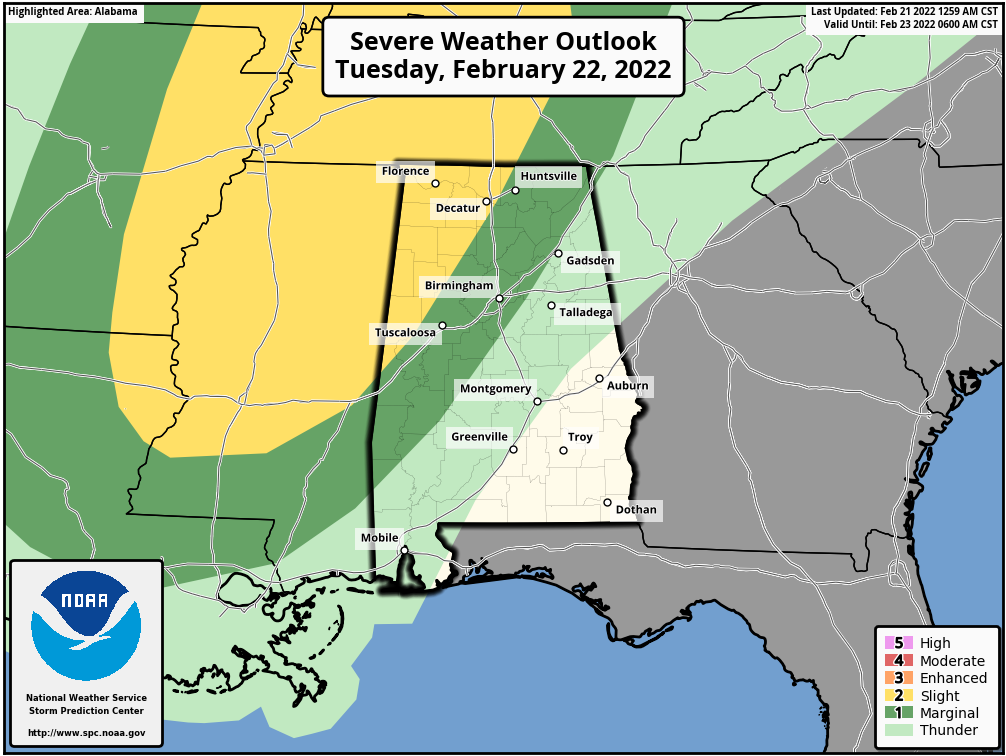
The core threat will come from strong straight-line winds Tuesday evening, although an isolated tornado or two can’t be totally ruled out, especially in the slight risk area over northwest Alabama. Some hail is possible as well. For now the it looks like core severe weather threat will come from about 5 p.m. until midnight. As always, be sure you can hear warnings if they are needed.
WEDNESDAY THROUGH FRIDAY: The weather will be very mild Wednesday and Thursday, with highs in the 70s. A few showers are possible both days, but the rain won’t be especially widespread or heavy. Then the front to the north gets a southward push, and rain and thunderstorms are likely Thursday night into Friday morning. There could be a few strong storms with the front, but for now the odds of organized severe weather look low.
The rain should end by midday Friday, but clouds will likely linger through the afternoon. The day will be sharply colder, with highs between 48 and 52 degrees.
Rain amounts between now and Friday will be 2-3 inches over the Tennessee Valley of far north Alabama, with 1-2 inches likely for places like Birmingham, Tuscaloosa, Anniston and Gadsden. Amounts will be less than 1 inch for much of south Alabama.
THE ALABAMA WEEKEND: The day Saturday looks cool and dry, with highs remaining in the upper 40s and low 50s. A wave on the front to the south will bring more rain to the state Saturday night and early Sunday morning. Some clearing is likely by Sunday afternoon with a high in the low 50s.
NEXT WEEK: For now most of the week looks dry with cool days and chill nights — temperatures a little below average for early March.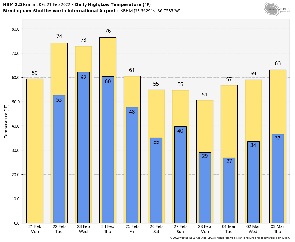 ON THIS DATE IN 1971: A tornado outbreak occurred in the Delta region of northeastern Louisiana and Mississippi. The first significant tornado touched down about 2:50 p.m. in Louisiana and crossed into Mississippi. This twister, which struck the towns of Delhi and Inverness, killed 46. In all, 121 people lost their lives that day, including 110 in Mississippi. A total of 1,600 people were injured and 900 homes severely damaged or destroyed. The total loss was around $19 million.
BEACH FORECAST: Click here to see the AlabamaWx Beach Forecast Center page.
WEATHER BRAINS: You can listen to our weekly 90-minute show any time on your favorite podcast app. This is the show all about weather featuring many familiar voices, including the meteorologists at ABC 33/40.
CONNECT: You can find me on the major social networks:
For more weather news and information from James Spann and his team, visit AlabamaWx.


