James Spann: Warm Friday ahead; snow early Saturday for north Alabama
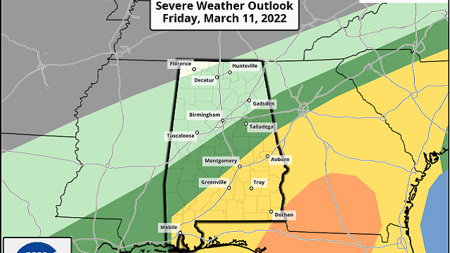
WILD RIDE AHEAD: Get ready for a wild ride on the Alabama weather roller coaster. We are enjoying a beautiful day today with ample sunshine and temperatures in the 60s. We rise into the mid to upper 70s Friday with a mix of sun and clouds. It will be the warmest day of the week, but don’t get used to it. A sharp cold front will bring rain and storms to the state Friday night, and some of the storms could be severe over the southern half of the state. The Storm Prediction Center has pulled the risk area northward a bit on its latest update; a slight risk (level 2 of 5) is now defined for areas south of a line from Citronelle to Prattville to Roanoke, and a marginal risk (level 1 of 5) extends as far north as Demopolis, Alabaster and Jacksonville.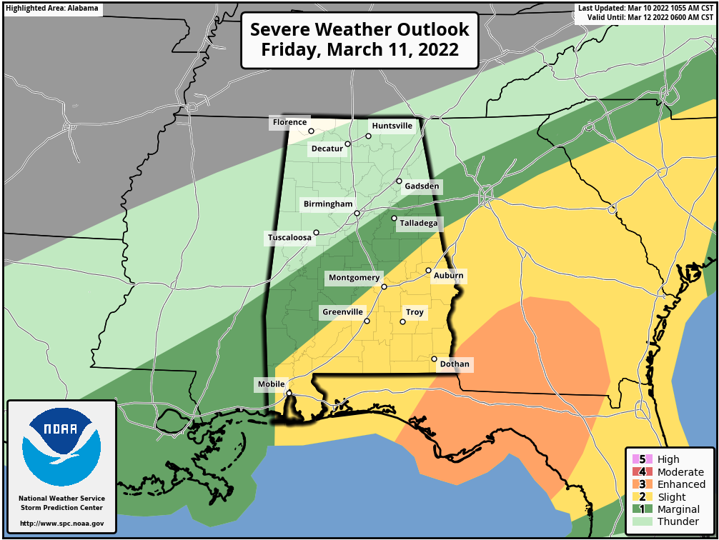 Storms across south Alabama could produce damaging winds and a few tornadoes; storms across central Alabama will bring gusty winds as they pass through. The main window for severe storms in the risk areas will come from about 6 p.m. Friday until 2 a.m. Saturday.
SNOW TO START THE WEEKEND: Much colder air rushes into the state late Friday night, and the rain will change to snow over north Alabama before dawn Saturday. Snow amounts of 1-2 inches are a good possibility along and north of U.S. 278 (Hamilton to Cullman to Gadsden), with one-half inch possible down to Tuscaloosa, Birmingham and Anniston. The snow will accumulate on grassy areas; most roads will be wet. Temperatures will approach 80 degrees Friday, and this will greatly limit accumulation potential.
But remember that some icing is very possible on bridges across north Alabama early Saturday morning; the highest chance is north of U.S. 278, but isolated slick spots could develop down to I-20.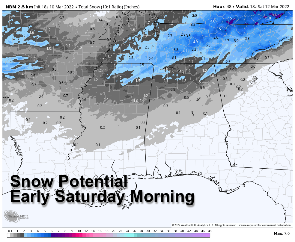 The sky will clear during the day Saturday, but temperatures won’t get out of the 30s over the northern third of the state, with wind chill indices hovering around freezing all day thanks to an icy north wind.
By Sunday morning, temperatures drop into the 17- to 24-degree range over north and central Alabama, a very significant late-season freeze. Growers will need to make preparations now for the cold. Some spots will be below freezing for 8-12 hours Saturday night, and freezing temperatures are likely down to the Gulf Coast.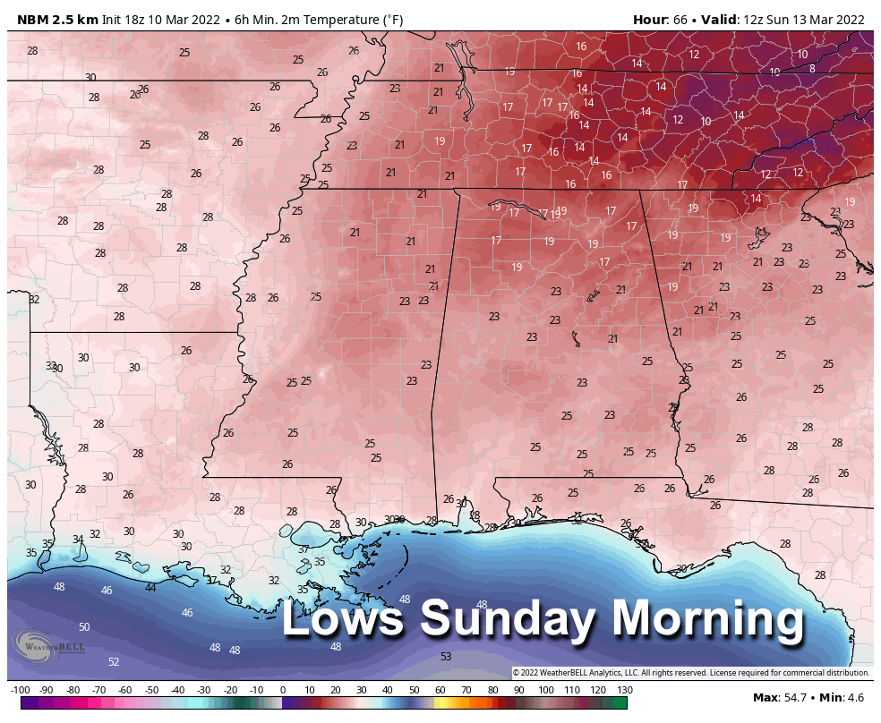 Sunday will be sunny with a high in the 50s.
NEXT WEEK: Monday will be dry and warmer, with a high in the 60s. Showers return to the state Tuesday into Wednesday morning as an upper trough passes through. We will see highs in the 70s over the latter half of the week, and another system will likely bring showers or storms by Friday or Friday night.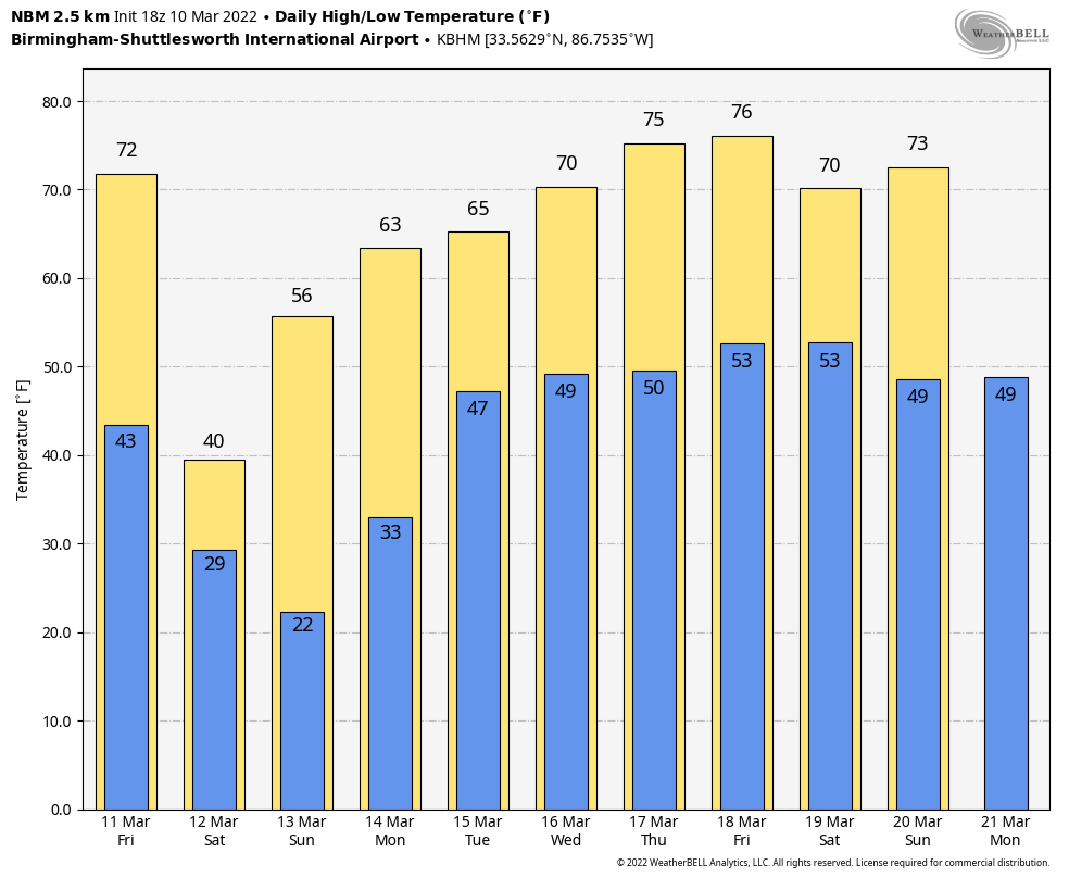 ON THIS DATE IN 1986: Severe thunderstorms and tornadoes hit Indiana, Kentucky and Ohio. A total of 19 tornadoes occurred; three in Indiana reached F3 intensity. A densely populated subdivision of southeast Lexington, Kentucky, was heavily damaged by a tornado. Twenty people were injured and 900 homes were destroyed or demolished. A very strong thunderstorm downburst hit the Cincinnati area. At the Greater Cincinnati Airport, windows were blown out of the control tower, injuring the six controllers on duty.
BEACH FORECAST: Click here to see the AlabamaWx Beach Forecast Center page.
WEATHER BRAINS: You can listen to our weekly 90-minute show any time on your favorite podcast app. This is the show all about weather featuring many familiar voices, including the meteorologists at ABC 33/40.
CONNECT: You can find me on the major social networks:
For more weather news and information from James Spann and his team, visit AlabamaWx.


