James Spann: Strong to severe storms move into Alabama late Wednesday night
RADAR CHECK: Most of Alabama is rain-free this afternoon. With a mix of sun and clouds, temperatures are around the 80-degree mark. The average high for April 12 in Birmingham is 74. Tonight will be mostly cloudy with a few isolated showers.
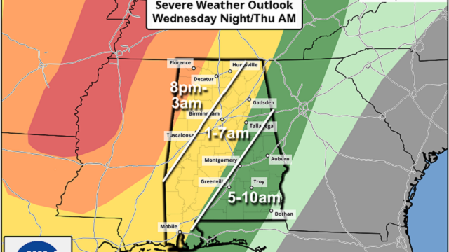
We don’t expect much change during the day Wednesday — highs around 80, some sun and only isolated showers. But a line of strong to severe thunderstorms will likely move into the state late Wednesday night into the early morning Thursday. The Storm Prediction Center maintains an enhanced risk (level 3 out of 5) for the northwest corner of the state. A slight risk (level 2) is up for much of north, central and southwest Alabama, and most of southeast Alabama is under a marginal risk (level 1).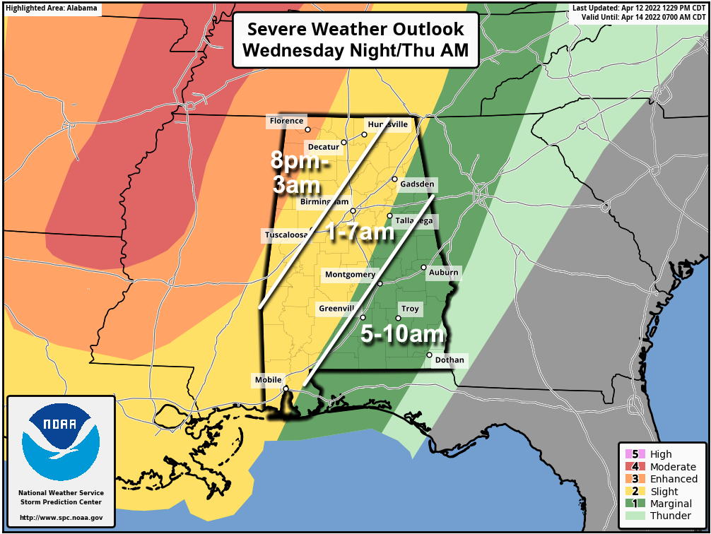 While a few storms could creep into northwest Alabama as early as 8-9 p.m., the main line should enter the northwest corner of the state around 11 p.m. It will reach I-59 (Tuscaloosa, Birmingham and Gadsden) around 4-5 a.m. and then move into east and southeast Alabama after 6 a.m. The storms should weaken after 3 a.m. as instability decreases and dynamic support fades.
The main threat will come from strong, gusty winds ahead of the line, but an isolated tornado can’t be totally ruled out, especially over the northwest counties of the state. With this being a middle-of-the-night event, be sure you have your NOAA Weather Radio on and don’t use the “do not disturb” feature on your phone so you can get notifications.
The sky will become partly to mostly sunny by Thursday afternoon as dry air returns; the high will be in the mid 70s. Friday will be dry and mild for most of Alabama as well, but a few showers are possible over the southwest counties around Mobile.
EASTER WEEKEND: A surface front will move up into the state from the south and meander around over the weekend, setting the stage for unsettled weather. The sky will be cloudy Saturday and Sunday with occasional showers likely both days. Some thunder is possible, but severe storms are not expected. Highs will be in the 70s.
NEXT WEEK: Showers remain likely Monday, but dry air returns Tuesday and Wednesday. Global models show another round of rain and possible thunderstorms Thursday.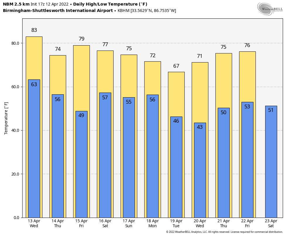 ON THIS DATE IN 1934: Winds atop Mount Washington, New Hampshire, averaged 186 mph for five minutes, with a peak gust of 231 mph, the highest wind speed ever clocked in the world at that time. In a report released by the World Meteorological Organization, that record was toppled in 1996 at Barrow Island, Australia, during Typhoon Olivia.
ON THIS DATE IN 2020: A total of 19 tornadoes touched down across north and central Alabama on Easter; an EF-2 at Boaz injured three people. This was part of a larger regional outbreak April 12-13 during which 141 tornadoes touched down across 10 states, inflicting widespread and locally catastrophic damage. The strongest tornado, a high-end EF-4, occurred in southern Mississippi, producing estimated winds of 190 mph, reaching a width of 2.25 miles and causing eight deaths. With a total of 32 tornado-related fatalities, it was the deadliest tornado outbreak since April 27-30, 2014.
BEACH FORECAST: Click here to see the AlabamaWx Beach Forecast Center page.
WEATHER BRAINS: You can listen to our weekly 90-minute show any time on your favorite podcast app. This is the show all about weather featuring many familiar voices, including the meteorologists at ABC 33/40.
CONNECT: You can find me on the major social networks:
For more weather news and information from James Spann and his team, visit AlabamaWx.


