James Spann: Warm, humid weather continues for Alabama
James Spann forecasts warm, humid weather for Alabama from Alabama NewsCenter on Vimeo.
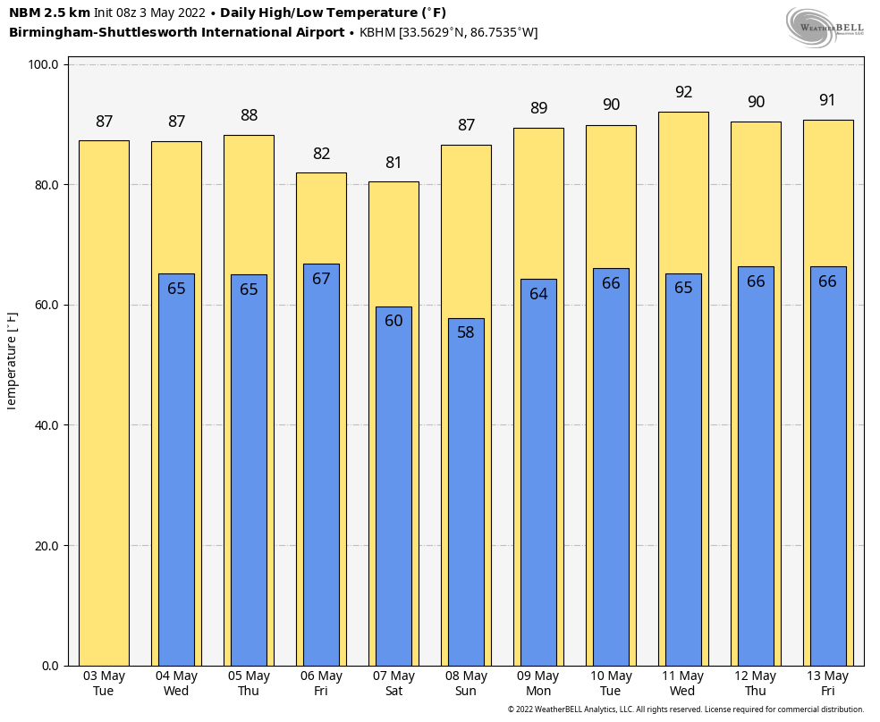
LIKE SUMMER: Today will be a another warm, humid day for Alabama. With a partly sunny sky, temperatures reach the mid 80s this afternoon; the average high for Birmingham on May 3 is 79. Most of the day will be dry, but we will mention a chance of scattered showers and storms tonight as a weakening cold front approaches — nothing widespread or severe.
On Wednesday, look for a mix of sun and clouds. A few scattered showers and thunderstorms are possible, mostly during the afternoon and evening, as the front stalls out near the Tennessee border. The high will be in the mid 80s, and the chance of any one spot seeing a shower tonight is 40-45%. Higher probabilities are over the northern half of the state.
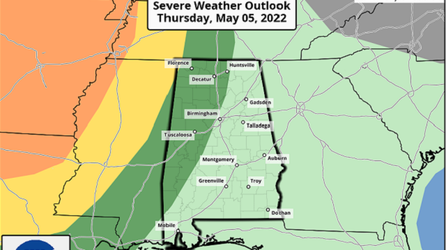
THURSDAY/FRIDAY: Most of the day Thursday will be dry with highs in the 80s again. Then, an approaching front will bring showers and storms into the state late Thursday night into the day Friday. The Storm Prediction Center has defined a marginal risk (level 1 out of 5) of severe thunderstorms for much of north and west Alabama in the outlook that runs through 7 a.m. Friday. For now it has not defined a risk beyond 7 a.m. Friday due to model uncertainty.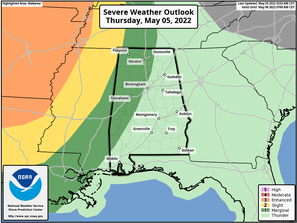 The broad window for heavier thunderstorms will run from midnight Thursday night through 6 p.m. Friday; we should be able to narrow this down more Wednesday as we get within range of the high-resolution models. The main threat with the heavier storms during this period will come from strong straight-line winds and hail; the tornado threat looks low for now based on forecast wind profiles.
MOTHER’S DAY WEEKEND: Dry air settles into the state Friday night following the frontal passage, and the weekend will feature sunny days and fair nights. The high will be between 77 and 81 degrees Saturday, followed by mid 80s Sunday.
NEXT WEEK: A strong upper ridge builds over the Deep South, and much of the week looks dry. Temperatures could very well touch 90 degrees by midweek under the ridge, our hottest weather so far this year.
 ON THIS DATE IN 1999: There were 63 tornadoes in Oklahoma, making this the worst outbreak ever to strike the state. In central Oklahoma alone, eight individual supercell thunderstorms produced 57 tornadoes. Bridge Creek, Moore and southern parts of the Oklahoma City metro area were hit the hardest. When it was near Moore, Oklahoma, a truck-mounted Doppler radar measured a wind speed of 318 mph, the highest ever observed in a tornado. This tornado killed 36 people. To the north in Kansas, an F4 tornado tracked 24 miles through Sumner and Sedgwick counties, killing six, injuring 154 and causing $146 million in damages.
ON THIS DATE IN 2009: A derecho moved across central Alabama, producing widespread and long-lived straight-line wind damage (associated with a fast-moving squall line). There was significant damage in several counties from the Mississippi state line to the Georgia state line.
BEACH FORECAST: Click here to see the AlabamaWx Beach Forecast Center page.
WEATHER BRAINS: You can listen to our weekly 90-minute show any time on your favorite podcast app. This is the show all about weather featuring many familiar voices, including the meteorologists at ABC 33/40.
CONNECT: You can find me on the major social networks:
For more weather news and information from James Spann and his team, visit AlabamaWx.


