Scott Martin: Oppressive heat continues for Alabama, but its end is near
FRIDAY: It will be another hot day across Alabama with partly cloudy to mostly sunny skies. A few isolated to scattered storms may be possible in eastern Alabama late this afternoon and into the early evening if any outflow from storms off to the east make it into the state. Highs will be in the mid 90s to the lower 100s.
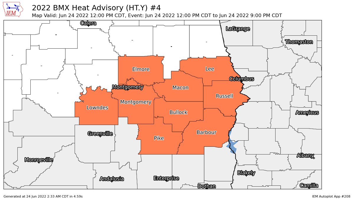
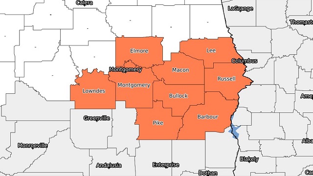
A heat advisory has been issued for nine counties in the southeastern corner of central Alabama until 9 p.m. Higher humidity and hot temperatures will lead to heat index values around 105 degrees.
THE WEEKEND: An easterly flow will set up on Saturday, allowing more moisture to push into the state, along with slightly cooler temperatures. Skies will be partly to mostly sunny, and the eastern half of the state will have a good chance of scattered storms during the afternoon and early evening. The western half will have a smaller chance for storms. Highs will be in the lower 90s in the east to the mid to upper 90s in the west.
An approaching front will stop the progress of the westward-moving trough on Sunday. That will keep the chance of isolated to scattered afternoon showers and storms in the forecast, mainly for the western half of the state. Highs will be in the upper 80s to the mid 90s.
NEXT WEEK: The front slows down and will make it into northern Alabama on Monday. Scattered storms will be possible, with the higher chances closer to the front. Highs will be in the mid 80s to the mid 90s.
The front makes it deeper into the state on Tuesday, keeping scattered storms possible mostly during the afternoon to early evening. Highs will be in the mid 80s to the lower 90s.
The front will stall, keeping scattered storms possible on Wednesday. Highs will be in the upper 80s to the lower 90s.
On Thursday, moisture continues to hang around and will keep scattered storms possible. Highs will be in the upper 80s to the mid 90s.
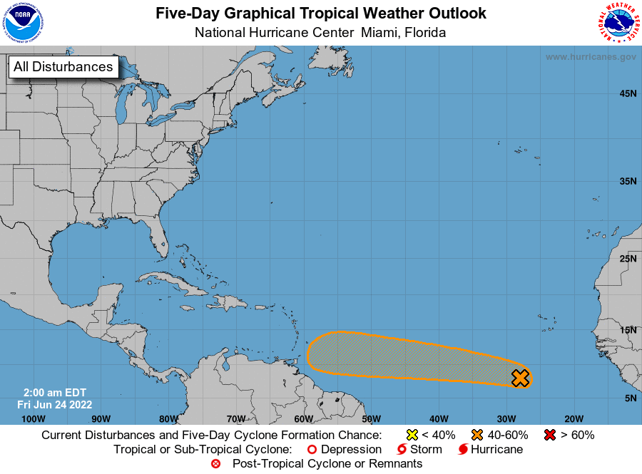
TROPICS: A tropical wave moving westward across the far eastern Atlantic could become a depression by early next week. It has a 50% chance of formation within the next five days. Guidance models show it will stay on a westward course through that time period, approaching the Windward and Leeward islands. It’s too early to know where it goes after that. Most likely, this will become Tropical Storm Bonnie, but will it become a hurricane? We’ll have to watch and see.
For more weather news and information from James Spann, Scott Martin and other members of the James Spann team, visit AlabamaWx.


