James Spann: Scattered showers, storms forming in Alabama this afternoon
RADAR CHECK: A number of scattered showers and thunderstorms are developing over central Alabama this afternoon; most of them are south of I-59, the approximate location of a stalled surface front. Like Monday, stronger storms will be capable of producing heavy rain, gusty winds, small hail and lots of lightning. Away from the storms, we have a mix of sun and clouds with temperatures in the mid to upper 80s over most of the state. Extreme south Alabama is hotter, with temperatures in places like Mobile and Dothan between 90 and 94 degrees.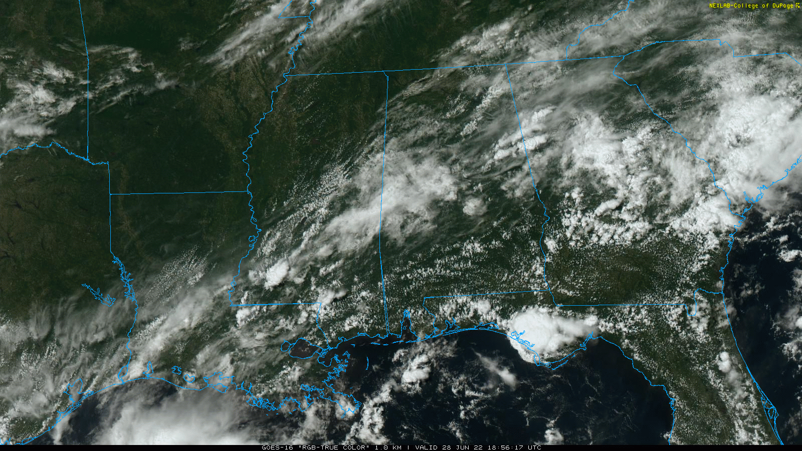 Scattered storms will end after sunset. We will be mostly dry during the late night with a low around 70 degrees.
REST OF THE WEEK: The weak surface front will dissipate, and all of the state will be in a warm, humid air mass through Friday with a mix of sun and clouds daily and scattered, mostly afternoon and evening showers and thunderstorms. The storms that form will be random, and it won’t rain everywhere. Odds of any one spot getting wet each day are 40-50%, and highs will remain mostly in the mid to upper 80s.
FOURTH OF JULY WEEKEND: The sun will be out at times Saturday through Monday, and each day we will deal with scattered showers and storms, most active between 2 and 10 p.m. Odds of your cookout or outdoor event seeing rain will remain 40-50% daily. Nobody knows in advance exactly when and where the afternoon storms will form; you just have to watch radar trends. It will be just the kind of weather you expect in early July in Alabama. Highs will be generally in the upper 80s.
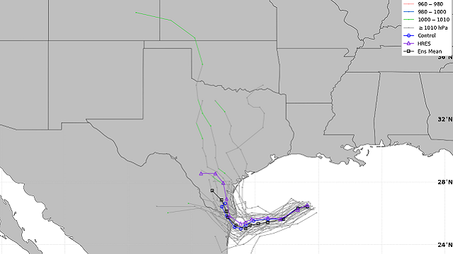
REST OF NEXT WEEK: We will roll with a persistence forecast — partly sunny days with scattered showers and storms during the afternoons and evenings, with highs most days between 88 and 92 degrees.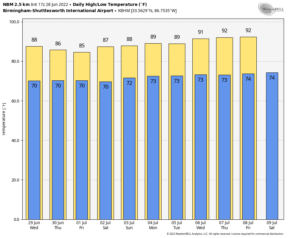 TROPICS: An area of low pressure centered over the northwestern Gulf of Mexico continues to produce disorganized showers and thunderstorms. This system is forecast to move slowly westward or west-southwestward and approach the coast of Texas during the next two days. Slow development of the low is possible, and it could become a short-lived tropical depression near the coast before it moves inland. Regardless of development, heavy rain will be possible along portions of the Texas coast later this week.
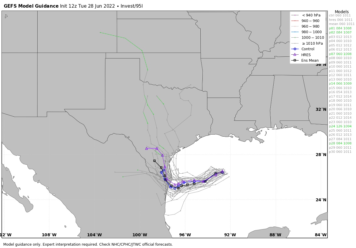 In the Atlantic, Potential Tropical Cyclone 2 should be a tropical depression or storm within the next 12 hours (the name will be Bonnie); the system will pass through the Windward Islands tonight. This is a very low-latitude system that will skirt the northern coast of South America, then make landfall in Central America (most likely the coast of Nicaragua) Saturday morning. This is far south of the U.S.
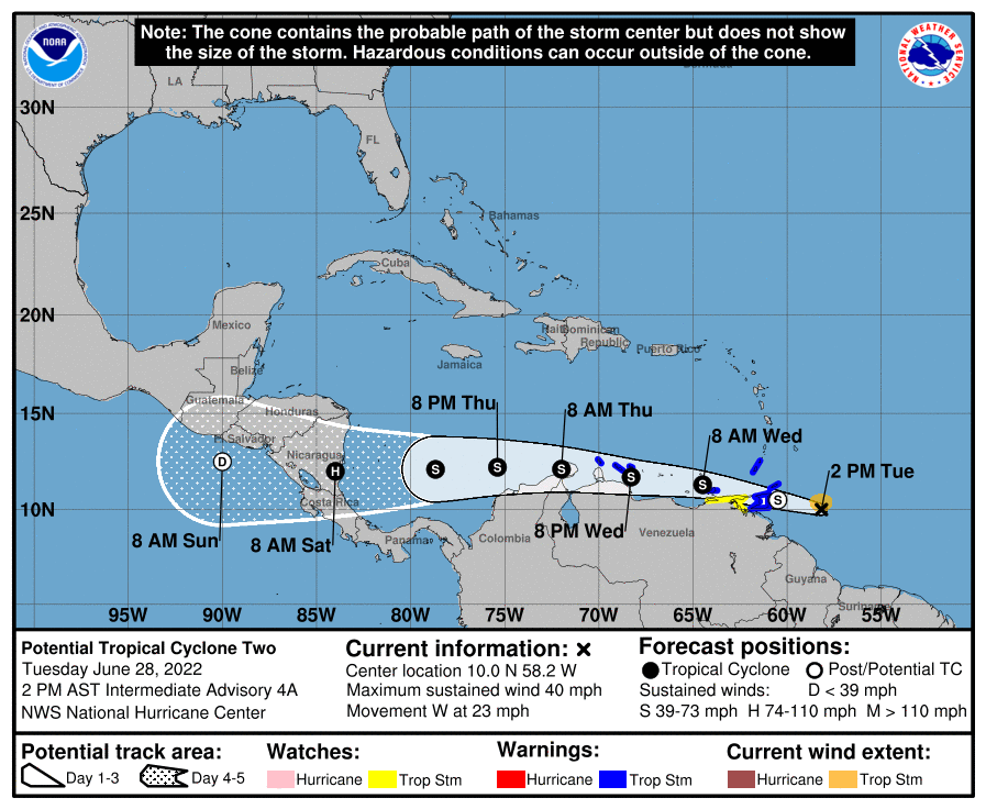 ON THIS DATE IN 1924: An estimated F4 tornado struck the Ohio towns of Sandusky and Lorain, killing 85 people and injuring more than 300. This tornado is the deadliest ever in Ohio history.
ON THIS DATE IN 1975: Lightning struck Lee Trevino and two other golfers at the Western Open golf tournament in Oak Brook, Illinois.
BEACH FORECAST: Click here to see the AlabamaWx Beach Forecast Center page.
For more weather news and information from James Spann and his team, visit AlabamaWx.


