James Spann: Rain chances going up for Alabama, heat levels coming down
James Spann forecasts higher rain chances for Alabama through the weekend from Alabama NewsCenter on Vimeo.
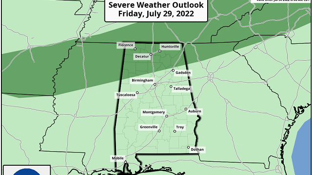
SHOWER, STORM COVERAGE INCREASING: A surface front will approach the Alabama/Tennessee border over the next 24 hours, bringing an increase in the number of scattered showers and storms to the state. We can’t promise rain for everyone later today, but any one spot will have a 45-55% chance of getting wet for a time or two. The Storm Prediction Center maintains a marginal risk (level 1 out of 5) of severe thunderstorms for the northern quarter of the state this afternoon; heavier storms will be capable of producing strong winds.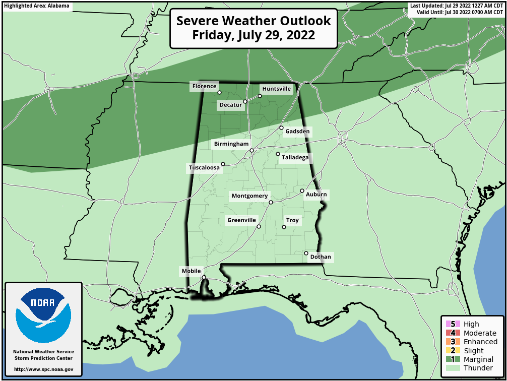 Otherwise, look for a mix of sun and clouds today with a high between 90 and 94 degrees.
THE ALABAMA WEEKEND: With the stalled surface front nearby, the sky will be occasionally cloudy Saturday and Sunday with scattered to numerous showers and thunderstorms both days. The weekend won’t be a washout and it won’t rain everywhere, but most places have a good chance of seeing a few summer downpours. While most of the showers and storms will come during the afternoon and evening, we can’t rule out a few late-night or morning showers as well. Along with the increase in shower coverage, heat levels will come down, with afternoon highs holding below 90 degrees for many communities across north and central Alabama. Expect a high in the low 90s for the southern counties.
NEXT WEEK: Scattered showers and storms will stay in the forecast, with the higher coverage coming during the first half of the week. Highs will be between 88 and 92 degrees Monday through Wednesday and in the low 90s Thursday and Friday.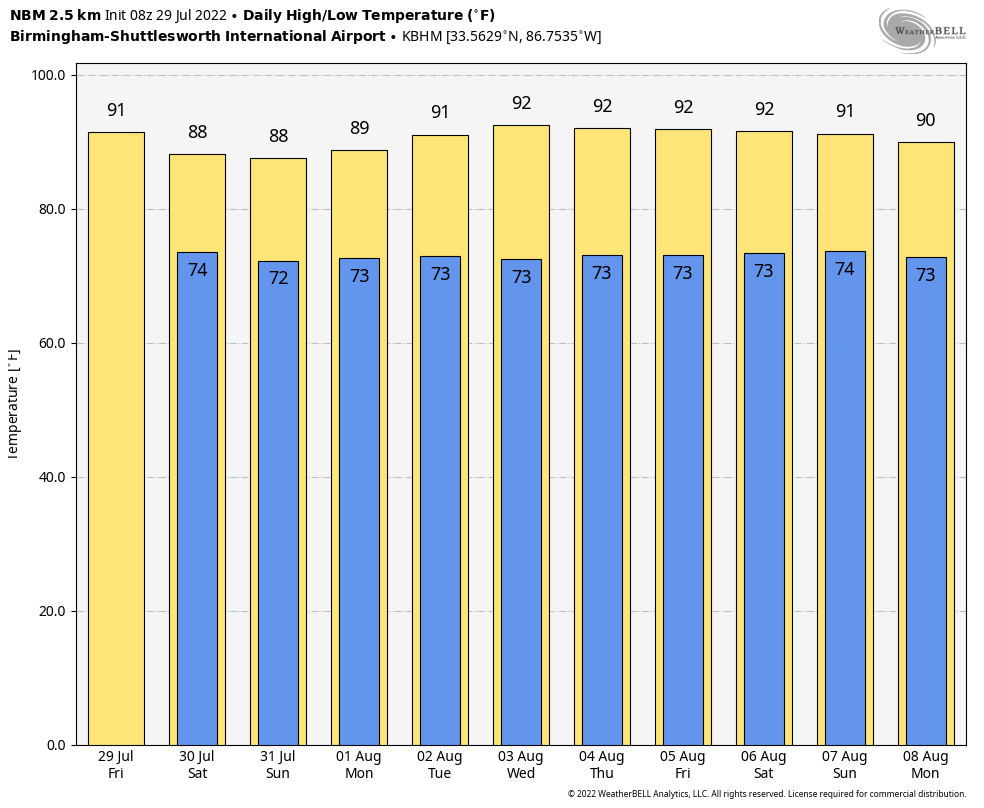 TROPICS: There’s still no sign of any tropical trouble across the Atlantic basin for at least the next five days as subsidence (sinking air) and dry air continue to squash any potential development.
ON THIS DATE IN 1960: Severe thunderstorms brought damaging winds, possibly as high as 100 mph, to central Oklahoma. Eight planes and several hangars were damaged at Wiley Post Airfield, while two aircraft and additional hangars were damaged at Will Rogers World Airport. The winds caused seven injuries in the area, including two youths who were injured by flying debris.
ON THIS DATE IN 2004: A record-setting flash flood occurred over part of Greenville, South Carolina, during the morning. Six to eight inches of rain fell just east of Berea, a northwestern suburb, which caused the Reedy River through downtown Greenville to crest 9 feet above flood stage. This crest was the highest level since 1908.
BEACH FORECAST: Click here to see the AlabamaWx Beach Forecast Center page.
For more weather news and information from James Spann and his team, visit AlabamaWx.


