James Spann: Dry weather continues for Alabama with warmer afternoons ahead
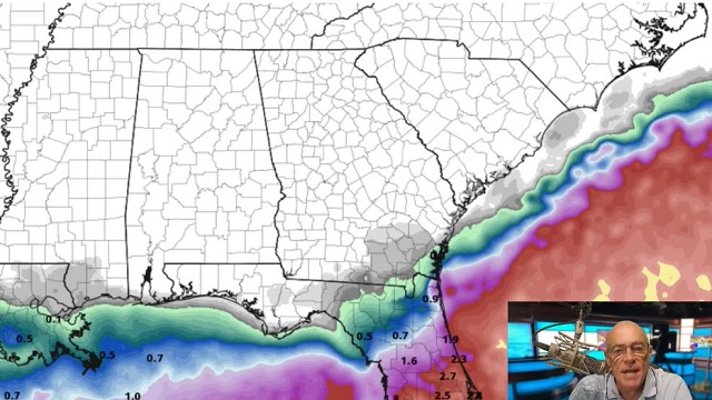
DRY DAYS: Dry weather will continue across Alabama through the weekend with sunny, warm afternoons and clear, pleasant nights. Highs will be in the mid to upper 80s, with lows in the 60s through Sunday as very dry air holds in place. NEXT WEEK: Heat levels crank up a bit as an upper ridge builds over the region. Highs will be in the low 90s most days with dry weather continuing. There’s still no sign of any big rain event for the next seven to 10 days.
 FOOTBALL WEATHER: Clear weather is the story for the high school football games across Alabama Friday night with temperatures falling into the 70s during the games.
Saturday, Auburn hosts Penn State (2:30 p.m. kickoff) at Jordan-Hare Stadium. The sky will be sunny and the temperature about 87 degrees at kickoff. Alabama will host Louisiana-Monroe (3 p.m. kickoff) at Bryant-Denny Stadium. It will be sunny and very warm, with temperatures falling from near 88 degrees at kickoff into the low 80s by the final whistle.
UAB is also at home, hosting Georgia Southern at Protective Stadium in downtown Birmingham (2:30 p.m. kickoff). Expect a sunny sky with a kickoff temperature around 87 degrees, falling into the low 80s by the end of the game.
TROPICS: Tropical Depression 7 has formed in the Atlantic, about 800 miles east of the Leeward Islands. Winds are 35 mph and the system is expected to become Tropical Storm Fiona soon. The National Hurricane Center forecast track keeps it below hurricane strength over the next five days and has it near Hispaniola late in the weekend. There is a real chance the system could dissipate over the mountainous island; if it survives, most global models suggest a northward turn before affecting the contiguous U.S. Of course, it’s still too early to know the final destination. Just something to watch for now.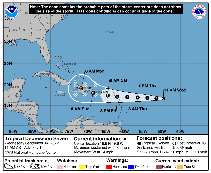 The rest of the Atlantic basin is very quiet.
ON THIS DATE IN 1928: A violent, estimated F4 tornado, with winds of 200 mph, tore across Rockford, Illinois. The tornado first touched down eight miles south-southwest of Rockford and moved across the southeast part of the city. It was on the ground for 25 miles with a width varying from 200 to 500 feet. A total of 14 people were killed, with around 100 injuries reported in Rockford alone.
ON THIS DATE IN 2008: Hurricane Ike became extratropical. The St. Louis Metropolitan Area experienced hurricane conditions, with Ike’s remnants inflicting severe damage to homes. Several areas in Illinois and Indiana, already flooded by the frontal boundary to the north, saw significant additional rainfall. A state of emergency was declared for Cook County, Illinois, due to flooding of the Des Plaines River. Hurricane-force wind gusts were reported to the east of the center across parts of Kentucky, Indiana, Ohio and Pennsylvania with significant wind damage including structural damage to buildings and trees.
BEACH FORECAST: Click here to see the AlabamaWx Beach Forecast Center page.
For more weather news and information from James Spann and his team, visit AlabamaWx.


