Scott Martin: Hot, dry Saturday for Alabama; storms return Sunday
THE ALABAMA WEEKEND: Today will be a hot one with a mix of sun and clouds — no rain to help cool us off any. Highs will be in the upper 80s to the mid 90s. Humidity will be lower, so it won’t feel all that bad. On Sunday, a low moving out of the upper Midwest and into the Great Lakes region will start pushing a cold front toward Alabama and advecting moisture up from the Gulf of Mexico. Scattered showers and storms will be possible throughout the day and into the evening. Highs will be in the upper 80s to the lower 90s.
THE WORK WEEK AHEAD: The cold front will continue to move toward the state on Monday, keeping our weather unsettled. Scattered showers and storms will be possible throughout the day, and a few strong storms as well. Highs will be in the upper 80s to the lower 90s. The weakening front will move into Alabama Tuesday and will keep a chance of isolated to scattered showers and storms possible along and ahead of it. Highs will be in the upper 80s to the mid 90s.
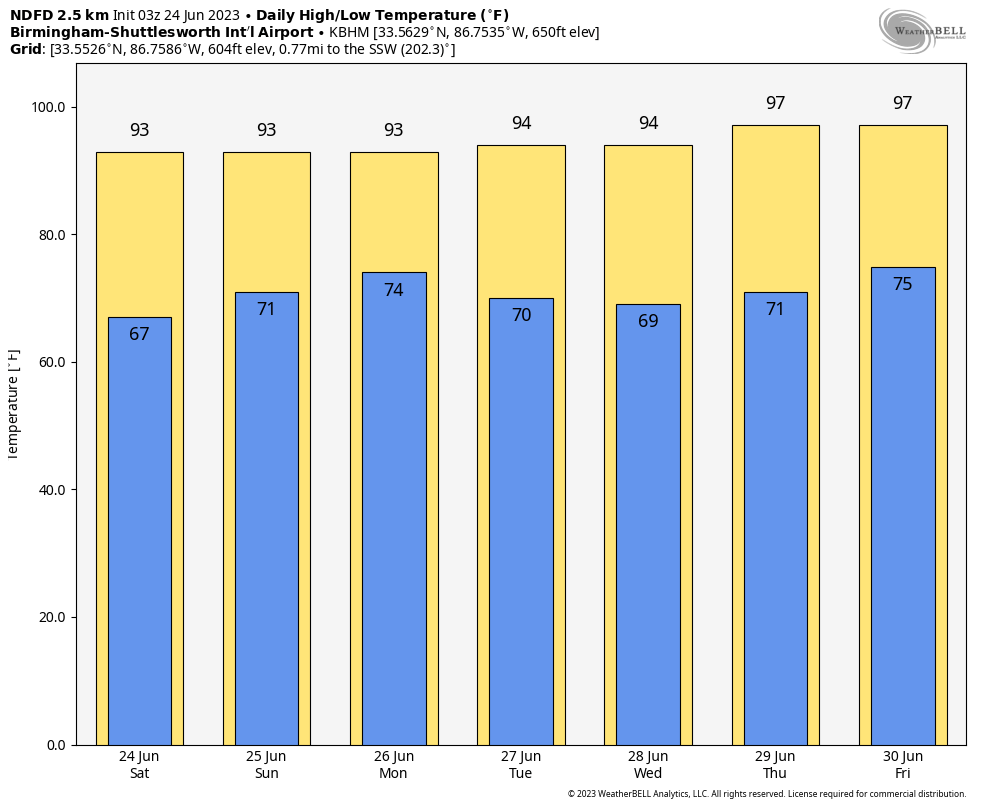
Ridging starts to build in over the state on Wednesday, and temperatures will be hotter. We’ll have sunny skies with highs in the lower to mid 90s. We go even hotter on Thursday with mainly sunny skies, but a few of us may see an isolated afternoon shower or storm. Highs will be in the lower to mid 90s in the east and up into the upper 90s in the west and southwest. On Friday, we’ll continue to have mostly sunny skies and highs in the 90s, with only a small chance of a few scattered showers and storms.
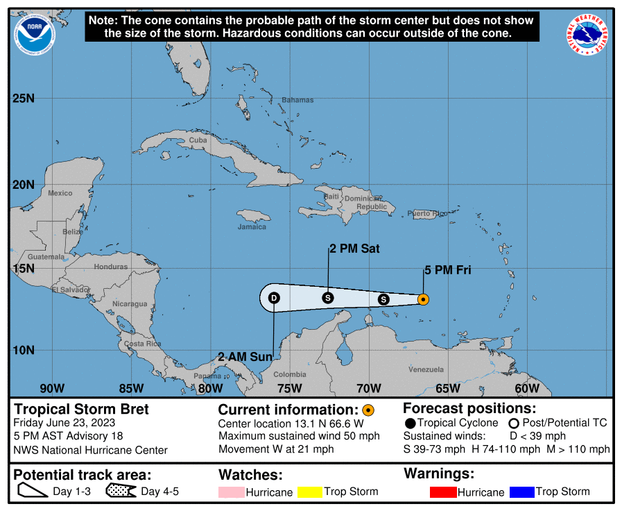
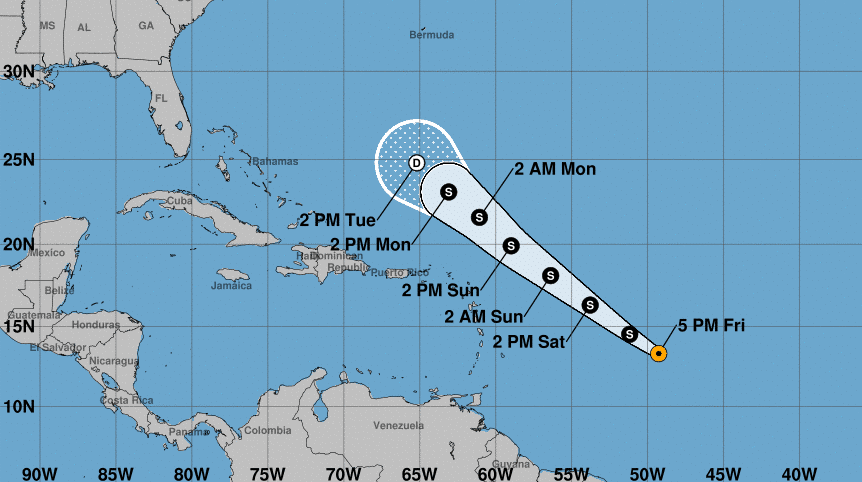
TROPICS: Wind shear is starting to cause Bret to lose its organization, and weakening has begun. That trend will continue until it dissipates over the central Caribbean Sea. Winds are down to 50 mph.
Tropical Storm Cindy also has winds at 50 mph and looks very healthy on satellite. Cindy could actually be even stronger, but dry air is being pulled into the system, limiting any further strengthening. Wind shear will become a problem, and Cindy is expected to become a remnant low by Tuesday afternoon.
BEACH FORECAST CENTER: Get the latest weather and rip current forecasts for the beaches from Dauphin Island to Panama City Beach, Florida, on our Beach Forecast Center page. There, you can select the forecast of the region you are interested in.
ON THIS DATE IN 1975: A fairly innocuous-looking thunderstorm at JFK airport in New York City produced a microburst that caused Eastern Airline 66 to crash 2,400 feet short of the runway, killing 112 people. The control tower, only 1.2 miles away, was never affected by the microburst as the outflow was held back by a sustained sea-breeze front.
For more weather news and information from James Spann, Scott Martin and other members of the James Spann team, visit AlabamaWx.


