James Spann: Slowly rising heat levels ahead for Alabama; dry weather continues
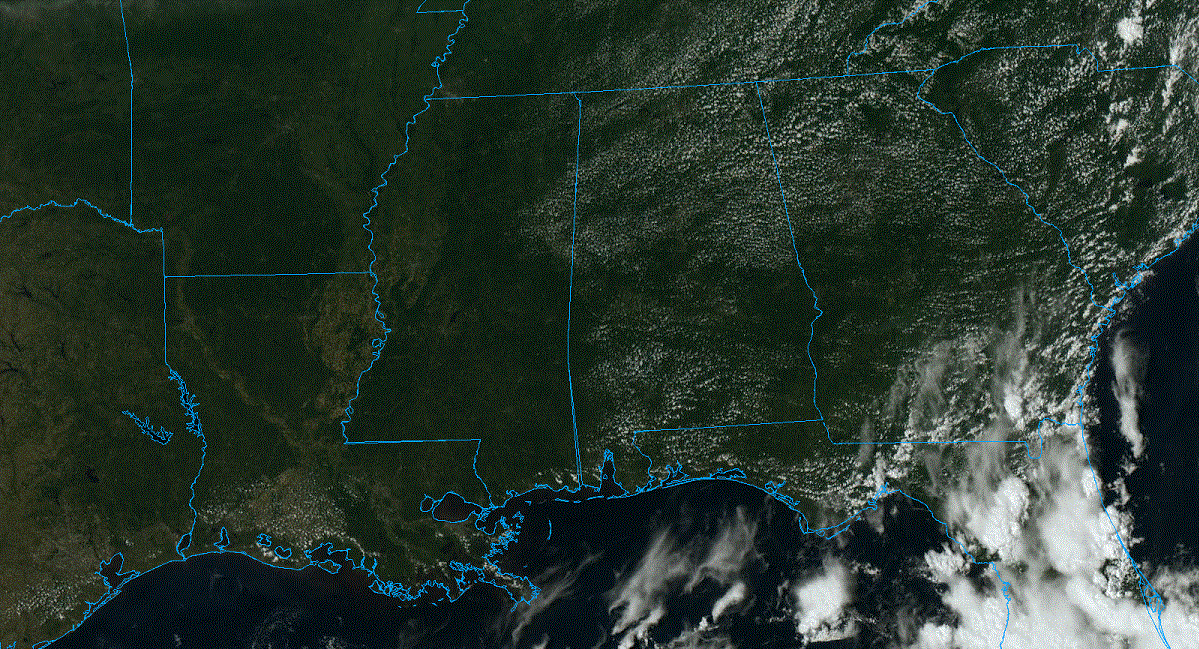
NICE SUMMER AFTERNOON: The sky is mostly sunny across all of Alabama this afternoon with temperatures ranging from the low 80s over the northern third of the state to the low 90s over the southern counties. Tonight will be fair and pleasant, with a low in the 60s for most places.
FRIDAY, THE WEEKEND AND NEXT WEEK: Most of the state will be rain-free for the next seven days, and as an upper high builds over the region, expect rising heat and humidity levels. With mostly sunny days and fair nights, the high will be in the low 90s Friday, followed by mid 90s over the weekend. Next week, afternoon highs will be in the mid to upper 90s as the upper high takes over. Any afternoon storms will be confined to areas near the Gulf Coast, and even there most communities will stay dry.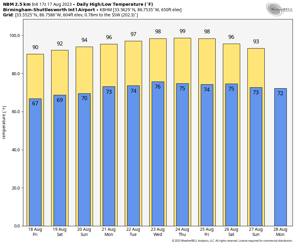 TROPICS: Two tropical waves are in the central and eastern Atlantic; the National Hurricane Center (NHC) gives both of them a 60% chance of development over the next seven days. They are far from land, and it remains to be seen whether they will ultimately get close to the U.S.
Closer to home, a broad area of low pressure could form in the central or western Gulf of Mexico by the beginning of next week. Some slow development of this system is possible thereafter as it moves westward and approaches the Texas coast by the middle of next week. The NHC gives it a 30% chance of becoming a depression or storm, and it could bring some needed and beneficial rain to parts of Texas in a week or so.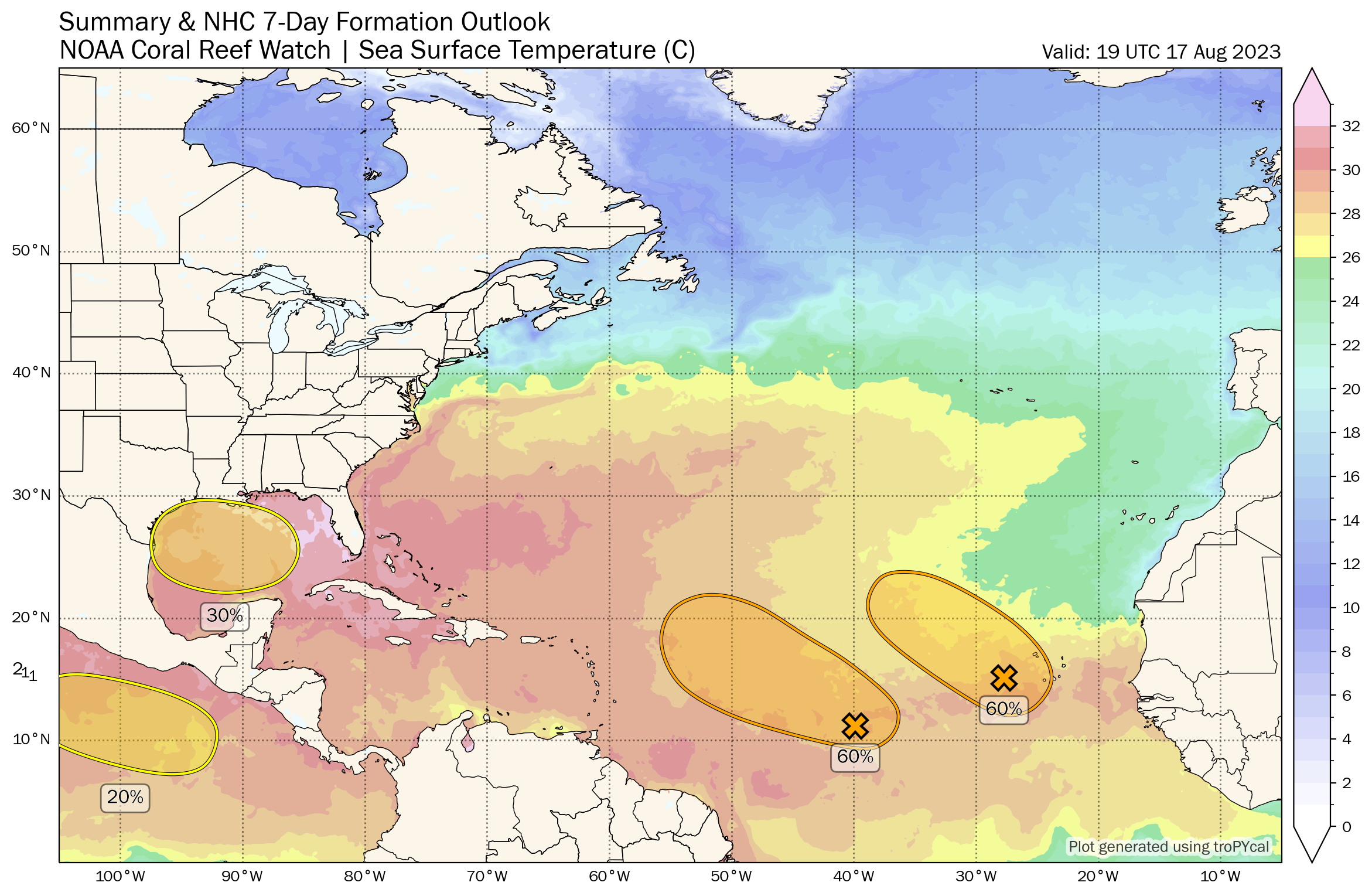 Over in the eastern Pacific, Hilary (now with winds of 105 mph) is expected to become a major hurricane tonight off the coast of Mexico. It will weaken and make landfall over northern Baja California, and the deep plume of tropical moisture will move up into Southern California and parts of Arizona and Nevada Monday and Tuesday with flooding potential.
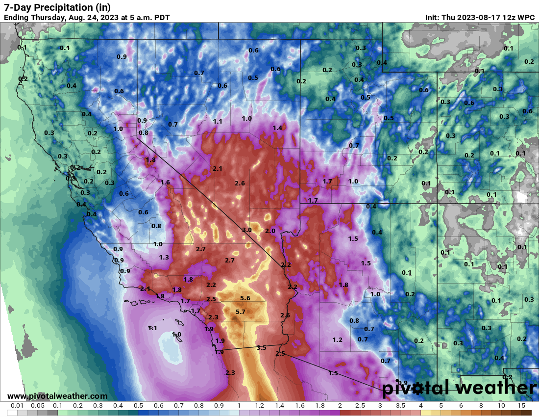
ON THIS DATE IN 1946: An estimated F4 tornado killed 11 people and injured 100 others in the Mankato, Minnesota, area around 6:52 p.m. The deaths and most of the injuries occurred in the complete destruction of the 26 cabins at the Green Gables tourist camp, 3 miles southwest of Mankato. A 27-ton road grader was reportedly hurled about 100 feet. Another tornado an hour later destroyed downtown Wells, Minnesota.
ON THIS DATE IN 1969: Hurricane Camille made landfall a half-hour before midnight in Bay St. Louis, Mississippi. At peak intensity, the hurricane had peak 1-minute sustained winds of 175 mph and a minimum pressure of 900 millibars, the second-lowest pressure recorded for a U.S. landfall behind the 1935 Labor Day hurricane. It is one of just four Category 5 hurricanes to make landfall in the U.S.
Camille caused tremendous damage in its wake and produced a peak official storm surge of 24 feet. It flattened nearly everything along the Mississippi coast and caused additional flooding and deaths inland while crossing the Appalachian Mountains of Virginia. In the U.S., Camille killed more than 259 people.
For more weather news and information from James Spann and his team, visit AlabamaWx.


