James Spann: Higher rain coverage, lower heat levels ahead for Alabama
James Spann forecasts more rain, lower temperatures for Alabama in the coming days from Alabama News Center on Vimeo.
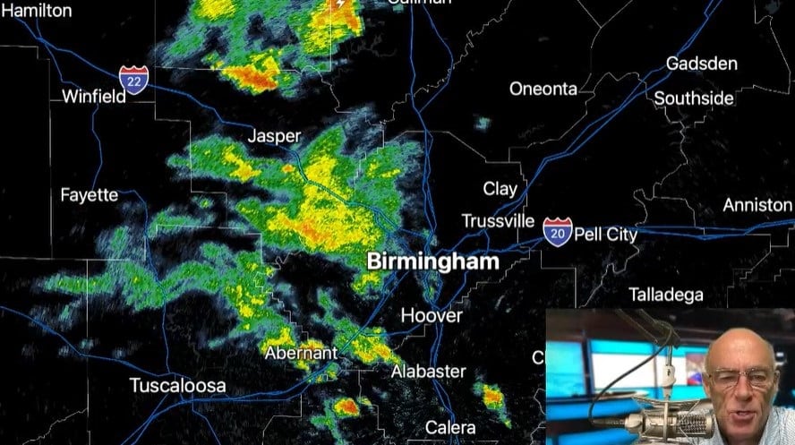
RADAR CHECK: Rain is falling early this morning in spots north and west of Birmingham; the rest of the state is dry with temperatures in the 70s. With a mix of sun and clouds we expect a high in the low to mid 90s today and random, scattered showers and thunderstorms this afternoon and early tonight. The chance of any one place seeing rain is 30-40%.
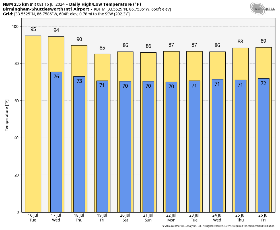
Scattered showers and storms will become more numerous Wednesday and Thursday as the ridge continues to weaken over the Deep South. Heat levels will trend lower, with highs in the low 90s in most places Wednesday, followed by upper 80s Thursday.
FRIDAY AND THE WEEKEND: A relatively wet, unsettled pattern is setting up for Alabama on these three days, with occasional showers and thunderstorms likely. It won’t be a total washout, but rain is likely at times, with a few downpours involved. Beneficial rain is a good possibility, and daytime temperatures will be well below average, with highs only in the mid 80s.
NEXT WEEK: The pattern won’t change much; we expect numerous showers and thunderstorms daily with highs only in the mid to upper 80s most days. While rain distribution on summer days is always uneven, average rain amounts for the next seven days will be 2-3 inches. There’s no sign of any excessive heat for the rest of July.
TROPICS: The Atlantic basin remains very quiet, and tropical storm formation is not expected for at least the next seven days.
MONDAY’S STORMS: It was feast or famine in terms of rain across Alabama Monday. While some places didn’t get a drop, other communities were soaked. Here are some totals:
- Weaver — 3.83 inches
- Mobile — 2.67
- Coker — 1.29
- Heflin — 1.15
- Lake View — .9
- Montgomery — .6
- Tuscaloosa — .59
- Anniston — .56
ON THIS DATE IN 1979: The most damaging tornado in Wyoming history touched down 3 miles west-northwest of the Cheyenne airport. This strong tornado moved east or east-southeast across the northern part of Cheyenne, causing $22 million in damage and one fatality.
For more weather news and information from James Spann and his team, visit AlabamaWx.


