James Spann: Lower humidity, cooler nights for Alabama this weekend
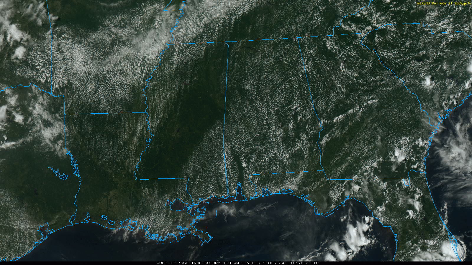
DRY AFTERNOON: There are no showers across Alabama this afternoon; temperatures range from the upper 80s over the northern counties to the mid 90s down south. Tonight will be fair with a low between 67 and 72 degrees.
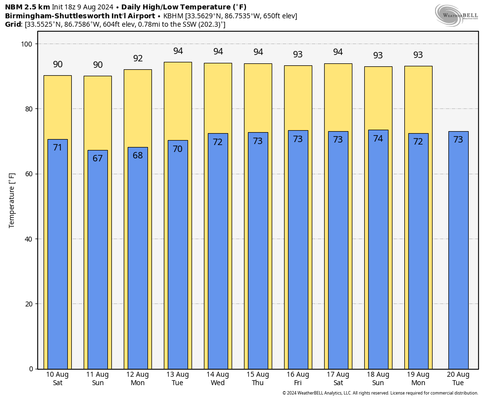
For the weekend, a drier, continental air mass drops in from the north. This will mean lower humidity levels and cooler nights; lows will be in the mid to upper 60s over the northern half of the state early Sunday and Monday mornings. Highs will be close to 90 Saturday and Sunday.
NEXT WEEK: The quiet pattern continues. We will mention the risk of a few isolated showers over the latter half of the week, but still no chance of any widespread rain. Highs will be mostly in the low to mid 90s, with lows in the low to mid 70s.
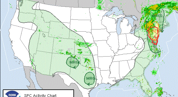
 TROPICS: The remnant circulation of former Tropical Storm Debby is northeast of Pittsburgh this afternoon and will accelerate tonight, bringing periods of rain to the Northeast. A few isolated tornadoes are possible there as well.
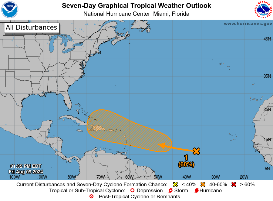
A large area of disorganized showers and thunderstorms well to the west-southwest of the Cabo Verde Islands over the tropical Atlantic is associated with a tropical wave. Any development of the wave should be slow to occur during the next couple of days while it moves westward to west-northwestward across the central tropical Atlantic.
Conditions are expected to become more conducive for development thereafter, and a tropical depression could form by early next week while the system approaches and then moves near or over the Lesser Antilles. The system is forecast to continue moving generally west-northwestward and could approach portions of the Greater Antilles by the middle of next week. The National Hurricane Center gives the system a 60% chance of development. If a tropical cyclone does form, it will likely turn north before reaching the U.S. or the Gulf of Mexico based on the forecast upper air pattern in seven to 10 days.
ON THIS DATE IN 1878: The second-deadliest tornado in New England history struck Wallingford, Connecticut, killing 34 people, injuring 100 others and destroying 30 homes. The tornado started as a waterspout over a dam on the Quinnipiac River. It was 400 to 600 feet wide and had a short path length of two miles. The deadliest New England tornado occurred in 1953 when an F4 killed 90 people in Worcester, Massachusetts.
ON THIS DATE IN 1969: An F3 tornado hit Cincinnati, Ohio, killing four people and causing $15 million property damage.
For more weather news and information from James Spann and his team, visit AlabamaWx.


