James Spann: Colder today and some clearing this afternoon in Alabama
James Spann Alabama NewsCenter Weather Forecast January 27 from Alabama NewsCenter on Vimeo.
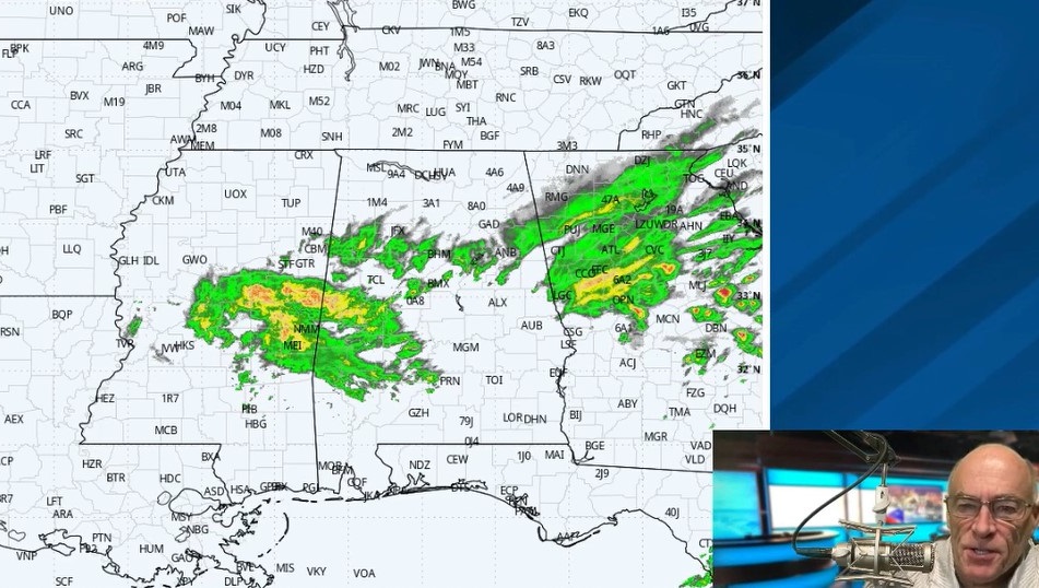
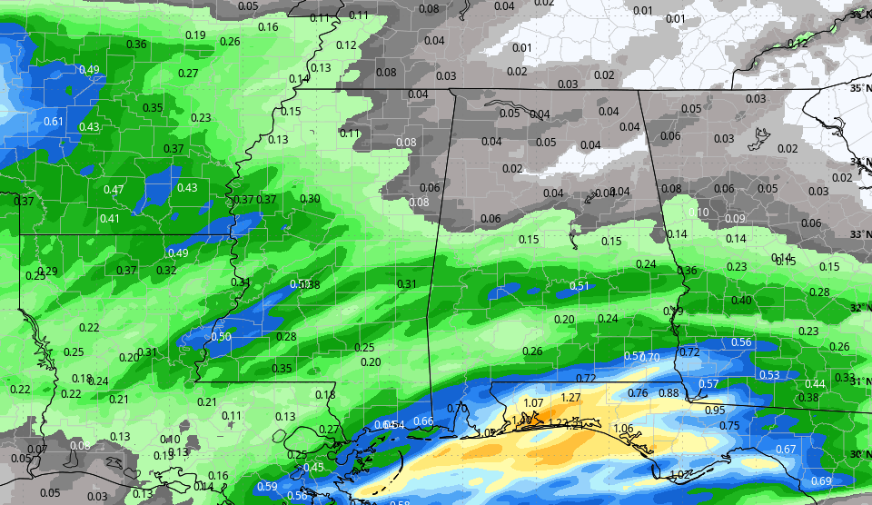
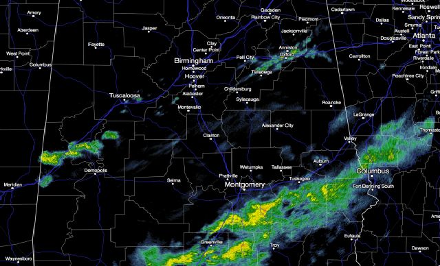
RAIN PUSHING SOUTH: Rain continues to sag slowly southward across Alabama this morning… rain is falling in spots along I-20, but by midday almost all of the rain should be over the southern half of the state.

Colder air has moved into North Alabama; some spots are at freezing, but the precipitation has moved out, and there are no winter weather travel issues.
We will be optimistic in the forecast and forecast gradual clearing this afternoon for the northern third of the state, but clouds will hang tough in many places. Expect a high today in the 48-52 degree range.
TOMORROW/FRIDAY: Sunny pleasant days, clear cold nights. Tomorrow morning should be the coldest, with upper 20s likely; the high tomorrow will be in the mid 50s, followed by mid to upper 50s Friday.
MILD WINTER WEEKEND: This will be one of the nicest weekends we have enjoyed in a while. Saturday will feature a sunny sky with a high in the mid 60s, and on Sunday we rise into the 66-69 degree range. Clouds will begin to increase Sunday, and we could see a few showers Sunday night ahead of a cold front.
The front will lose upper support, and drift into Alabama Monday with a risk of showers. Nothing widespread or heavy, and we stay in the 60s.
SEVERE WEATHER POTENTIAL NEXT WEEK: Interesting to note our friends at the Storm Prediction Center have put a decent part of Alabama in a severe weather risk on the “Day 7” convective outlook, which is for Tuesday, Tuesday night, and early Wednesday morning of next week.

Global models develop a very dynamic weather system, that will bring big snow to the southern Rockies Sunday, and ultimately out across the High Plains and the Great Lakes. We will be in the warm sector of the system, and it certainly looks like a setup for strong to severe storms for parts of the southern U.S.
Understand there is no way we can be specific so far in advance, but just be aware of the potential for some active thunderstorms in here in 6 days or so. See the Weather Xtreme video for maps, graphics, and more details.
Colder air will follow the storms over the latter part of next week.
WEATHER BRAINS: Don’t forget you can listen to our weekly 90 minute netcast anytime on the web, or on iTunes. This is the show all about weather featuring many familiar voices, including our meteorologists here at ABC 33/40.
CONNECT: You can find me on all of the major social networks…
Facebook
Twitter
Google Plus
Instagram
For more weather news and information from James Spann and his weather team, visit Alabama WX.