James Spann: More widely scattered showers today, tomorrow in Alabama
James Spann: Storms more scattered, but may pack a punch from Alabama NewsCenter on Vimeo.
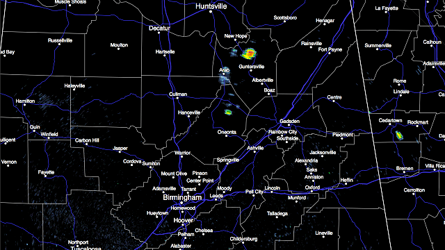
RADAR CHECK: It is a rather quiet morning across Alabama after the big MCS (mesoscale convective system) that rolled southward through the state last night. We see just a few isolated showers over Blount and Marshall counties as I write this around 6 a.m.
Today will be hotter; most communities will reach the mid 90s this afternoon with a partly sunny sky. The air becomes unstable this afternoon, and where storms form they could pack a punch with potential for wet microbursts (localized areas of damaging straight-line winds) and huge amounts of lightning. But the storms will be very widely scattered, and many places won’t see rain today. SPC has all of Alabama in a “marginal risk” for severe storms this afternoon.

TOMORROW: A surface boundary will push into the state during the afternoon, and with temperatures up in the mid 90s, the air will be unstable and once again we will have the risk of scattered, strong thunderstorms. It won’t rain everywhere, but where storms develop they could become strong to severe, with potential for wet microbursts. SPC has the standard “slight risk” of severe weather up for parts of Central and South Alabama, with a “marginal risk” for the rest of the state tomorrow.

THE ALABAMA WEEKEND: A nice surge of dry air moves in here tomorrow night, setting up a great weekend with sunny days, clear, cooler nights and lower humidity. Showers will be confined to far South Alabama; highs will be in the 80s with lows in the 60s. Cooler spots will visit the 50s early Sunday morning. Enjoy those lower dewpoints.
NEXT WEEK: The weather continues to look dry Monday and Tuesday with a slow warming trend; then we will bring back the risk of scattered storms Wednesday through Friday with highs generally in the low 90s.
TROPICS: Just a slight risk of some slow development over the far Southwest Gulf of Mexico over the next five days; otherwise, the Atlantic basin remains very quiet.
AT THE BEACH: About five to seven hours of sunshine today and tomorrow along the coast from Gulf Shores over to Panama City Beach with scattered thunderstorms. Then, for the weekend, expect increasing amounts of sunshine and fewer showers as dry air drops southward. Highs will be in the upper 80s along the immediate coast, with low 90s inland. See a detailed Gulf Coast forecast here.
WEATHER BRAINS: You can listen to our weekly 90-minute netcast anytime on the web, or on iTunes. This is the show all about weather featuring many familiar voices, including meteorologists at ABC 33/40. We will produce next week’s show tonight at 8:30 CT (I am on vacation next week). You can watch it live here.
For more weather news and information, visit AlabamaWX.


