James Spann: Unsettled weather for Alabama the rest of the week
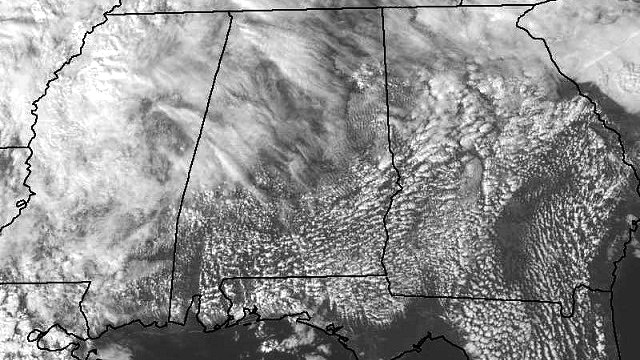
THIS AFTERNOON: Another warm January day with temperatures mostly in the upper 60s and low 70s; just a few isolated showers are over North Alabama. Clouds will thicken tonight with a weakening surface front approaching from the west.

MIDWEEK: We will mention a chance of showers tomorrow and tomorrow night as the front gets close, but there will be little upper support, and rain amounts should be on the light side, generally one-quarter inch or less for the places that do see rain. Otherwise, the sky will remain mostly cloudy and tomorrow’s high will be in the low 70s.
The front will wash out Wednesday, and while we will still mention a chance of widely scattered showers, a decent part of the day should be dry. The high Wednesday will be in the 65- to 70-degree range, and the sky will feature more clouds than sun.
The next wave from the west will bring rain into the state Thursday afternoon and Thursday night. This one will have better dynamics, and we could see some strong thunderstorms Thursday night. But at the moment it looks like the best instability will be a little west of Alabama, and for now the overall severe weather threat looks fairly low. Rain amounts of one-half to 1 inch look likely with this system.
FRIDAY AND THE WEEKEND: Rain and storms should end early in the day Friday, and the sun should break out with temperatures rising back into the low to mid 70s as the warm January pattern continues. Then, over the weekend, a rather robust weather system will approach from the west. We will mention a chance of showers during the day Saturday as the Gulf of Mexico will be “wide open,” but the main event will come Saturday night and Sunday, with rain and thunderstorms. The latest Global Forecast System is trending a little slower, suggesting the main threat of strong storms will come Sunday. And, with much better instability, severe storms could certainly be a possibility. Still a little too early to be specific about timing and the overall magnitude of the threat.
On the positive side, rain amounts over the weekend could approach 2 inches; don’t forget the northern half of the state is still in a drought.
NEXT WEEK AND BEYOND: Monday looks cloudy and much cooler with a chance of some light rain; the high will drop back into the low to mid 50s, where we should be in January. And the pattern will favor even colder air toward the end of the month.

WEATHER BRAINS: You can listen to our weekly 90-minute netcast anytime on the web, or on iTunes. This is the show all about weather featuring many familiar voices, including meteorologists at ABC 33/40. We will produce this week’s show tonight at 8:30. You can watch it live here.
CONNECT: You can find me on all of the major social networks:
Facebook
Twitter
Google Plus
Instagram
For more weather news and information, visit AlabamaWX.