Don’t let your guard down: Main event in today’s weather still to come
The morning round of storms is winding down across Central Alabama. Scattered downpours continue over East Alabama but are moving into Georgia.There’s still some lightning between Talladega and Roanoke, but lightning flash rates have gone way down.

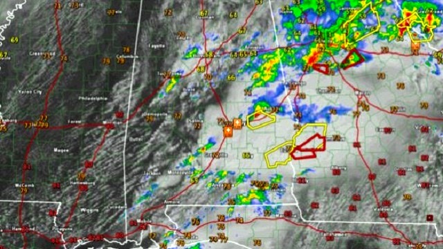
Round two continues with severe storms across South Central Alabama. One is approaching Auburn now.
More counties were just removed from the tornado watch, but a new tornado watch will be required later today.
The sun is breaking out across areas west of I-65. What seems like good news at face value is actually bad news, because the sun will work on the moist airmass left in place and will rapidly destabilize things.
That is already evident in a newly formed line of showers pushing across Jefferson, Tuscaloosa and Hale counties. These should not be able to become severe, but they could eventually develop lightning.
This warming and destabilizing concerns us as we go through the day. Additional storms will form later that will be able to feed on this unstable air. It is 70 degrees at Tuscaloosa now and 79 at Demopolis. Instability levels are already at 1,000 joues or higher in areas south of US 82/I-20.
These storms will become severe as they pass east of I-65, and the potential is there for all modes of severe weather, including tornadoes, large hail and damaging winds.
For frequent updates on today’s weather from James Spann, Bill Murray and the rest of the James Spann team, visit AlabamaWX.


