Brian Peters: Storms once again today for Alabama
DROUGHT MONITOR: The latest Drought Monitor from Thursday, July 11, showed that Alabama was very close to being 100 percent drought free. Only one very small area of extreme western Colbert County remained in the abnormally dry category. I am amazed that only seven months ago a large chunk of Alabama was in exceptional drought and we’ve been able to recover so well. Amazed but thankful.
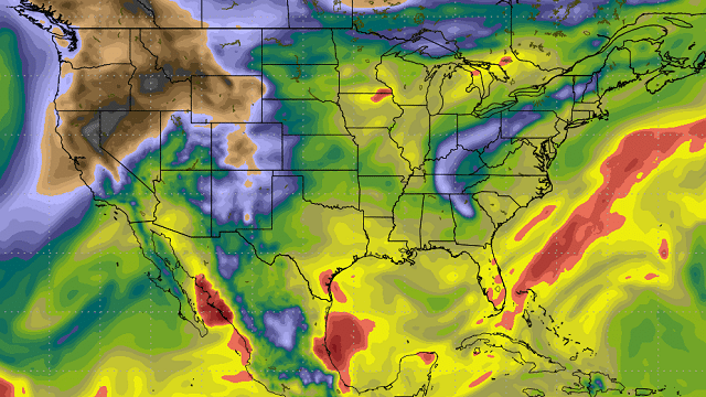
TODAY: Some clouds left over from rather late convection last night were visible on the infrared satellite image this morning. Some patchy fog was also observed in central Alabama, with visibility reduced to a half mile in spots. Radar was free of echoes in Alabama this morning, and temperatures were fairly uniform, with most locations in the lower 70s. A weak, nearly stationary front was situated east to west across Tennessee, and as the upper air pattern becomes a little more northwesterly aloft that front is expected to sag into central Alabama before washing out late Sunday and early Monday. This should bring fairly good chances for showers and thunderstorms to central Alabama today and Sunday, with highs around the 90-degree mark.
TROPICS: The tropical Atlantic was quiet, while Hurricane Fernanda and two other areas of disturbed weather were being watched in the eastern North Pacific. None of these were a threat to land as they move west-northwest.

NEXT WEEK: The Global Forecast System suggests from Monday through Thursday some much drier air will push into the northern half of Alabama. This should be enough of a change to significantly lower our rain chances to less than 10 percent for the middle of the week. Most forecasts that I have looked at this morning keep some small chances in the forecast. Using precipitable water values, I think we should be able to take any mention of showers out of the forecast for Tuesday, Wednesday and Thursday. Highs during this period should be fairly steady in the lower 90s, while lows remain steady in the lower half of the 70s.

Friday the large upper ridge over the west will nose into the Middle Mississippi River Valley, and moisture levels across north and central Alabama will rise, so it looks like the forecast will need to mention the possibility of isolated showers and thunderstorms. With the ridge nosing our direction, I expect highs to climb into the middle 90s.
The ridge weakens a little on Saturday, but not enough to show any significant change to our weather, so isolated showers stay in the forecast with highs in the middle 90s.
BEACH FORECAST: The weather at the beach will consist of daily chances for showers and thunderstorms with highs in the upper 80s. You can click here to see the AlabamaWx Beach Forecast Center page.
BEYOND NEXT WEEK: Looking into voodoo country, the GFS remains pretty consistent in keeping us between a trough along the East Coast and a ridge along the eastern slopes of the Rockies. This pattern would favor warm weather with some daily chances for rain in the form of showers and thunderstorms. The pattern does not support any kind of extreme heat for us, but it does keep it hot over the western half of the country.
Have a great day and Godspeed.

For more weather news and information, visit Alabama Wx.


