James Spann: Heavy rain, strong storms for Alabama through Wednesday
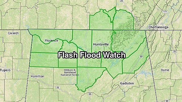
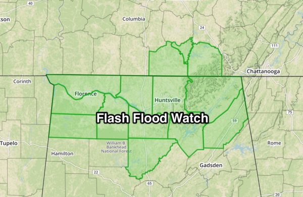
BIG SOAKING AHEAD: An upper trough lifting out of the Southwest will bring lots of rain to Alabama over the next 24 hours. The National Weather Service office in Huntsville has issued a Flash Flood Watch for its counties in the Tennessee Valley for the possibility of 2 to 3 inches of rain.
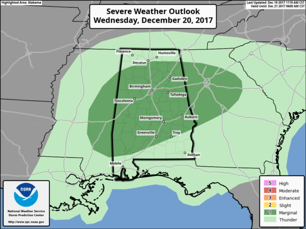
In addition to the threat of heavy rain, a few strong to severe storms are possible through central Alabama late tonight into tomorrow morning. The Storm Prediction Center maintains a “marginal risk.”
TONIGHT: A band of moderate to heavy rain sets up over the northern third of Alabama. Some thunder is possible, but the severe weather threat will be very low through the night. Flash flooding will be the primary threat.
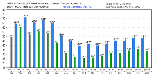
TOMORROW: Showers and storms will increase south of the big overnight rain mass across central Alabama during the morning. These storms could become strong to severe; the main window for stronger storms will come from 6 a.m. until 3 p.m. Heavier storms could produce strong, gusty winds, and we can’t rule out a brief isolated tornado or two based on the projected shear profile. Winds become unidirectional by afternoon, however. The day will be mild in temperature, with a high at or just over 70 degrees.
THURSDAY: We project dry, mild weather as Alabama will be between waves; with a mix of sun and clouds the high will be pretty close to 70 degrees, about 15 degrees above average for late December.
FRIDAY AND THE WEEKEND: Rain moves back into the state Friday afternoon and Friday night ahead of the Arctic front. This will be the last mild day for a while with a high again close to 70 degrees. A thunderstorm or two is possible Friday night, but for now severe storms are not expected.
Saturday will be wet and cooler. Periods of rain are likely, and temperatures could very well fall from the 50s in the morning into the 40s by mid to late afternoon as winds veer around to the north. Then, by Sunday, the best chance of rain shifts down into south Alabama. Some sun is possible over the northern counties Sunday afternoon with a high in the 40s.
CHRISTMAS DAY: Monday looks mostly sunny but very cold; the high will be close to 40 degrees over the northern half of the state, and some communities could hold in the 30s all day.
REST OF NEXT WEEK: Our weather stays dry and cold through midweek; then we warm up toward the end of the week, and rain should return by Friday. For now we see no threat of snow or ice issues for Alabama for the next 10 days.
BEACH FORECAST: Click here to see the AlabamaWx Beach Forecast Center page.
WEATHER BRAINS: You can listen to our weekly 90-minute netcast anytime on the web, or on iTunes. This is the show all about weather featuring many familiar voices, including meteorologists at ABC 33/40.
CONNECT: You can find me on all of the major social networks:
Facebook
Twitter
Google Plus
Instagram
Pinterest
Snapchat: spannwx
For more weather news and information from James Spann and his team, visit AlabamaWx.


