Brian Peters: Chilly Saturday, cold Sunday morning for Alabama
Brian Peters: Alabama keeps cool today, drops toward freezing tonight from Alabama NewsCenter on Vimeo.
RAW SATURDAY: The rain that fell Friday evening and early this morning has moved out of north and central Alabama, with a surface low situated near Demopolis along the frontal boundary stretching from southeast Mississippi into north Georgia. The wind across central Alabama has come around to the north, with temperatures in the 40s across the Tennessee River Valley and in the 50s across much of central Alabama. South Alabama counties are still in the 60s. Today is going to be chilly and raw, with clouds hanging tough and at least some chance for patchy rain or a passing shower.
Freeze warnings are in effect for about the northern half of Alabama for Sunday morning. A wind advisory is in effect for much of the northern quadrant of Alabama east of I-65 for this afternoon and this evening, for wind 15 to 25 mph with higher gusts.
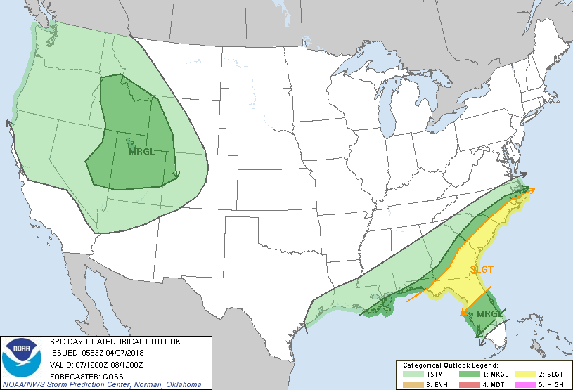
The Storm Prediction Center has a slight risk for severe storms across north Florida and along the coast of Georgia and the Carolinas.
FROSTY SUNDAY MORNING: Surface high pressure settles into the Southeast by early Sunday. This will be another chilly morning, with that freeze warning in effect from 2 a.m. to 9 a.m. as the morning temperatures drop into the lower 30s. Frost is expected across much of the northern half of Alabama. Highs Sunday should recover a bit from today, with readings in the middle 60s.
NEXT WEEK: The upper-level pattern flattens out on Monday but sharpens up with a short wave moving across the Southeast on Tuesday. We’ll maintain a small chance for showers both days, though most people will probably stay dry. The afternoon highs should reach the lower 70s.
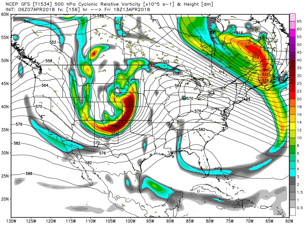
For Wednesday and into the latter half of the week, we should remain dry and fairly warm as an upper ridge builds across the eastern U.S. Look for highs to reach well into the 70s and potentially around 80 by Friday. But on Friday we will have our eye on a strong upper-level closed low over western Nebraska that will generate a surface low in northeast Nebraska that will move toward the western Great Lakes on Saturday, dragging a cold front across the Mississippi River. This should bring a rainy and somewhat stormy start to next weekend. But it does look like we should dry out while cooling down for next Sunday.
LONG TERM: Looking out into voodoo country, the pattern remains pretty active. By Monday, April 16, the eastern trough moves off the coast while a new trough enters the picture over Wyoming. The Wyoming trough digs into the Ohio River Valley on April 18, bringing another potential for some brief cold to the eastern half of the country by April 19. The overall pattern begins to dampen somewhat by April 22.
BEACH FORECAST: Click here to see the AlabamaWx Beach Forecast Center page.
WEATHERBRAINS: You can listen to our weekly 90-minute netcast any time on the web or on iTunes. This is the show all about weather featuring many familiar voices, including meteorologists at ABC 33/40.
Enjoy the day and stay warm. Godspeed.
 For more weather news and information from James Spann, Brian Peters and other members of the James Spann team, visit AlabamaWx.


