James Spann: Alabama gets cooler Friday, with a brighter weekend ahead
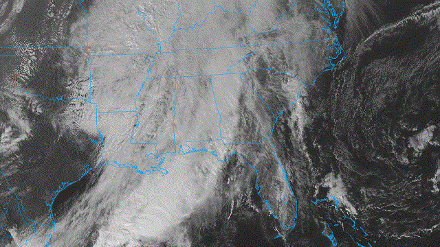
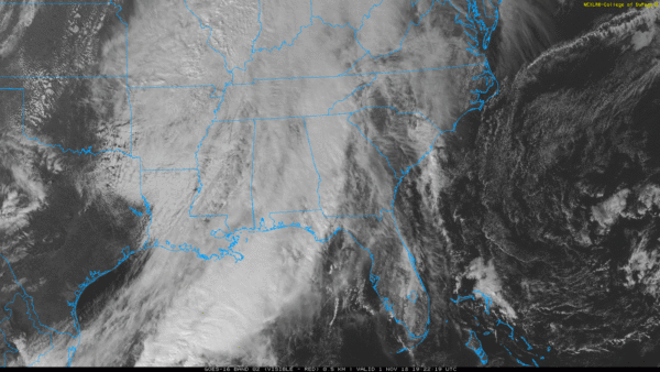
RADAR CHECK: The large mass of rain that was over Alabama this morning is now well east of the state, but clouds linger with temperatures in the 60s. A few showers are possible tonight with a passing cold front, but nothing too heavy or widespread.
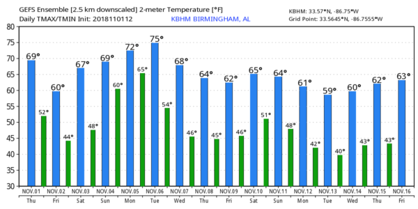
Friday will be much cooler; we stay in the 50s all day with a mostly cloudy sky. A touch of light rain or drizzle is possible in spots, but most of the day will be dry. Clouds move out Friday evening, and the weather Friday night will be clear and rather chilly. Most north and central Alabama communities will drop into the 38- to 42-degree range Saturday morning. Colder spots will see some light frost.
THE ALABAMA WEEKEND: Look for a good supply of sunshine Saturday with a high in the upper 60s; Sunday will be partly sunny with a high in the low 70s. A cold front will have the potential to bring showers to the state late Sunday night or Monday morning.
FOOTBALL WEATHER: We’ll have great weather for the high school games across the state Friday night; look for a clearing sky with temperatures falling from the mid 50s at kickoff into the 40s by the fourth quarter.
Auburn will host Texas A&M Saturday (11 a.m. kickoff) at Jordan-Hare Stadium. The sky will be sunny, with temperatures rising from near 64 degrees at kickoff into the upper 60s by the second half.
Alabama is on the road to take on LSU in Baton Rouge Saturday night (7 p.m. kickoff). It will be a perfect night for football, with a clear sky and temperatures falling through the 60s.
UAB will host UTSA at Legion Field in Birmingham Saturday evening (6:30 p.m. kickoff). The sky will be clear with low 60s at kickoff and mid 50s by the fourth quarter.
NEXT WEEK: We’re still seeing signals from global models of a severe weather threat for parts of the Deep South next Tuesday, election day. It’s too early for details — just something to watch for now. The latter half of the week will be dry and cool.
TROPICS: All is quiet across the Atlantic basin, and tropical storm formation is not expected through the weekend.
THIS MORNING’S ACTIVITY: National Weather Service Huntsville confirmed a short-lived EF-0 tornado in northwest Franklin County. But, generally speaking, there was little damage across the northern two-thirds of the state.
BEACH FORECAST: Click here to see the AlabamaWx Beach Forecast Center page.
WEATHER BRAINS: You can listen to our weekly 90-minute show any time on your favorite podcast app. This is the show all about weather featuring many familiar voices, including meteorologists at ABC 33/40.
CONNECT: You can find me on all of the major social networks:
Facebook
Twitter
Instagram
Pinterest
Snapchat: spannwx
For more weather news and information from James Spann and his team, visit AlabamaWx.


