James Spann: Cold, wet weather continues in Alabama through midweek
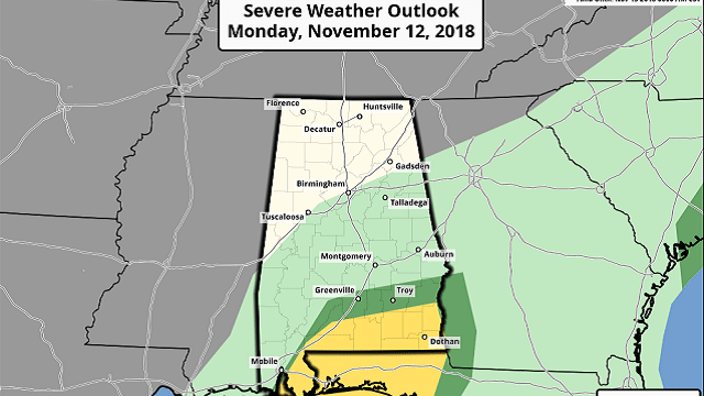
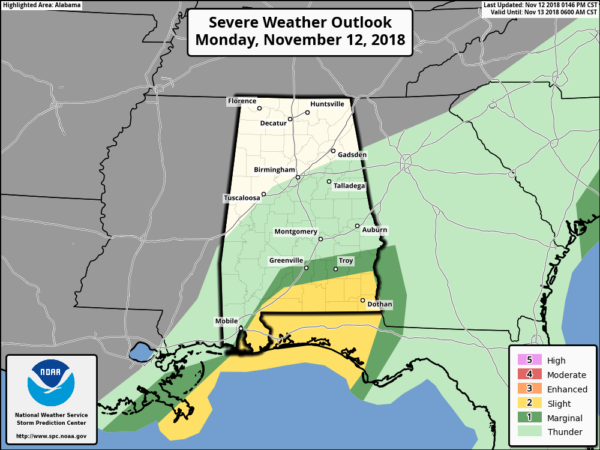
COLD SOAKER: As advertised, just about every square inch of Alabama has been soaked today. With a broad upper trough to the west, a warm front to the south and a very moist air mass in place, we will continue to forecast rain for north Alabama tonight, with potential for strong storms over far south Alabama, near the warm front. A tornado watch remains in effect for deep south Alabama until 7 p.m.
Temperatures will hold in the 40s over north Alabama tonight, with 50s and 60s closer to the coast and south of the warm front.
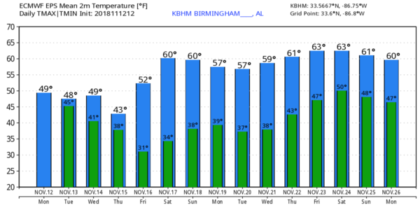
TUESDAY: Lingering rain is likely during the morning, but the rain should taper off during midday as the first part of the upper trough lifts away, northeast of Alabama. Otherwise, Tuesday will be cloudy and cold, with temperatures in the 40s all day over most of the state. The warmer air now over the Gulf Coast counties will be pushed southward, unfortunately.
WEDNESDAY/THURSDAY: The part of the upper trough that hangs back will move slowly through Alabama with more rain Wednesday afternoon and Wednesday night. Same setup as today — it will be a cold rain with temperatures mostly in the 40s. That batch of rain will end Thursday morning, but clouds linger all day, and once again we won’t get out of the 40s. Keep in mind we should be in the mid to upper 60s in mid-November, based on seasonal averages.
FRIDAY AND THE WEEKEND: The sky finally clears Thursday night, and we will have brighter weather Friday through the weekend with sunny, cool days and clear, cold nights. The high will be in the mid 50s Friday, then close to 60 degrees Saturday and Sunday. The coldest morning will come early Friday, with most communities seeing a low between 28 and 34 degrees.
THANKSGIVING WEEK: For now, our weather looks dry Monday through Thanksgiving Day with highs in the upper 50s and low 60s, and lows in the 30s and 40s. Rain is possible on Friday.
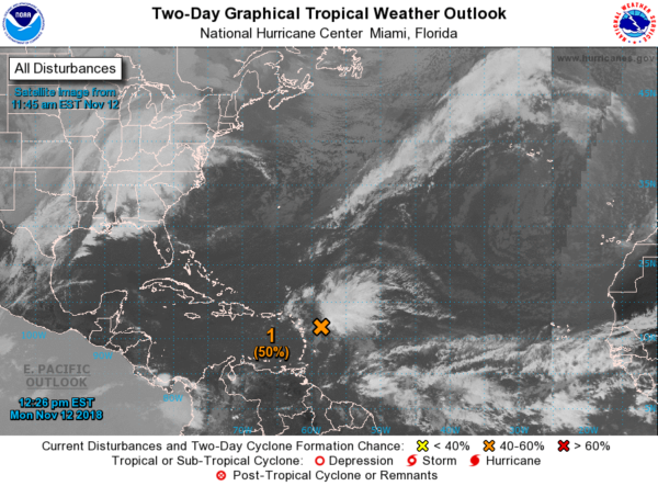
TROPICS: A disturbance near the Leeward Islands is expected to become a tropical depression or storm over the next three to five days (the name will be Patty), but it should recurve into the Atlantic well before getting close to the U.S.
RAIN THIS MORNING: Here are some rain totals from the team of ABC 33/40 Skywatchers:
- Weaver — 3.45 inches
- Jacksonville — 2.76 inches
- Montevallo — 2.47 inches
- McAdory — 2.22 inches
- Rock Creek — 2.2 inches
- Mountain Brook — 2.08 inches
- Hueytown — 1.98 inches
- Bessemer — 1.95 inches
BEACH FORECAST: Click here to see the AlabamaWx Beach Forecast Center page.
WEATHER BRAINS: You can listen to our weekly 90-minute show any time on your favorite podcast app. This is the show all about weather featuring many familiar voices, including meteorologists at ABC 33/40.
CONNECT: You can find me on all of the major social networks:
Facebook
Twitter
Instagram
Pinterest
Snapchat: spannwx
For more weather news and information from James Spann and his team, visit AlabamaWx.