Scott Martin: Potential for severe storms in Alabama on Sunday
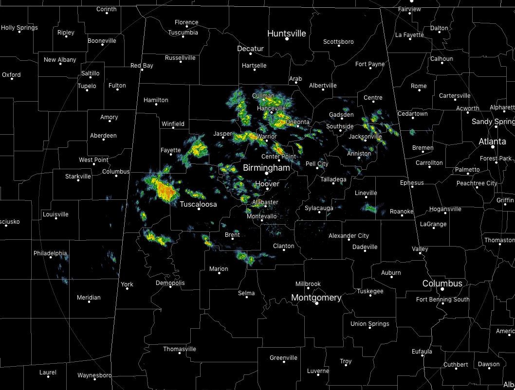
At 7 this morning, we had some scattered shower activity moving across central Alabama. Much of this activity was light in nature, but the cluster moving into the western parts of Tuscaloosa County was putting down some heavier rainfall. These are pushing off to the east-northeast around 35 mph.
TODAY: After the showers that we have out there this morning move off to the east, they are expected to diminish and we should have dry conditions during the afternoon and evening. Showers out ahead of our next system will begin to move into the western parts of the state after midnight. Today’s highs will be in the upper 50s to the upper 70s with overnight lows in the lower 30s to the lower 40s.
SUNDAY: A cold front that pushed through Alabama on Friday is stalled out over the northern Gulf of Mexico, just offshore. It will begin to be pulled back to the north as a warm front on Sunday as warm air advection begins to build out ahead of a developing low and a strong cold front. Air across Alabama will be unstable, and with the forcing and lift from the front and the low, we’ll have the ingredients in place for severe storms on Sunday. We’ll have the potential for severe weather throughout the afternoon and evening, with damaging thunderstorm wind gusts up to and exceeding 60 mph and a few tornadoes possible.
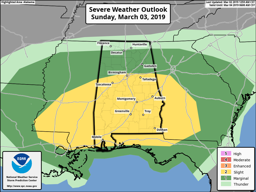
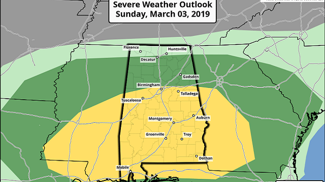
The Storm Prediction Center has all of Alabama south of a line from Reform to Fultondale to Heflin defined in a slight risk (level 2 of 5) for severe storms throughout the day, while much of the state north of that line is defined in a marginal risk (level 1 of 5).
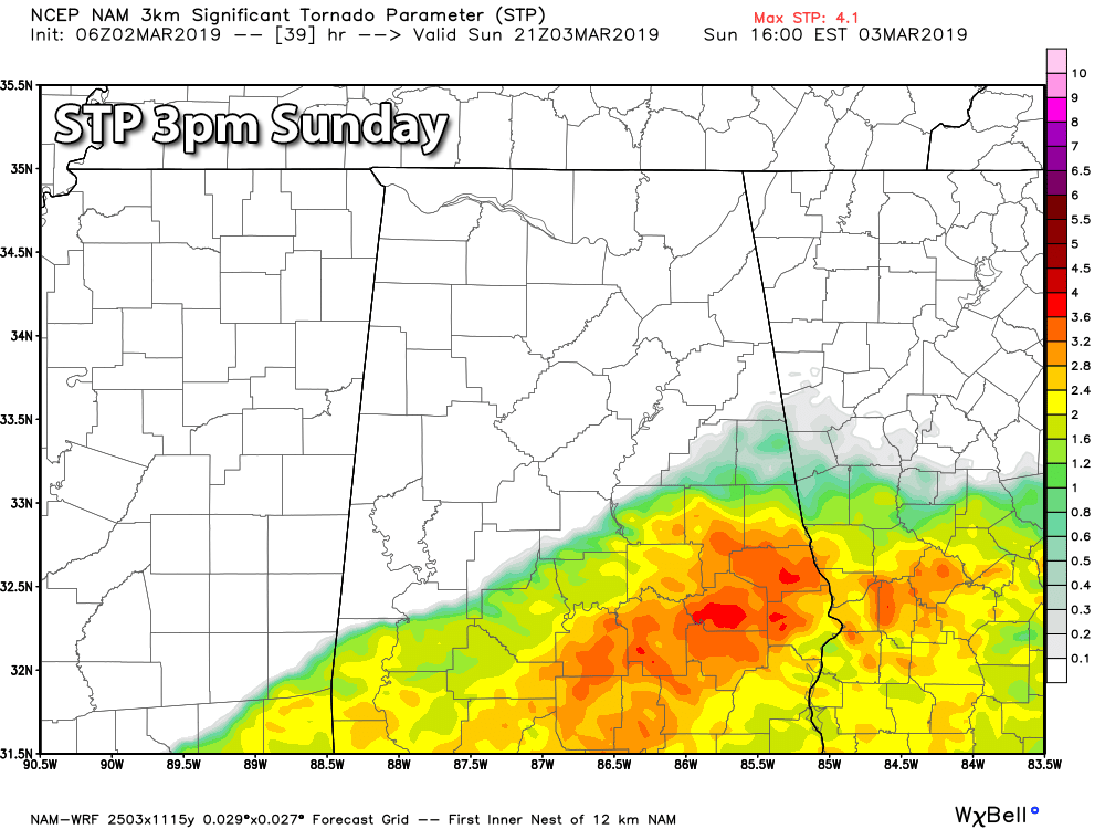
With dewpoints forecast to be in the mid-60s and colder air aloft, this will allow for decent instability to build across the area, with the higher values south of the warm front (slight risk areas). We’ll have stronger low-level shear in place, so this will bring in the threat of a few tornadoes and damaging winds. Timing for strong to severe storms will be from noon to 9 p.m. Sunday. Highs will be in the mid-50s to the mid-70s from northwest to southeast.
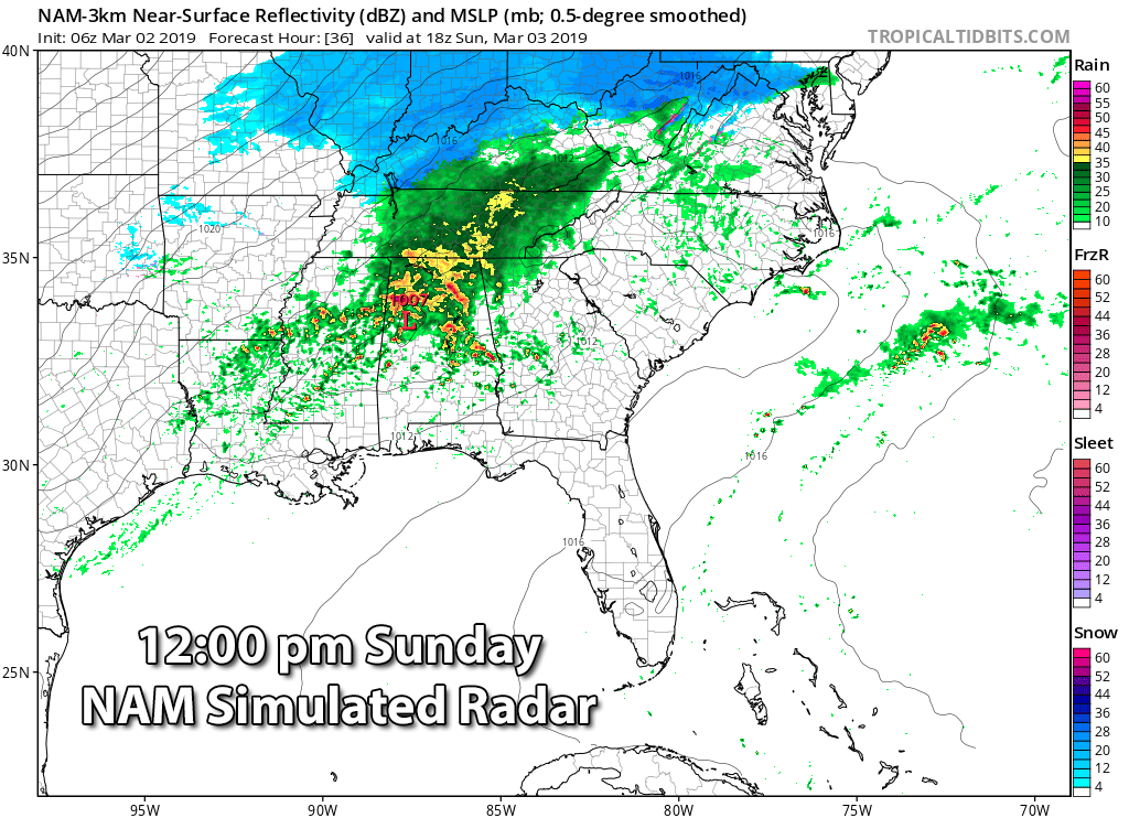
We could see some cells develop out ahead of the main line of storms that could become strong to severe, but as the dynamics begin to push off more to the east and northeast, the event will shift into more of a linear event.
Look for updates throughout the day today and Sunday on AlabamaWx for this severe storm threat. Any warnings issued are instantly posted to the blog with the information from the National Weather Service office. Have a dependable way to receive weather alerts close by and have those safety kits ready to go just in case your location goes under a warning.
After the cold front pushes through late Sunday night, much colder and drier air will move in during the late night and overnight hours. There were some hints at possible flurries on the backside of the system, but the latest model runs show that the precipitation will be out of Alabama before the cold air arrives. Overnight lows will be in the upper 20s to the mid-40s from northwest to southeast.
MONDAY: It will be a totally different feeling on Monday as Old Man Winter has made a return to Alabama. We’ll have more clouds than sun to start the day, but slow clearing will take place. We’ll be dry, but afternoon highs will be only in the lower 40s to the mid-50s after starting off the morning in the lower 20s to the mid-30s.
TUESDAY: Cobalt blue skies and maximum sunshine can be expected Tuesday, but highs will be below normal for early March. After starting off with morning lows in the 20s, highs will top out in the lower 40s to the lower 50s.
WEDNESDAY: We’ll have plenty of sunshine, but it will still be a rather cool day. After starting off with early morning lows in the mid-20s to the lower 30s, we’ll top out in the mid-40s to the lower 50s.
THURSDAY: It will be a decent day on Thursday as temperatures begin to moderate. That usually means that we’ll have some rain and storms to put up with, but the good news is those won’t be in Alabama until Friday. Skies will start off mostly sunny, but clouds will be on the increase by afternoon and through the evening and overnight. Highs will be in the lower 50s to the lower 60s.
FRIDAY: A low will be stationed over northern Illinois at midday on Friday, which will swing a cold front through Alabama late in the day and through the evening. Rain and thunderstorms will be likely, and we could have the potential for a few strong storms as we’ll have decent shear and instability in place, but it is too early to tell if we’ll be dealing with severe storms. Highs will be in the lower 60s to the lower 70s.
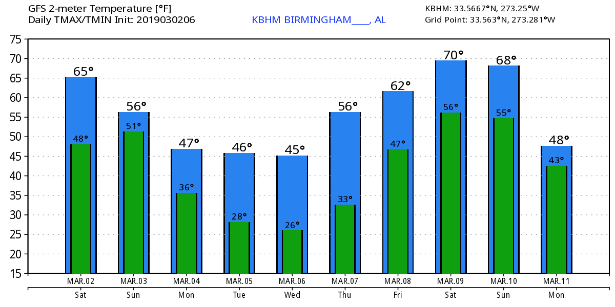
VOODOO LAND: Next weekend looks to start off dry after rain moves out early Saturday morning, but it will be only a short break, as showers look to move back in on Sunday morning. Temperatures for next weekend are trending mild, but cold air looks to make a return trip to Alabama on Monday, March 11. But all of this can change, as it is out in Voodoo Land. One thing we’ll have to do is watch every system when they move through, as we have now entered the beginning of meteorological spring and the start of the spring severe weather season.
For more weather news and information from James Spann, Scott Martin and other members of the James Spann team, visit AlabamaWx.


