James Spann: A few showers, storms for east Alabama today
James Spann has the midweek forecast for Alabama from Alabama NewsCenter on Vimeo.
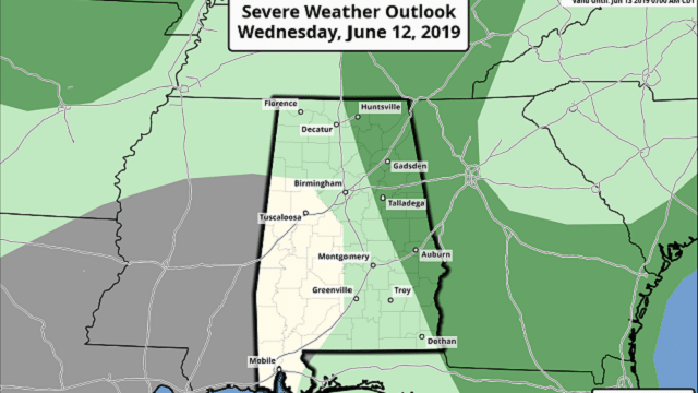
DEEPER MOISTURE EAST OF I-65: We will mention a chance of scattered showers and thunderstorms this afternoon, mainly for the eastern counties of Alabama, ahead of a cold front. The Storm Prediction Center has east Alabama in a marginal risk (level 1 out of 5) of severe storms east of I-65.
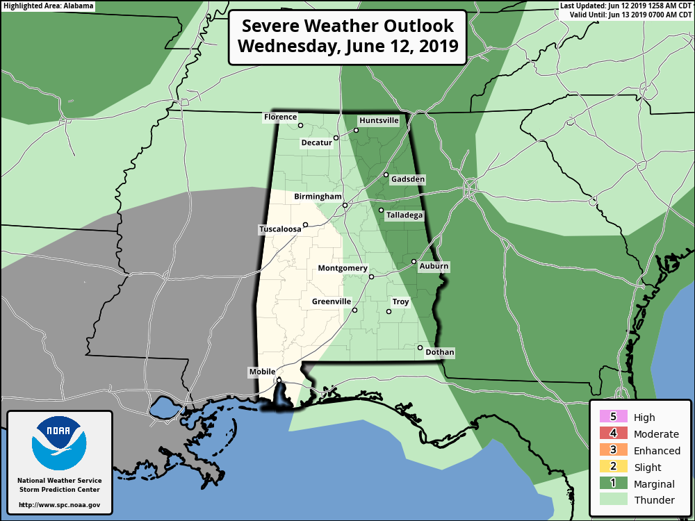
A few storms could produce strong winds and some hail during the afternoon and evening. West Alabama will be mostly dry today, and highs will be in the 82- to 85-degree range with a mix of sun and clouds.
THURSDAY/FRIDAY: These two days will bring some delightful weather to the state for early summer — mostly sunny days; fair, cool nights, and low humidity levels. Highs will be in the low 80s Thursday, followed by mid 80s Friday. Temperatures drop into the 50s early Friday morning, and some of the normally cooler spots across north Alabama could touch the upper 40s briefly.
THE ALABAMA WEEKEND: Saturday will be dry and warmer; the sky will be mostly sunny with a high in the upper 80s. Then we will bring back a chance of scattered, mostly afernoon and evening showers and thunderstorms on Sunday as moisture levels rise. Sunday’s high will be in the mid to upper 80s with a mix of sun and clouds.
NEXT WEEK: Not much change; the weather will be fairly typical for June most of the week — partly sunny days with some risk of scattered showers and storms, and highs in the 87- to 90-degree range.
TROPICS: All is quiet across the Atlantic basin, and tropical storm formation is not expected over the next seven days.
ON THIS DATE IN 2005: The remnant circulation of Tropical Storm Arlene moved through north and central Alabama. Arlene’s local effects were rather minor. Storm total rainfall generally was 1 to 3 inches east of Interstate 65, and 2 to 5 inches west of Interstate 65, with isolated higher amounts. Estimated maximum wind gusts were 30 to 40 mph, with a few isolated higher amounts. The heaviest rain and the strongest winds were generally experienced along and west of Interstate 65. Several trees and power lines were blown down across central Alabama with a few power outages. Minor local flooding and river flooding occurred.
BEACH FORECAST: Click here to see the AlabamaWx Beach Forecast Center page.
WEATHER BRAINS: You can listen to our weekly 90-minute show any time on your favorite podcast app. This is the show all about weather featuring many familiar voices, including the meteorologists at ABC 33/40.
CONNECT: You can find me on the major social networks:
Facebook
Twitter
Instagram
Pinterest
Snapchat: spannwx
For more weather news and information from James Spann and his team, visit AlabamaWx.