James Spann: Highs remain in the 90s for Alabama through next week
James Spann forecasts another week of Alabama heat wave from Alabama NewsCenter on Vimeo.
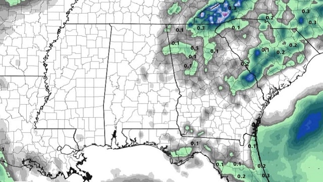
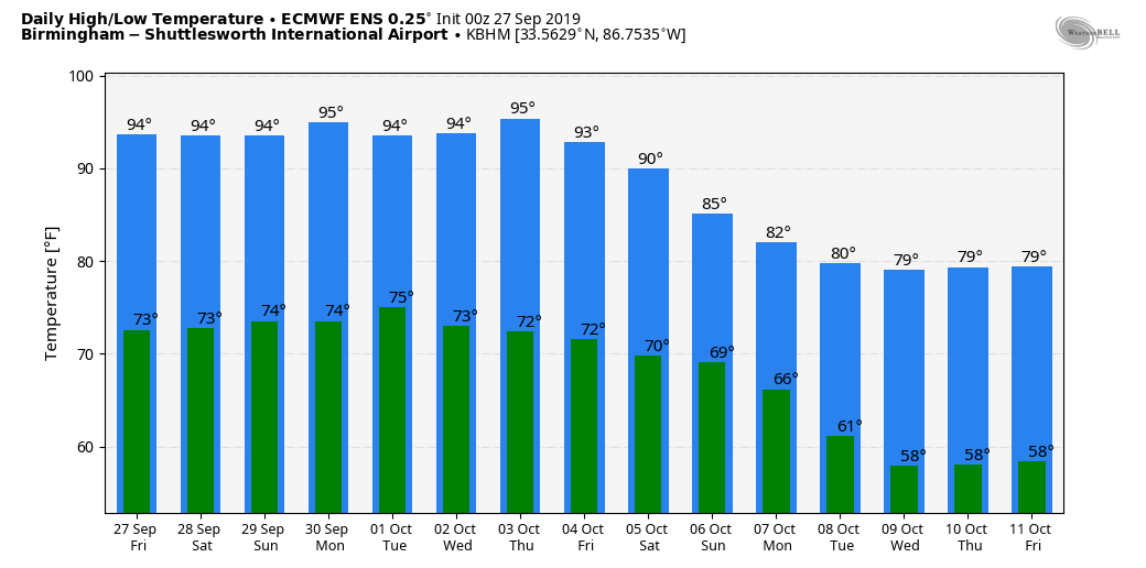
FALL HEAT WAVE ROLLS ALONG: A strong upper ridge of high pressure simply won’t budge much over the next five to seven days, meaning Alabama’s weather won’t change much. Look for partly to mostly sunny days through the weekend with only isolated afternoon and evening showers or storms; odds of any one place seeing rain will remain in the 10-20% range. Highs will remain generally in the mid 90s, right at record levels for this time of the year.
NEXT WEEK: No change. We’ll have hot, mostly dry weather all week with highs still in the 90s. Any afternoon showers and storms will remain widely spaced, and meaningful rain is not likely. Heat waves and droughts always go hand in hand, and they tend to self perpetuate.
The hottest temperature on record during October in Birmingham is 94. That was measured in 1954, 1941, 1927 and 1919. Considering the lack of soil moisture and the projected upper pattern, we could break that record at some point next week.
FOOTBALL WEATHER: It will be mostly clear and warm for the high school games tonight. Temperatures will fall from the low 80s at kickoff into the 70s by the second half of the games.
Saturday, Alabama hosts Ole Miss at Bryant-Denny Stadium (2:30 p.m. kickoff). The sky will be partly sunny with temperatures in the mid 90s at kickoff, falling back to near 90 by the fourth quarter. There is an outside risk of a brief shower during the game.
Auburn will host Mississippi State Saturday evening at Jordan-Hare Stadium (kickoff at 6). The sky will be clear with temperatures falling from near 89 at kickoff into the low 80s by the final whistle.
UAB travels to Bowling Green to take on Western Kentucky Saturday evening (kickoff at 6). Clear weather is the forecast with a kickoff temperature near 87 degrees, falling to near 80 by the fourth quarter.
Jacksonville State will also be on the road, playing Austin Peay in Clarksville, Tennessee, Saturday afternoon (kickoff at 2). Expect a partly sunny sky with temperatures in the low 90s at kickoff, falling into the upper 80s by the end of the game. There’s a small risk of a shower.
THURSDAY’S HEAT: Official highs across Alabama Thursday included:
- Montgomery — 100
- Tuscaloosa — 97
- Birmingham — 96
- Anniston — 96
- Huntsville — 95
- Muscle Shoals — 94
- Mobile — 93
New records were established at Montgomery, Huntsville and Birmingham; the daily record high was tied in in Tuscaloosa.
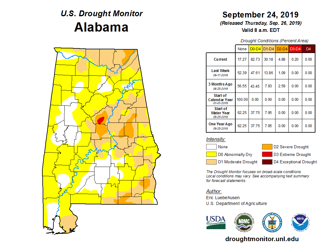
DROUGHT MONITOR: The new Drought Monitor was released Thursday, and about 35-40% of Alabama is now in drought conditions, and most of the rest of the state is abnormally dry. The drought will only intensify over the next week. Birmingham has received only 0.56 of an inch of rain for the entire month of September.
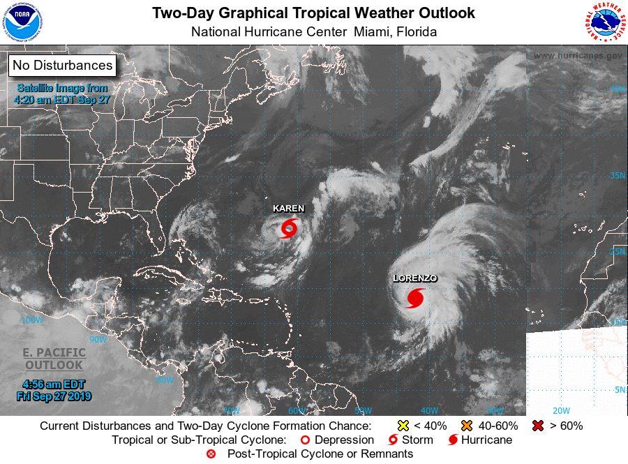
TROPICS: Hurricane Lorenzo, with sustained winds of 145 mph, will recurve into the Atlantic well east of the U.S. It could threaten the Azores early next week as it weakens. Tropical Storm Karen is expected to dissipate east of the Bahamas over the weekend. The rest of the Atlantic basin is quiet.
BEACH FORECAST: Click here to see the AlabamaWx Beach Forecast Center page.
WEATHER BRAINS: You can listen to our weekly 90-minute show any time on your favorite podcast app. This is the show all about weather featuring many familiar voices, including the meteorologists at ABC 33/40.
CONNECT: You can find me on the major social networks:
Facebook
Twitter
Instagram
Pinterest
Snapchat: spannwx
For more weather news and information from James Spann and his team, visit AlabamaWx.


