James Spann: A few isolated showers for Alabama
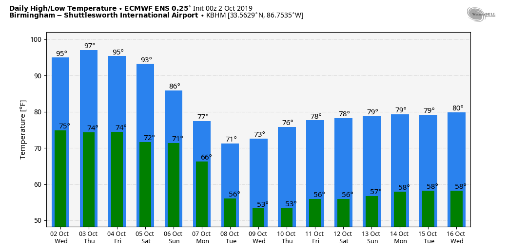
MORE RECORDS: Here are some mid-afternoon temperatures across Alabama, again all at record levels:
- Tuscaloosa — 100
- Muscle Shoals — 98
- Birmingham — 98
- Huntsville — 97
- Anniston — 97
- Mobile — 96
- Montgomery — 96
We note a few isolated showers on radar over the eastern half of the state. They are small, widely spaced and are not lasting long. Most places stay dry through tonight.
THURSDAY/FRIDAY: The strong upper high remains parked over Alabama. Look for hot and mostly dry weather both days with only isolated afternoon showers and storms; the highs will be back in the mid to upper 90s Thursday, followed by low to mid 90s Friday.
THE ALABAMA WEEKEND: The upper high finally begins to break down. Showers are possible Saturday, mainly over north and east Alabama, with a high in the low 90s. Rain becomes much more likely statewide Sunday afternoon and Sunday night ahead of the long-awaited cold front. Sunday’s high will be in the low 80s.
NEXT WEEK: The latest global models are a little faster with the front, suggesting that rain ends Monday morning, followed by slow clearing. Temperatures won’t get out of the 70s Monday, and then we will enjoy delightful autumn weather during midweek with sunny, pleasant days and fair, cool nights. Another cold front has potential to bring a chance of rain late in the week.
FOOTBALL WEATHER: For the high school games Friday night, the sky will be mostly fair with temperatures falling from the low 80s at kickoff into the upper 70s by the final whistle.
Saturday, Auburn travels to Gainesville to take on the Florida Gators (2:30 p.m. Central kickoff). The sky will be partly to mostly sunny with a kickoff temperature in the low 90s and just a 1 in 5 chance of a brief passing shower during the game.
Saturday evening UAB will host Rice at Birmingham’s Legion Field (kickoff at 6). There will be just an outside risk of a shower early in the game; otherwise it will be mostly fair with temperatures falling from near 90 at kickoff through the 80s during the game.
Jacksonville State will host Tennessee State Saturday evening (kickoff at 6). There will be a risk of showers mainly during the first half of the game. Temperatures fall from near 87 at kickoff into the low 80s by the fourth quarter.
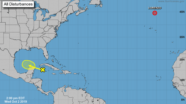
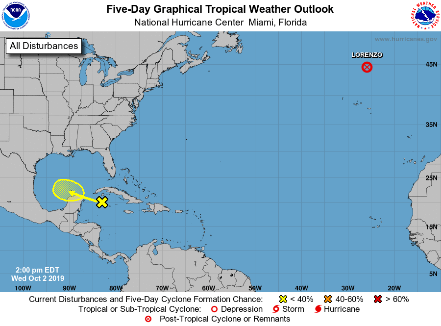
TROPICS: Lorenzo, in the North Atlantic, is now extra-tropical and will impact Ireland and the United Kingdom Thursday and Friday. A tropical wave in the northwest Caribbean will move into the southern Gulf of Mexico this weekend, but for now development is not expected.
RAIN UPDATE: Today is the 18th consecutive day without measurable rain at Birmingham; the total since Sept. 1 is only 0.56 of an inch, and the deficit for the year is up to 4.04 inches. The new Drought Monitor will be released Thursday morning.
ON THIS DATE IN 1858: The only hurricane to impact California struck San Diego on this day. Two researchers with NOAA, Michael Chenoweth and Christopher Landsea, reconstructed the path of the storm using accounts from newspapers of the high winds. They estimated that if a similar storm were to have hit in 2004, it would have caused around $500 million in damage.
BEACH FORECAST: Click here to see the AlabamaWx Beach Forecast Center page.
WEATHER BRAINS: You can listen to our weekly 90-minute show any time on your favorite podcast app. This is the show all about weather featuring many familiar voices, including the meteorologists at ABC 33/40.
CONNECT: You can find me on the major social networks:
Facebook
Twitter
Instagram
Pinterest
Snapchat: spannwx
For more weather news and information from James Spann and his team, visit AlabamaWx.


